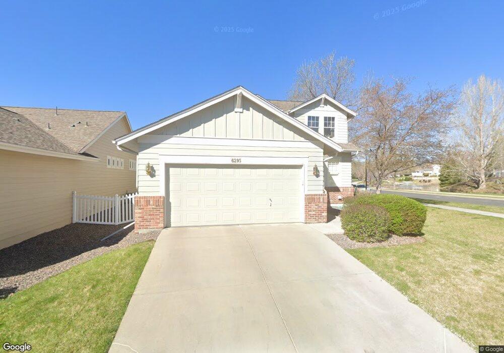
6295 Cole Way Arvada, CO 80004
Ralston Valley NeighborhoodEstimated Value: $645,714 - $792,000
About This Home
This home is located at 6295 Cole Way, Arvada, CO 80004 and is currently estimated at $714,179, approximately $352 per square foot. 6295 Cole Way is a home located in Jefferson County with nearby schools including Fremont Elementary School, Drake Junior High School, and Arvada West High School.
Ownership History
We collect this data history from publicly available records. To have your information removed, we recommend requesting removal directly through your county’s website.
Purchase Details
Home Financials for this Owner
Home Financials are based on the most recent Mortgage that was taken out on this home.Purchase Details
Home Financials for this Owner
Home Financials are based on the most recent Mortgage that was taken out on this home.Purchase Details
Home Financials for this Owner
Home Financials are based on the most recent Mortgage that was taken out on this home.Home Values in the Area
Average Home Value in this Area
Purchase History
We collect this data history from publicly available records. To have your information removed, we recommend requesting removal directly through your county’s website.
| Date | Buyer | Sale Price | Title Company |
|---|---|---|---|
| $335,000 | -- | ||
| $328,000 | Frontier Title | ||
| $315,661 | Land Title Guarantee Company |
Mortgage History
We collect this data history from publicly available records. To have your information removed, we recommend requesting removal directly through your county’s website.
| Date | Status | Borrower | Loan Amount |
|---|---|---|---|
| Closed | $268,000 | ||
| Previous Owner | $200,000 | ||
| Previous Owner | $252,528 |
Tax History
We collect this data history from publicly available records. To have your information removed, we recommend requesting removal directly through your county’s website.
| Year | Tax Paid | Tax Assessment Tax Assessment Total Assessment is a certain percentage of the fair market value that is determined by local assessors to be the total taxable value of land and additions on the property. | Land | Improvement |
|---|---|---|---|---|
| 2025 | $3,981 | $38,606 | $10,758 | $27,848 |
| 2024 | $3,641 | $37,535 | $13,167 | $24,368 |
| 2023 | $3,641 | $37,535 | $13,167 | $24,368 |
| 2022 | $3,017 | $30,802 | $9,097 | $21,705 |
| 2021 | $3,066 | $31,689 | $9,359 | $22,330 |
| 2020 | $2,884 | $29,881 | $8,121 | $21,760 |
| 2019 | $2,845 | $29,881 | $8,121 | $21,760 |
| 2018 | $2,787 | $28,466 | $6,288 | $22,178 |
| 2017 | $2,552 | $28,466 | $6,288 | $22,178 |
| 2016 | $2,739 | $28,785 | $6,417 | $22,368 |
| 2015 | $2,535 | $28,785 | $6,417 | $22,368 |
| 2014 | $2,535 | $25,042 | $6,018 | $19,024 |
Map
- 13679 W 62nd Dr
- 13571 W 61st Ln
- 6340 Deframe Way
- 13674 W 63rd Cir
- 6323 Braun Ln
- 13507 W 63rd Place
- 6392 Coors Ln
- 6383 Deframe Way
- 13527 W 63rd Way
- 13812 W 64th Place
- 6429 Devinney St
- 13115 W 63rd Place
- 13040 W 63rd Place Unit A
- 6282 Yank Ct
- 13755 W 65th Dr
- 0 W 58th Dr
- 13885 W 66th Dr
- 5908 Zang Way
- 13050 W 58th Ave
- 13030 W 58th Ave
- 6294 Cole Way
- 13669 W 62nd Dr
- 6296 Cole Way
- 13659 W 62nd Dr
- 6293 Cole Way
- 13678 W 62nd Dr
- 13688 W 62nd Dr
- 13649 W 62nd Dr
- 13668 W 62nd Dr
- 13639 W 62nd Dr
- 13519 W 62nd Dr
- 13658 W 62nd Dr
- 13698 W 62nd Dr
- 13529 W 62nd Dr
- 13648 W 62nd Dr
- 13708 W 62nd Dr
- 13539 W 62nd Dr
- 13638 W 62nd Dr
- 13549 W 62nd Dr
- 13718 W 62nd Dr
Ask me questions while you tour the home.