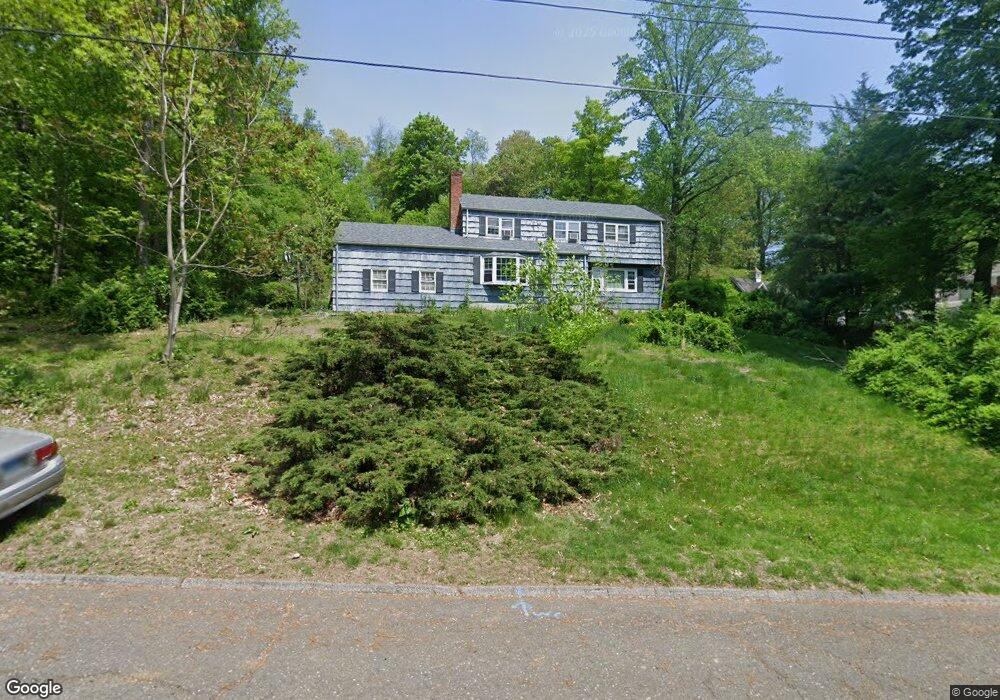
63 Hills Point Rd Trumbull, CT 06611
Tashua NeighborhoodEstimated Value: $701,000 - $723,000
4
Beds
3
Baths
2,114
Sq Ft
$338/Sq Ft
Est. Value
About This Home
This home is located at 63 Hills Point Rd, Trumbull, CT 06611 and is currently estimated at $713,820, approximately $337 per square foot. 63 Hills Point Rd is a home located in Fairfield County with nearby schools including Jane Ryan School, Madison Middle School, and Trumbull High School.
Ownership History
Date
Name
Owned For
Owner Type
Purchase Details
Closed on
Jun 5, 2015
Sold by
Smith Linda
Bought by
Smith James
Current Estimated Value
Purchase Details
Closed on
Jun 30, 2009
Sold by
Magro Joseph R and Magro Virginia Rose
Bought by
Smith James T and Smith Linda S
Create a Home Valuation Report for This Property
The Home Valuation Report is an in-depth analysis detailing your home's value as well as a comparison with similar homes in the area
Home Values in the Area
Average Home Value in this Area
Purchase History
We collect this data history from publicly available records. To have your information removed, we recommend requesting removal directly through your county’s website.
| Date | Buyer | Sale Price | Title Company |
|---|---|---|---|
| Smith James | -- | -- | |
| Smith James T | $422,000 | -- |
Source: Public Records
Mortgage History
We collect this data history from publicly available records. To have your information removed, we recommend requesting removal directly through your county’s website.
| Date | Status | Borrower | Loan Amount |
|---|---|---|---|
| Previous Owner | Smith James T | $25,000 | |
| Previous Owner | Smith James T | $45,000 | |
| Previous Owner | Smith James T | $135,000 |
Source: Public Records
Tax History
| Year | Tax Paid | Tax Assessment Tax Assessment Total Assessment is a certain percentage of the fair market value that is determined by local assessors to be the total taxable value of land and additions on the property. | Land | Improvement |
|---|---|---|---|---|
| 2025 | $12,511 | $340,480 | $170,030 | $170,450 |
| 2024 | $11,415 | $319,690 | $170,030 | $149,660 |
| 2023 | $11,233 | $319,690 | $170,030 | $149,660 |
| 2022 | $11,052 | $319,690 | $170,030 | $149,660 |
| 2021 | $10,263 | $282,240 | $148,120 | $134,120 |
| 2020 | $6,102 | $282,240 | $148,120 | $134,120 |
| 2018 | $9,841 | $282,240 | $148,120 | $134,120 |
| 2017 | $4,829 | $282,240 | $148,120 | $134,120 |
| 2016 | $9,410 | $282,240 | $148,120 | $134,120 |
| 2015 | $9,509 | $284,100 | $148,100 | $136,000 |
| 2014 | $9,307 | $284,100 | $148,100 | $136,000 |
Source: Public Records
Map
Nearby Homes
- 80 Mariner Cir
- 64 Mariner Cir
- 4781 Madison Ave
- 170 Driftwood Ln
- 44 Haverhill Rd
- 75 Lilac Ln
- 55 Lilac Ln
- 16 Deepdene Rd
- 19 Merrimac Dr
- 125 Buck Hill Rd
- 73 Buck Hill Rd
- 4490 Madison Ave
- 45 Lynwood Dr
- 28 Kingston Rd
- 45 Wendover Rd
- 34 Canoe Brook Rd
- 97 Ridgeview Ave
- 20 Sherman Ave
- 49 Sunrise Ave
- 53 Oakland Dr
- 57 Hills Point Rd
- 196 Merrimac Dr
- 168 Merrimac Dr
- 162 Merrimac Dr
- 51 Hills Point Rd
- 62 Hills Point Rd
- 180 Merrimac Dr
- 156 Merrimac Dr
- 56 Hills Point Rd
- 68 Hills Point Rd
- 195 Merrimac Dr
- 45 Hills Point Rd
- 50 Hills Point Rd
- 150 Merrimac Dr
- 74 Hills Point Rd
- 185 Merrimac Dr
- 20 Anita Ave
- 167 Merrimac Dr
- 44 Hills Point Rd
- 37 Hills Point Rd
Your Personal Tour Guide
Ask me questions while you tour the home.