Estimated Value: $259,000 - $309,000
3
Beds
2
Baths
1,464
Sq Ft
$190/Sq Ft
Est. Value
About This Home
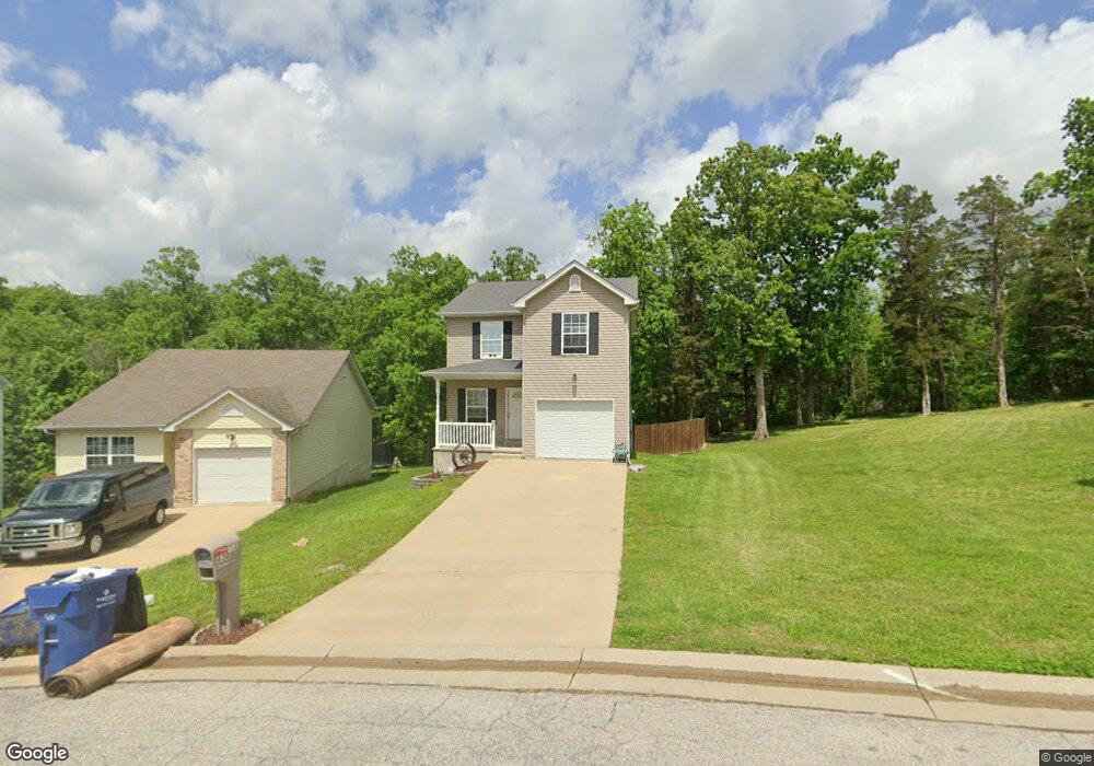
This home is located at 630 Lindsey Dr, Union, MO 63084 and is currently estimated at $277,611, approximately $189 per square foot. 630 Lindsey Dr is a home with nearby schools including Union High School and Immaculate Conception School.
Ownership History
Date
Name
Owned For
Owner Type
Purchase Details
Closed on
Jun 21, 2010
Sold by
Bequette Construction Inc
Bought by
Moffitt Ian Travis
Current Estimated Value
Home Financials for this Owner
Home Financials are based on the most recent Mortgage that was taken out on this home.
Original Mortgage
$136,400
Outstanding Balance
$97,920
Interest Rate
4.81%
Mortgage Type
Purchase Money Mortgage
Estimated Equity
$179,691
Purchase Details
Closed on
Mar 31, 2010
Sold by
Bequette Development Llc
Bought by
Bequette Constructions Inc
Create a Home Valuation Report for This Property
The Home Valuation Report is an in-depth analysis detailing your home's value as well as a comparison with similar homes in the area
Home Values in the Area
Average Home Value in this Area
Purchase History
We collect this data history from publicly available records. To have your information removed, we recommend requesting removal directly through your county’s website.
| Date | Buyer | Sale Price | Title Company |
|---|---|---|---|
| Moffitt Ian Travis | $136,400 | None Available | |
| Bequette Constructions Inc | -- | None Available |
Source: Public Records
Mortgage History
We collect this data history from publicly available records. To have your information removed, we recommend requesting removal directly through your county’s website.
| Date | Status | Borrower | Loan Amount |
|---|---|---|---|
| Open | Moffitt Ian Travis | $136,400 |
Source: Public Records
Tax History
| Year | Tax Paid | Tax Assessment Tax Assessment Total Assessment is a certain percentage of the fair market value that is determined by local assessors to be the total taxable value of land and additions on the property. | Land | Improvement |
|---|---|---|---|---|
| 2025 | $1,915 | $32,118 | $0 | $0 |
| 2024 | $1,915 | $33,176 | $0 | $0 |
| 2023 | $1,999 | $33,176 | $0 | $0 |
| 2022 | $1,966 | $32,558 | $0 | $0 |
| 2021 | $1,969 | $32,558 | $0 | $0 |
| 2020 | $1,806 | $29,376 | $0 | $0 |
| 2019 | $1,802 | $29,376 | $0 | $0 |
| 2018 | $1,570 | $26,857 | $0 | $0 |
| 2017 | $1,574 | $26,857 | $0 | $0 |
| 2016 | $1,470 | $24,525 | $0 | $0 |
| 2015 | $1,447 | $24,525 | $0 | $0 |
| 2014 | $1,460 | $24,736 | $0 | $0 |
Source: Public Records
Map
Nearby Homes
- 626 Lindsey Dr
- 26 & 30 Ridge Point Meadows
- 105 Old Farm Estates Rd
- 207 Grand Central Dr
- 0 Lot 5 Clearview Dr Unit 19010510
- 0 Lot 3 Clearview Dr Unit MIS26011988
- 0 Koko Beach Rd
- 0 Lot 4 Clearview Dr Unit 19010507
- 0 Lot 6 Clearview Dr Unit 19010511
- 0 Clearview Unit 19010495
- 908 W Springfield Ave
- 154 Joel Ave
- 413 Rosedale Ave
- 120 Highland Dr
- 914 W State St
- 412 Macarthur Ave
- 327 Hickory Spring Ln
- 613 W State St
- 613 S Jefferson Ave
- 615 S Jefferson Ave
Your Personal Tour Guide
Ask me questions while you tour the home.