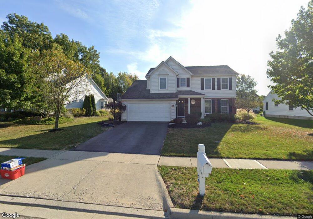
6327 Commonwealth Dr Westerville, OH 43082
Estimated Value: $495,809 - $535,000
4
Beds
3
Baths
2,114
Sq Ft
$245/Sq Ft
Est. Value
About This Home
This home is located at 6327 Commonwealth Dr, Westerville, OH 43082 and is currently estimated at $517,952, approximately $245 per square foot. 6327 Commonwealth Dr is a home located in Delaware County with nearby schools including Fouse Elementary School, Genoa Middle School, and Westerville Central High School.
Ownership History
Date
Name
Owned For
Owner Type
Purchase Details
Closed on
Jun 4, 2002
Sold by
Lencyk Richard L
Bought by
Yaussy Brian and Yaussy Melanie
Current Estimated Value
Home Financials for this Owner
Home Financials are based on the most recent Mortgage that was taken out on this home.
Original Mortgage
$176,500
Outstanding Balance
$70,976
Interest Rate
6.12%
Mortgage Type
New Conventional
Estimated Equity
$446,976
Purchase Details
Closed on
Oct 19, 2001
Sold by
M/I Schottenstein Homes
Bought by
Lencyk Richard L Joanna L
Home Financials for this Owner
Home Financials are based on the most recent Mortgage that was taken out on this home.
Original Mortgage
$204,850
Interest Rate
6.92%
Mortgage Type
New Conventional
Create a Home Valuation Report for This Property
The Home Valuation Report is an in-depth analysis detailing your home's value as well as a comparison with similar homes in the area
Home Values in the Area
Average Home Value in this Area
Purchase History
| Date | Buyer | Sale Price | Title Company |
|---|---|---|---|
| Yaussy Brian | $220,700 | -- | |
| Lencyk Richard L Joanna L | $227,665 | -- |
Source: Public Records
Mortgage History
| Date | Status | Borrower | Loan Amount |
|---|---|---|---|
| Open | Yaussy Brian | $176,500 | |
| Previous Owner | Lencyk Richard L Joanna L | $204,850 |
Source: Public Records
Tax History
| Year | Tax Paid | Tax Assessment Tax Assessment Total Assessment is a certain percentage of the fair market value that is determined by local assessors to be the total taxable value of land and additions on the property. | Land | Improvement |
|---|---|---|---|---|
| 2024 | $7,310 | $140,770 | $32,550 | $108,220 |
| 2023 | $7,166 | $140,770 | $32,550 | $108,220 |
| 2022 | $6,826 | $103,180 | $21,000 | $82,180 |
| 2021 | $6,894 | $103,180 | $21,000 | $82,180 |
| 2020 | $6,935 | $103,180 | $21,000 | $82,180 |
| 2019 | $6,349 | $90,650 | $21,000 | $69,650 |
| 2018 | $6,147 | $90,650 | $21,000 | $69,650 |
| 2017 | $5,923 | $80,510 | $16,980 | $63,530 |
| 2016 | $5,872 | $80,510 | $16,980 | $63,530 |
| 2015 | $5,825 | $80,510 | $16,980 | $63,530 |
| 2014 | $5,736 | $80,510 | $16,980 | $63,530 |
| 2013 | $5,571 | $78,650 | $16,980 | $61,670 |
Source: Public Records
Map
Nearby Homes
- 6370 Pinehurst Pointe Unit 96370
- 6363 Pinehurst Pointe Unit 66363
- 6531 Upper Lake Cir Unit 6531
- 6544 Upper Lake Cir
- 6136 Charmar Dr
- 0 Paul Rd Unit 226003866
- 6451 Marsella Ct
- 5679 Innisbrook Ct
- 6618 Burbank Place
- 7134 Nightshade Dr
- 5217 Sierra Dr
- 5562 Alston Grove Dr
- 5117 Thornwood Dr
- 6293 Andrews Dr W
- 6185 Grisham St
- 6663 Hilmar Dr
- 5287 Genoa Farms Blvd
- 5395 Anacala Ct
- 5349 Slater Ridge Unit 5349
- 6471 Margaret Dr
- 6341 Commonwealth Dr
- 6311 Commonwealth Dr
- 6314 Champions Dr
- 6326 Champions Dr
- 6355 Commonwealth Dr
- 6300 Champions Dr
- 6295 Commonwealth Dr
- 6330 Commonwealth Dr
- 6340 Champions Dr
- 6342 Commonwealth Dr
- 6367 Commonwealth Dr
- 6356 Commonwealth Dr
- 6275 Commonwealth Dr
- 6304 Commonwealth Dr
- 6288 Champions Dr
- 6352 Champions Dr
- 6292 Commonwealth Dr
- 6368 Commonwealth Dr
- 6311 Champions Dr
- 6261 Commonwealth Dr
Your Personal Tour Guide
Ask me questions while you tour the home.