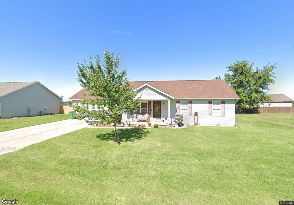
633 Rutter St Saint Libory, IL 62282
Estimated Value: $198,291 - $238,000
3
Beds
2
Baths
1,504
Sq Ft
$143/Sq Ft
Est. Value
About This Home
This home is located at 633 Rutter St, Saint Libory, IL 62282 and is currently estimated at $215,323, approximately $143 per square foot. 633 Rutter St is a home located in St. Clair County with nearby schools including St Libory Elementary School and Freeburg Community High School.
Ownership History
Date
Name
Owned For
Owner Type
Purchase Details
Closed on
Jul 23, 2015
Sold by
Stroder Joshua S and Stroder Emily E
Bought by
Hall John R and Hall Joni D
Current Estimated Value
Purchase Details
Closed on
Jun 16, 2010
Sold by
Armstrong Francis and Armstrong Casimira
Bought by
Stroder Joshua S and Stroder Emily E
Home Financials for this Owner
Home Financials are based on the most recent Mortgage that was taken out on this home.
Original Mortgage
$123,722
Interest Rate
5.05%
Mortgage Type
FHA
Create a Home Valuation Report for This Property
The Home Valuation Report is an in-depth analysis detailing your home's value as well as a comparison with similar homes in the area
Purchase History
| Date | Buyer | Sale Price | Title Company |
|---|---|---|---|
| Hall John R | $125,000 | Attorney | |
| Stroder Joshua S | $130,000 | None Available |
Source: Public Records
Mortgage History
| Date | Status | Borrower | Loan Amount |
|---|---|---|---|
| Previous Owner | Stroder Joshua S | $123,722 |
Source: Public Records
Tax History
| Year | Tax Paid | Tax Assessment Tax Assessment Total Assessment is a certain percentage of the fair market value that is determined by local assessors to be the total taxable value of land and additions on the property. | Land | Improvement |
|---|---|---|---|---|
| 2024 | $3,766 | $52,472 | $5,212 | $47,260 |
| 2023 | $3,024 | $41,436 | $4,745 | $36,691 |
| 2022 | $3,241 | $37,330 | $4,275 | $33,055 |
| 2021 | $3,150 | $35,398 | $4,054 | $31,344 |
| 2020 | $3,143 | $36,576 | $4,189 | $32,387 |
| 2019 | $3,182 | $35,656 | $3,935 | $31,721 |
| 2018 | $3,246 | $36,786 | $4,060 | $32,726 |
| 2017 | $2,676 | $36,065 | $3,981 | $32,084 |
| 2016 | $2,642 | $36,618 | $4,042 | $32,576 |
| 2014 | $2,354 | $40,007 | $4,161 | $35,846 |
| 2013 | $1,198 | $41,713 | $4,338 | $37,375 |
Source: Public Records
Map
Nearby Homes
- 1019 Saint Peter Ave
- 964 Kleefeld Ln
- 000 Katy
- 725 Lone Oak St
- 882 Edward St
- 000 Darmstadt Rd
- 2109 S 3rd St
- 92 S Centennial Rd
- 163 N Mill Rd
- 5929 Highbanks Rd
- 10971 Platinum Ln
- 6450 Timber Lane Dr
- 0 Five Forks Rd
- 4 W Church St
- 10 S Washington St
- 1365 Green Diamond Rd
- 8847 New Athens Darmstadt Rd
- 712 N Main St
- 427 East Dr
- 434 East Dr
- 625 Rutter St
- 624 Hailie St
- 632 Hailie St
- 641 Rutter St
- 626 Rutter St
- 632 Rutter St
- 649 Rutter St
- 636 Hailie St
- 1008 Jean Marie St
- 627 Hailie St
- 617 Rutter St
- 620 Kate Ct
- 631 Hailie St
- 7231 State Route 15
- 657 Rutter St
- 640 Hailie St
- 639 Hailie St
- 1007 Jean Marie St
- 1007 Jean Marie Ct
- 1012 Jean Marie St
Your Personal Tour Guide
Ask me questions while you tour the home.