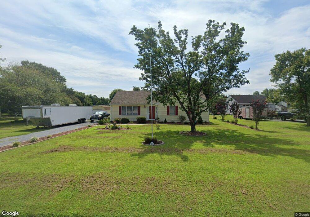
6334 Ayrshire Dr Salisbury, MD 21801
South Salisbury NeighborhoodEstimated Value: $249,000 - $280,000
Studio
2
Baths
1,200
Sq Ft
$220/Sq Ft
Est. Value
About This Home
This home is located at 6334 Ayrshire Dr, Salisbury, MD 21801 and is currently estimated at $263,510, approximately $219 per square foot. 6334 Ayrshire Dr is a home located in Wicomico County with nearby schools including Westside Primary School, Westside Intermediate School, and Salisbury Middle School.
Ownership History
Date
Name
Owned For
Owner Type
Purchase Details
Closed on
Apr 21, 2017
Sold by
Nicole Lee Buck Known Of Record Nyung Eu
Bought by
Buck Kevin Dion
Current Estimated Value
Home Financials for this Owner
Home Financials are based on the most recent Mortgage that was taken out on this home.
Original Mortgage
$104,000
Outstanding Balance
$86,282
Interest Rate
4.1%
Mortgage Type
New Conventional
Estimated Equity
$177,228
Purchase Details
Closed on
Sep 2, 1999
Sold by
Handley Ruby I Revocable Trust
Bought by
Buck Kevin D and Buck Myung
Purchase Details
Closed on
Nov 4, 1991
Sold by
Handley Barbara J
Bought by
Handley Edwin D and Handley Ruby I
Home Financials for this Owner
Home Financials are based on the most recent Mortgage that was taken out on this home.
Original Mortgage
$50,000
Interest Rate
8.78%
Create a Home Valuation Report for This Property
The Home Valuation Report is an in-depth analysis detailing your home's value as well as a comparison with similar homes in the area
Home Values in the Area
Average Home Value in this Area
Purchase History
We collect this data history from publicly available records. To have your information removed, we recommend requesting removal directly through your county’s website.
| Date | Buyer | Sale Price | Title Company |
|---|---|---|---|
| Buck Kevin Dion | -- | Secu Title Svcs Llc | |
| Buck Kevin D | $88,000 | -- | |
| Handley Edwin D | $76,000 | -- |
Source: Public Records
Mortgage History
We collect this data history from publicly available records. To have your information removed, we recommend requesting removal directly through your county’s website.
| Date | Status | Borrower | Loan Amount |
|---|---|---|---|
| Open | Buck Kevin Dion | $104,000 | |
| Previous Owner | Handley Edwin D | $50,000 | |
| Closed | Buck Kevin D | -- |
Source: Public Records
Tax History
| Year | Tax Paid | Tax Assessment Tax Assessment Total Assessment is a certain percentage of the fair market value that is determined by local assessors to be the total taxable value of land and additions on the property. | Land | Improvement |
|---|---|---|---|---|
| 2025 | $1,648 | $173,833 | $0 | $0 |
| 2024 | $1,580 | $158,567 | $0 | $0 |
| 2023 | $1,477 | $143,300 | $39,700 | $103,600 |
| 2022 | $1,500 | $141,300 | $0 | $0 |
| 2021 | $1,476 | $139,300 | $0 | $0 |
| 2020 | $1,476 | $137,300 | $35,700 | $101,600 |
| 2019 | $1,429 | $130,833 | $0 | $0 |
| 2018 | $1,368 | $124,367 | $0 | $0 |
| 2017 | $1,300 | $117,900 | $0 | $0 |
| 2016 | -- | $117,000 | $0 | $0 |
| 2015 | $1,267 | $116,100 | $0 | $0 |
| 2014 | $1,267 | $115,200 | $0 | $0 |
Source: Public Records
Map
Nearby Homes
- 26882 Pratt Rd
- 5991 Hounds Bay Cir
- 6178 Ayrshire Dr
- 6181 Rockawalkin Rd
- 27120 Coach House Ln
- 5756 Earldom Ln
- 6001 Williamsburg Pkwy
- 5709 Royal Mile Blvd
- 0 King Stuart Dr Unit MDWC2018516
- 5662 Clydesdale Dr
- 5660 Caledonia Dr
- 26906 Shetland Ct
- 5657 Caledonia Dr
- 27160 Scotland Pkwy
- 5490 Royal Mile Blvd
- 5482 Royal Mile Blvd
- 26339 Wolfe Creek Dr
- 5456 Nithsdale Dr
- 5485 Saint Andrews Dr
- 5437 Nithsdale Dr
- 6340 Ayrshire Dr
- 6328 Ayrshire Dr
- 6331 Ayrshire Dr
- 6041 Hunters Mill Dr
- 6322 Ayrshire Dr
- 6344 Ayrshire Dr
- 26924 Pratt Rd
- 26914 Pratt Rd
- 26936 Pratt Rd
- 6325 Ayrshire Dr
- 26904 Pratt Rd
- 6044 Hunters Mill Dr
- 26944 Pratt Rd
- 6318 Ayrshire Dr
- 6057 Hunters Mill Dr
- 6319 Ayrshire Dr
- 26894 Pratt Rd
- 6313 Ayrshire Dr
- 6348 Ayrshire Dr
- 26956 Pratt Rd
Your Personal Tour Guide
Ask me questions while you tour the home.