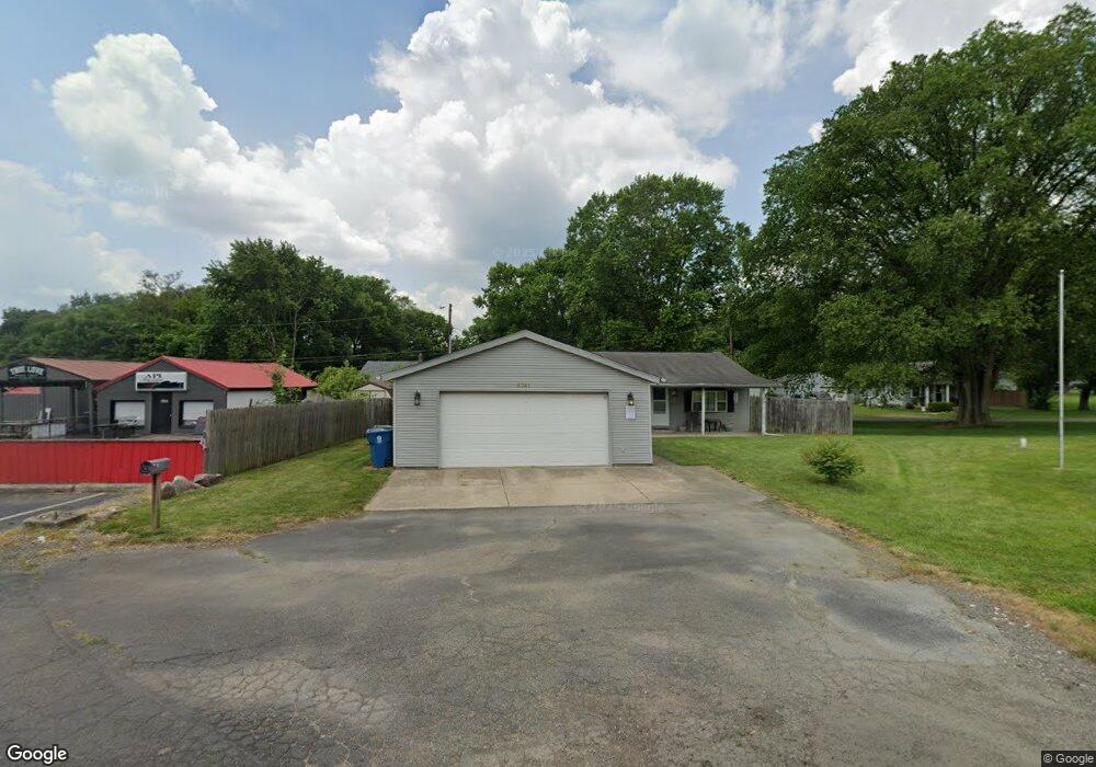
6341 Rip Rap Rd Dayton, OH 45424
Estimated Value: $117,586 - $186,000
About This Home
This home is located at 6341 Rip Rap Rd, Dayton, OH 45424 and is currently estimated at $148,147, approximately $154 per square foot. 6341 Rip Rap Rd is a home located in Montgomery County with nearby schools including Wayne High School.
Ownership History
We collect this data history from publicly available records. To have your information removed, we recommend requesting removal directly through your county’s website.
Purchase Details
Home Financials for this Owner
Home Financials are based on the most recent Mortgage that was taken out on this home.Purchase Details
Home Financials for this Owner
Home Financials are based on the most recent Mortgage that was taken out on this home.Purchase Details
Purchase Details
Purchase Details
Purchase Details
Purchase Details
Home Values in the Area
Average Home Value in this Area
Purchase History
We collect this data history from publicly available records. To have your information removed, we recommend requesting removal directly through your county’s website.
| Date | Buyer | Sale Price | Title Company |
|---|---|---|---|
| $68,000 | Vantage Land Title | ||
| $72,000 | Midwest Title Company | ||
| -- | None Available | ||
| $64,000 | Titlequest Agency Inc | ||
| $52,000 | -- | ||
| $52,000 | -- | ||
| -- | -- |
Mortgage History
We collect this data history from publicly available records. To have your information removed, we recommend requesting removal directly through your county’s website.
| Date | Status | Borrower | Loan Amount |
|---|---|---|---|
| Previous Owner | $66,768 | ||
| Previous Owner | $71,405 |
Tax History
We collect this data history from publicly available records. To have your information removed, we recommend requesting removal directly through your county’s website.
| Year | Tax Paid | Tax Assessment Tax Assessment Total Assessment is a certain percentage of the fair market value that is determined by local assessors to be the total taxable value of land and additions on the property. | Land | Improvement |
|---|---|---|---|---|
| 2025 | $1,212 | $22,690 | $4,520 | $18,170 |
| 2024 | $1,171 | $22,690 | $4,520 | $18,170 |
| 2023 | $1,171 | $22,690 | $4,520 | $18,170 |
| 2022 | $1,492 | $22,690 | $4,520 | $18,170 |
| 2021 | $1,497 | $22,690 | $4,520 | $18,170 |
| 2020 | $1,502 | $22,690 | $4,520 | $18,170 |
| 2019 | $1,723 | $23,080 | $4,070 | $19,010 |
| 2018 | $1,729 | $23,080 | $4,070 | $19,010 |
| 2017 | $1,714 | $23,080 | $4,070 | $19,010 |
| 2016 | $1,780 | $23,380 | $4,520 | $18,860 |
| 2015 | $1,757 | $23,380 | $4,520 | $18,860 |
| 2014 | $1,757 | $23,380 | $4,520 | $18,860 |
| 2012 | -- | $27,570 | $5,170 | $22,400 |
Map
- 2266 Kiel St
- 2239 Kiel St
- 1015 Colonial Way
- 7146 Caledonian Ave
- 7158 Caledonian Ave
- 7164 Caledonian Ave
- 7173 Caledonian Ave
- 2293 Kiel St
- 6163 Derby Place
- 2218 Kiel St
- 2260 Kiel St
- 4675 Santa Anita Place
- 5221 Quail Ridge
- 6668 Oakwood Ln
- 5272 Quail Ridge
- 687 Deerhurst Dr
- 734 Deerhurst Dr
- 701 Deerhurst Dr
- 659 Deerhurst Dr
- 6512 Wildview Dr
- 6363 Blackfoot St
- 6333 Blackfoot St
- 6303 Rip Rap Rd
- 4180 Navajo Ave
- 4170 Navajo Ave
- 6401 Rip Rap Rd
- 6277 Blackfoot St
- 4156 Navajo Ave
- 6320 Rip Rap Rd
- 6338 Apache St
- 6352 Apache St
- 6441 Rip Rap Rd
- 6326 Apache St
- 6255 Blackfoot St
- 6420 Rip Rap Rd
- 6461 Rip Rap Rd
- 0 Apache St Unit 468762
- 0 Apache St Unit 468758
- 0 Apache St Unit 468755
- 0 Apache St Unit 468745
Ask me questions while you tour the home.