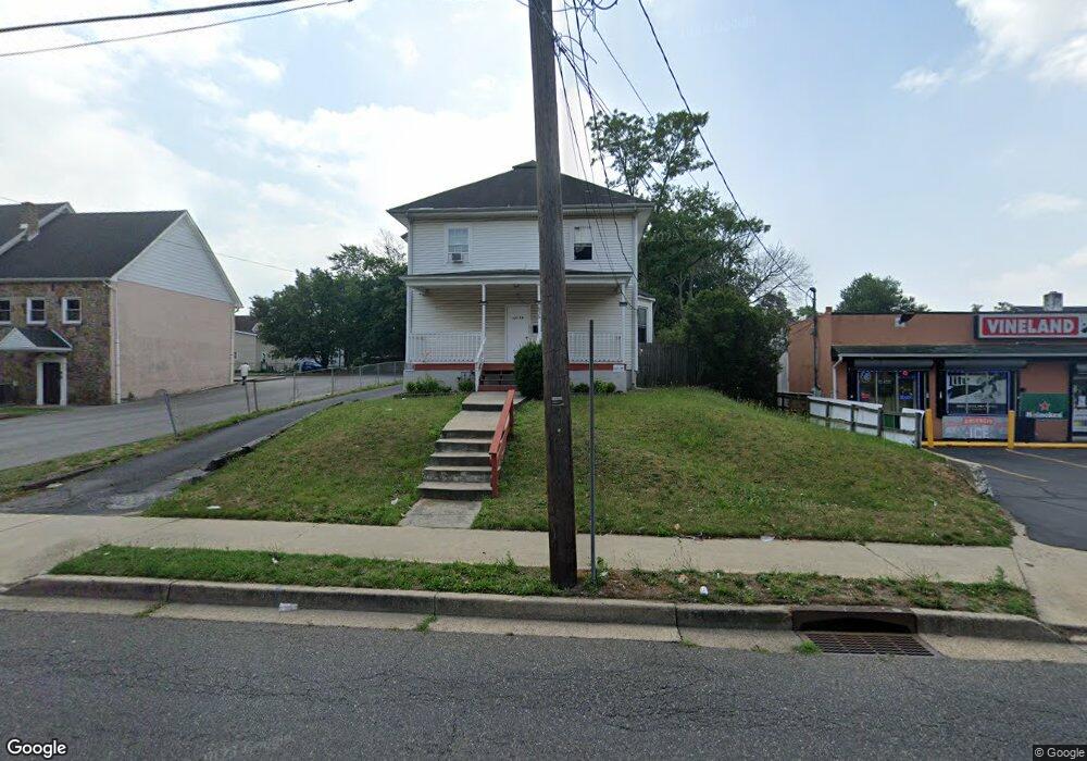
635 E Chestnut Ave Vineland, NJ 08360
Estimated Value: $230,372 - $315,000
Studio
--
Bath
1,954
Sq Ft
$140/Sq Ft
Est. Value
About This Home
This home is located at 635 E Chestnut Ave, Vineland, NJ 08360 and is currently estimated at $274,343, approximately $140 per square foot. 635 E Chestnut Ave is a home located in Cumberland County with nearby schools including Dr. William Mennies School, Landis Middle School, and Vineland Senior High School.
Ownership History
Date
Name
Owned For
Owner Type
Purchase Details
Closed on
Oct 18, 2006
Sold by
Mayerfeld Bernard and Mayerfeld Effie
Bought by
Rivera Victor L
Current Estimated Value
Purchase Details
Closed on
Oct 24, 2002
Sold by
Troth Ronald L
Bought by
Carter Kimberly A
Home Financials for this Owner
Home Financials are based on the most recent Mortgage that was taken out on this home.
Original Mortgage
$78,000
Interest Rate
6.08%
Create a Home Valuation Report for This Property
The Home Valuation Report is an in-depth analysis detailing your home's value as well as a comparison with similar homes in the area
Home Values in the Area
Average Home Value in this Area
Purchase History
| Date | Buyer | Sale Price | Title Company |
|---|---|---|---|
| Rivera Victor L | $155,000 | -- | |
| Carter Kimberly A | $78,000 | -- |
Source: Public Records
Mortgage History
| Date | Status | Borrower | Loan Amount |
|---|---|---|---|
| Previous Owner | Carter Kimberly A | $78,000 |
Source: Public Records
Tax History
| Year | Tax Paid | Tax Assessment Tax Assessment Total Assessment is a certain percentage of the fair market value that is determined by local assessors to be the total taxable value of land and additions on the property. | Land | Improvement |
|---|---|---|---|---|
| 2025 | $3,636 | $114,200 | $23,400 | $90,800 |
| 2024 | $3,636 | $114,200 | $23,400 | $90,800 |
| 2023 | $3,612 | $114,200 | $23,400 | $90,800 |
| 2022 | $3,505 | $114,200 | $23,400 | $90,800 |
| 2021 | $3,441 | $114,200 | $23,400 | $90,800 |
| 2020 | $3,343 | $114,200 | $23,400 | $90,800 |
| 2019 | $3,297 | $114,200 | $23,400 | $90,800 |
| 2018 | $3,210 | $114,200 | $23,400 | $90,800 |
| 2017 | $3,049 | $114,200 | $23,400 | $90,800 |
| 2016 | $2,942 | $114,200 | $23,400 | $90,800 |
| 2015 | $2,833 | $114,200 | $23,400 | $90,800 |
| 2014 | $2,679 | $114,200 | $23,400 | $90,800 |
Source: Public Records
Map
Nearby Homes
- 735 S Seventh St
- 816 E Quince St
- 220 S 7th St
- 708 S Myrtle St
- 306 S East Ave
- 724 S Myrtle St
- 511 E Grape St
- 73 S Myrtle St
- 520 E Grape St
- 719 3rd Street Terrace
- 726 Allen Ave
- 32 S Myrtle St
- 812 E Elmer St
- 709 S State St
- 735 S State St
- 420 W Wood St
- 0 S East Ave
- 19 Howard St
- 421 S West Ave
- 4 Howard St
- 718 S 7th St
- 624 Paul St
- 622 Paul St
- 720 S 7th St
- 615 E Chestnut Ave Unit 3
- 615 E Chestnut Ave Unit 2
- 615 E Chestnut Ave
- 632 E Chestnut Ave Unit 634
- 630 E Chestnut Ave
- 628 E Chestnut Ave
- 603 E Chestnut Ave
- 618 E Chestnut Ave
- 722 S 7th St
- 614 S 7th St
- 616 E Chestnut Ave
- 715 S 7th St
- 619 S 7th St
- 717 S 7th St
- 721 S Seventh St
- 719 S 7th St
Your Personal Tour Guide
Ask me questions while you tour the home.