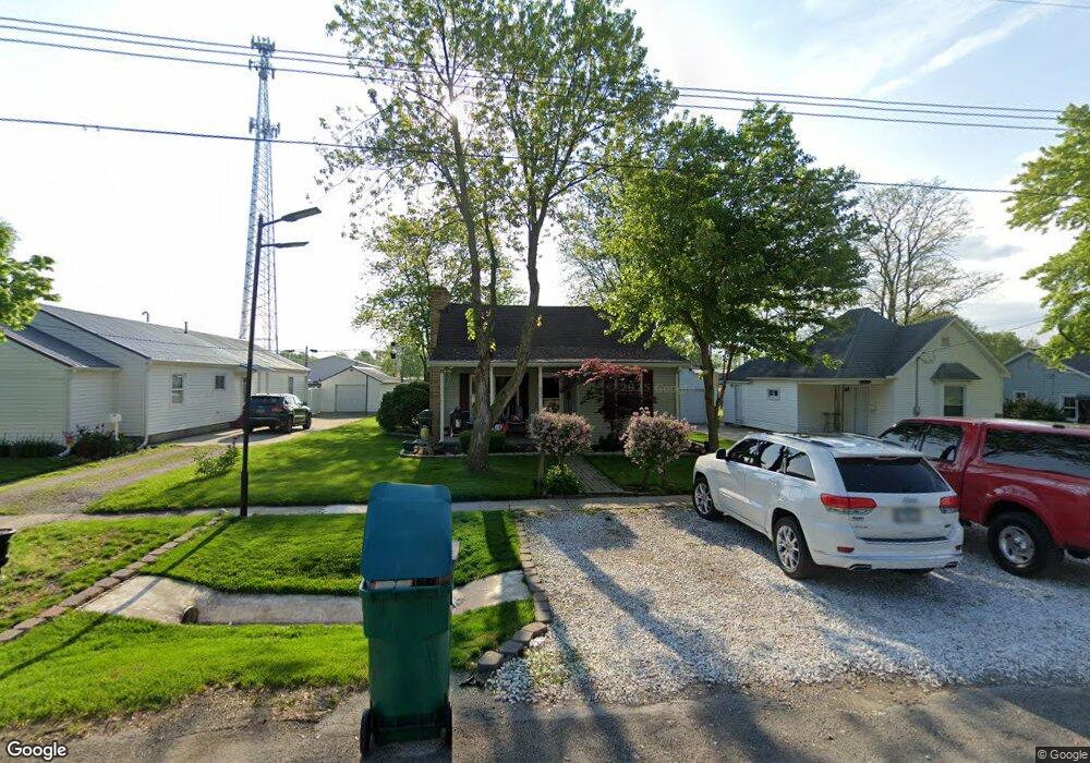
636 S 21st St Mattoon, IL 61938
Estimated Value: $77,000 - $99,000
3
Beds
1
Bath
1,039
Sq Ft
$80/Sq Ft
Est. Value
About This Home
This home is located at 636 S 21st St, Mattoon, IL 61938 and is currently estimated at $83,485, approximately $80 per square foot. 636 S 21st St is a home located in Coles County with nearby schools including Mattoon High School, St Mary School, and St. John's Lutheran School.
Ownership History
Date
Name
Owned For
Owner Type
Purchase Details
Closed on
Mar 20, 2017
Sold by
Wickman Troy A and Wickman Heather A
Bought by
Wickman Troy A and Wickman Heather A
Current Estimated Value
Purchase Details
Closed on
Mar 31, 2005
Sold by
Trexler Larry R and Trexler Mary
Bought by
Wickman Troy
Home Financials for this Owner
Home Financials are based on the most recent Mortgage that was taken out on this home.
Original Mortgage
$34,000
Interest Rate
5.88%
Mortgage Type
New Conventional
Create a Home Valuation Report for This Property
The Home Valuation Report is an in-depth analysis detailing your home's value as well as a comparison with similar homes in the area
Home Values in the Area
Average Home Value in this Area
Purchase History
| Date | Buyer | Sale Price | Title Company |
|---|---|---|---|
| Wickman Troy A | -- | -- | |
| Wickman Troy | $38,000 | None Available |
Source: Public Records
Mortgage History
| Date | Status | Borrower | Loan Amount |
|---|---|---|---|
| Closed | Wickman Troy | $34,000 |
Source: Public Records
Tax History
| Year | Tax Paid | Tax Assessment Tax Assessment Total Assessment is a certain percentage of the fair market value that is determined by local assessors to be the total taxable value of land and additions on the property. | Land | Improvement |
|---|---|---|---|---|
| 2024 | $1,174 | $19,813 | $3,593 | $16,220 |
| 2023 | $998 | $17,690 | $3,208 | $14,482 |
| 2022 | $998 | $17,398 | $3,155 | $14,243 |
| 2021 | $979 | $15,981 | $2,898 | $13,083 |
| 2020 | $964 | $16,558 | $3,003 | $13,555 |
| 2019 | $928 | $15,981 | $2,898 | $13,083 |
| 2018 | $913 | $15,981 | $2,898 | $13,083 |
| 2017 | $910 | $15,981 | $2,898 | $13,083 |
| 2016 | $892 | $15,981 | $2,898 | $13,083 |
| 2015 | $882 | $15,981 | $2,898 | $13,083 |
| 2014 | $882 | $15,981 | $2,898 | $13,083 |
| 2013 | $882 | $15,981 | $2,898 | $13,083 |
Source: Public Records
Map
Nearby Homes
- 2301 Charleston Ave
- 1509 Lafayette Ave
- 2505 Pine Ave
- 1312 Edgar Ave
- 113 S 25th St
- 2516 Pine Ave
- 1301 Lafayette Ave
- 2820 Walnut Ave
- 109 N 26th St
- 1612 Richmond Ave
- 2800 Pine Ave
- 2812 Pine Ave
- 1101 Wabash Ave
- 2617 Richmond Ave
- 1416 S Lawn Dr
- 2305 Shelby Ave
- 2317 Shelby Ave
- 2413 Moultrie Ave
- 2720 Champaign Ave
- 2800 Shelby Ave
Your Personal Tour Guide
Ask me questions while you tour the home.