63652 Campfire Rd Cambridge, OH 43725
Estimated Value: $106,947 - $170,000
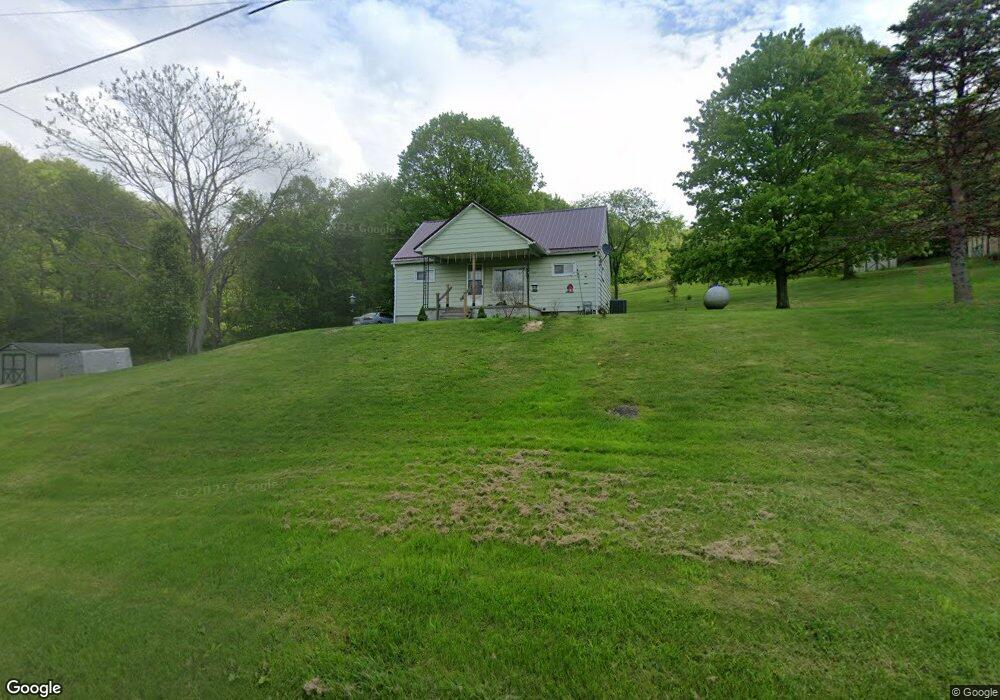
About This Home
This home is located at 63652 Campfire Rd, Cambridge, OH 43725 and is currently estimated at $125,737, approximately $154 per square foot. 63652 Campfire Rd is a home with nearby schools including Pike Elementary School, Larry Miller Intermediate Elementary School, and East Muskingum Middle School.
Ownership History
We collect this data history from publicly available records. To have your information removed, we recommend requesting removal directly through your county’s website.
Purchase Details
Home Financials for this Owner
Home Financials are based on the most recent Mortgage that was taken out on this home.Purchase Details
Purchase History
We collect this data history from publicly available records. To have your information removed, we recommend requesting removal directly through your county’s website.
| Date | Buyer | Sale Price | Title Company |
|---|---|---|---|
| $48,000 | Bennett Title Agency | ||
| -- | None Available |
Mortgage History
We collect this data history from publicly available records. To have your information removed, we recommend requesting removal directly through your county’s website.
| Date | Status | Borrower | Loan Amount |
|---|---|---|---|
| Closed | $25,500 |
Tax History
We collect this data history from publicly available records. To have your information removed, we recommend requesting removal directly through your county’s website.
| Year | Tax Paid | Tax Assessment Tax Assessment Total Assessment is a certain percentage of the fair market value that is determined by local assessors to be the total taxable value of land and additions on the property. | Land | Improvement |
|---|---|---|---|---|
| 2025 | $1,039 | $25,889 | $8,942 | $16,947 |
| 2024 | $1,041 | $25,889 | $8,942 | $16,947 |
| 2023 | $1,007 | $20,710 | $7,154 | $13,556 |
| 2022 | $879 | $20,710 | $7,150 | $13,560 |
| 2021 | $870 | $20,710 | $7,150 | $13,560 |
| 2020 | $778 | $18,320 | $5,380 | $12,940 |
| 2019 | $371 | $18,320 | $5,380 | $12,940 |
| 2018 | $339 | $18,320 | $5,380 | $12,940 |
| 2017 | $298 | $15,890 | $4,680 | $11,210 |
| 2016 | $298 | $15,890 | $4,680 | $11,210 |
| 2015 | $298 | $15,890 | $4,680 | $11,210 |
| 2014 | $223 | $13,860 | $4,070 | $9,790 |
| 2013 | $224 | $13,860 | $4,070 | $9,790 |
Map
- 0 Haught Rd Unit 5180764
- 64473 Haught Rd
- 3036 Meadow Rd
- 3899 Mayfair Ln Unit A
- 3899 Mayfair Ln
- 3388 Meadow Rd
- 3859 Mayfair Ln
- Lot 18 & 19 Greenbriar Dr
- 0 Taylor Rd Unit 5218777
- 63075 Ridgewood Dr
- 5759 College Hill Rd
- 5966 Fairdale Dr
- 60936 Patch Rd
- 110 Cherry Ln
- 6282 Belvedere Ave
- 6283 William Ave
- 63060 Merrick Rd
- 59 E Maple Ave
- 60145 Bliss Rd
- 66 W High St
- 63644 Campfire Rd
- 63674 Campfire Rd
- 2815 Peters Creek Rd
- 2383 Peters Creek Rd
- 3490 Peters Creek Rd
- 3519 Peters Creek Rd
- 63650 Redbud Rd
- 3583 Peters Creek Rd
- 0 Peters Creek Rd
- 64067 Lovers Lane Rd
- 63702 Redbud Rd
- 64157 Campfire Rd
- 64095 Lovers Lane Rd
- 64200 Campfire Rd
- 63737 Redbud Rd
- 63755 Redbud Rd
- 63555 Bobs Run Rd
- 63821 Redbud Rd
- 64064 Bobs Run Rd
- 63883 Redbud Rd
Ask me questions while you tour the home.