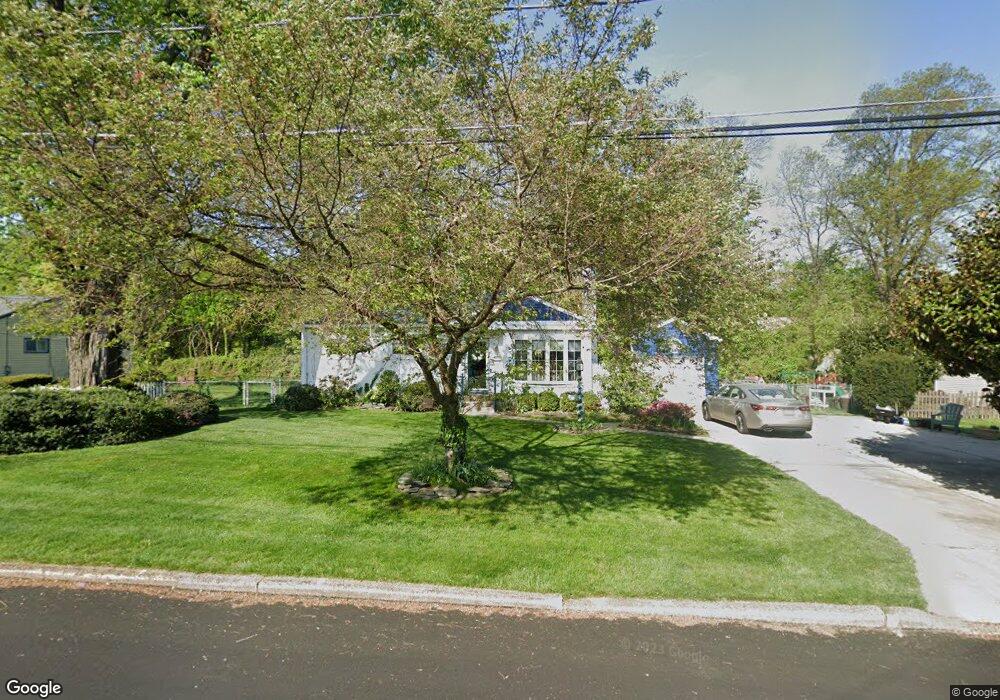
637 Devon Rd Moorestown, NJ 08057
Estimated Value: $369,629 - $491,000
About This Home
This home is located at 637 Devon Rd, Moorestown, NJ 08057 and is currently estimated at $451,157, approximately $404 per square foot. 637 Devon Rd is a home located in Burlington County with nearby schools including George C. Baker Elementary School, Moorestown Upper Elementary School, and William Allen Middle School.
Ownership History
We collect this data history from publicly available records. To have your information removed, we recommend requesting removal directly through your county’s website.
Purchase Details
Home Financials for this Owner
Home Financials are based on the most recent Mortgage that was taken out on this home.Purchase Details
Purchase Details
Home Values in the Area
Average Home Value in this Area
Purchase History
We collect this data history from publicly available records. To have your information removed, we recommend requesting removal directly through your county’s website.
| Date | Buyer | Sale Price | Title Company |
|---|---|---|---|
| -- | Hunter Title Agency Inc | ||
| -- | -- | ||
| -- | -- |
Mortgage History
We collect this data history from publicly available records. To have your information removed, we recommend requesting removal directly through your county’s website.
| Date | Status | Borrower | Loan Amount |
|---|---|---|---|
| Closed | $204,000 |
Tax History
We collect this data history from publicly available records. To have your information removed, we recommend requesting removal directly through your county’s website.
| Year | Tax Paid | Tax Assessment Tax Assessment Total Assessment is a certain percentage of the fair market value that is determined by local assessors to be the total taxable value of land and additions on the property. | Land | Improvement |
|---|---|---|---|---|
| 2025 | $6,296 | $220,200 | $137,300 | $82,900 |
| 2024 | $6,106 | $220,200 | $137,300 | $82,900 |
| 2023 | $6,106 | $220,200 | $137,300 | $82,900 |
| 2022 | $6,075 | $220,200 | $137,300 | $82,900 |
| 2021 | $5,998 | $220,200 | $137,300 | $82,900 |
| 2020 | $5,959 | $220,200 | $137,300 | $82,900 |
| 2019 | $5,851 | $220,200 | $137,300 | $82,900 |
| 2018 | $5,679 | $220,200 | $137,300 | $82,900 |
| 2017 | $5,716 | $220,200 | $137,300 | $82,900 |
| 2016 | $5,690 | $220,200 | $137,300 | $82,900 |
| 2015 | $5,615 | $220,200 | $137,300 | $82,900 |
| 2014 | $5,340 | $220,200 | $137,300 | $82,900 |
Map
- 36 Eraser Rd
- 3 Overbrook Cir
- 27 S Lenola Rd
- 10 S Lenola Rd
- 52 Westbrook Dr
- 12 Circle Dr
- 11 Errickson Ave
- 93 Westbrook Dr
- 503 Devon Rd
- 242 Center St
- 408 Kings Hwy
- 444 Shady Ln
- 115 E Kings Hwy Unit 243
- 115 E Kings Hwy Unit 271
- 115 E Kings Hwy Unit 186
- 115 E Kings Hwy Unit 392
- 115 E Kings Hwy Unit 211
- 115 E Kings Hwy Unit 246
- 320 W 3rd St
- 26 Morris Ave
- 639 Devon Rd
- 635 Devon Rd
- 710 Bowling Green
- 711 Bowling Green
- 633 Devon Rd
- 708 Bowling Green
- 710 Manor Terrace
- 711 E Camden Ave
- 709 Bowling Green
- 631 Devon Rd
- 709 E Camden Ave
- 708 Manor Terrace
- 706 Bowling Green
- 707 Bowling Green
- 629 Devon Rd
- 707 E Camden Ave
- 706 Manor Terrace
- 704 Bowling Green
- 705 Bowling Green
- 707 Manor Terrace
Ask me questions while you tour the home.