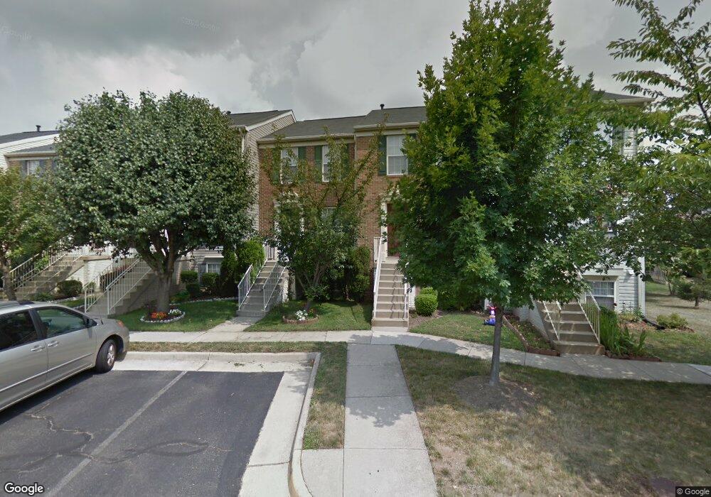
6370 Michael Robert Dr Springfield, VA 22150
Springtown NeighborhoodEstimated Value: $549,100 - $589,000
3
Beds
3
Baths
992
Sq Ft
$572/Sq Ft
Est. Value
About This Home
This home is located at 6370 Michael Robert Dr, Springfield, VA 22150 and is currently estimated at $567,775, approximately $572 per square foot. 6370 Michael Robert Dr is a home located in Fairfax County with nearby schools including Forestdale Elementary School, Key Middle, and Lewis High School.
Ownership History
Date
Name
Owned For
Owner Type
Purchase Details
Closed on
Jun 30, 2004
Sold by
Meriwether Pamela A
Bought by
Balajee Subramanian and Chandrasekaran,Revathi
Current Estimated Value
Home Financials for this Owner
Home Financials are based on the most recent Mortgage that was taken out on this home.
Original Mortgage
$322,000
Outstanding Balance
$161,707
Interest Rate
6.3%
Mortgage Type
New Conventional
Estimated Equity
$406,068
Purchase Details
Closed on
Aug 21, 1996
Sold by
Nvr Homes Inc
Bought by
Meriwether Pamela A
Home Financials for this Owner
Home Financials are based on the most recent Mortgage that was taken out on this home.
Original Mortgage
$157,850
Interest Rate
8.4%
Create a Home Valuation Report for This Property
The Home Valuation Report is an in-depth analysis detailing your home's value as well as a comparison with similar homes in the area
Home Values in the Area
Average Home Value in this Area
Purchase History
| Date | Buyer | Sale Price | Title Company |
|---|---|---|---|
| Balajee Subramanian | $322,000 | -- | |
| Meriwether Pamela A | $160,590 | -- |
Source: Public Records
Mortgage History
| Date | Status | Borrower | Loan Amount |
|---|---|---|---|
| Open | Balajee Subramanian | $322,000 | |
| Previous Owner | Meriwether Pamela A | $157,850 |
Source: Public Records
Tax History
| Year | Tax Paid | Tax Assessment Tax Assessment Total Assessment is a certain percentage of the fair market value that is determined by local assessors to be the total taxable value of land and additions on the property. | Land | Improvement |
|---|---|---|---|---|
| 2025 | $5,669 | $537,980 | $195,000 | $342,980 |
| 2024 | $5,669 | $489,310 | $180,000 | $309,310 |
| 2023 | $5,661 | $501,680 | $180,000 | $321,680 |
| 2022 | $5,299 | $463,440 | $165,000 | $298,440 |
| 2021 | $4,853 | $413,550 | $145,000 | $268,550 |
| 2020 | $4,679 | $395,360 | $130,000 | $265,360 |
| 2019 | $4,576 | $386,690 | $126,000 | $260,690 |
| 2018 | $4,515 | $392,650 | $126,000 | $266,650 |
| 2017 | $4,376 | $376,930 | $120,000 | $256,930 |
| 2016 | $4,306 | $371,720 | $120,000 | $251,720 |
Source: Public Records
Map
Nearby Homes
- 6348 Dakine Cir
- 6350 Racetec Place
- 6262 Casdin Dr
- 6421 Inwood Dr
- 6404 Inwood Dr
- 6405 Little Potters Ln
- 6333 Gildar St
- 6430 Franconia Rd
- 6267 Summit Point Ct
- 6615 Deer Gap Ct
- 6262 Summit Point Ct
- 6214 Franconia Forest Ln
- 6436 Burwell St
- 6582 Forsythia St
- 6139 Cinnamon Ct
- 6613 Elder Ave
- 6126 Old Brentford Ct
- 6753 Edge Cliff Dr
- 6209 Waterlily Ct
- 6009 Jennings Ln
- 6372 Michael Robert Dr
- 6368 Michael Robert Dr
- 6374 Michael Robert Dr
- 6366 Michael Robert Dr
- 6376 Michael Robert Dr
- 6378 Michael Robert Dr
- 6383 Trips Way
- 6381 Trips Way
- 6385 Trips Way
- 6380 Michael Robert Dr
- 6379 Trips Way
- 6387 Trips Way
- 6377 Trips Way
- 6389 Trips Way
- 6375 Trips Way
- 6369 Michael Robert Dr
- 6367 Michael Robert Dr
- 6377 Michael Robert Dr
- 6365 Michael Robert Dr
- 6379 Michael Robert Dr
Your Personal Tour Guide
Ask me questions while you tour the home.