Estimated Value: $281,947 - $319,000
3
Beds
2
Baths
1,264
Sq Ft
$237/Sq Ft
Est. Value
About This Home
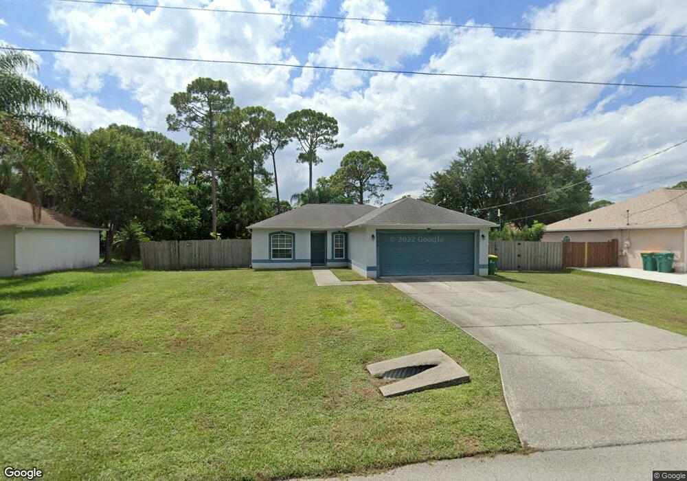
This home is located at 6388 Dane Ave, Cocoa, FL 32927 and is currently estimated at $299,487, approximately $236 per square foot. 6388 Dane Ave is a home located in Brevard County with nearby schools including Challenger 7 Elementary School, Space Coast Junior/Senior High School, and East Atlantic Prep of Brevard County.
Ownership History
Date
Name
Owned For
Owner Type
Purchase Details
Closed on
Jan 30, 2001
Sold by
Maronda Homes Inc Fl
Bought by
Hennes Robert
Current Estimated Value
Home Financials for this Owner
Home Financials are based on the most recent Mortgage that was taken out on this home.
Original Mortgage
$81,859
Outstanding Balance
$29,458
Interest Rate
7.03%
Estimated Equity
$270,029
Purchase Details
Closed on
Dec 2, 1999
Sold by
Kitcharoen Punthip Vuthivai
Bought by
Maronda Homes Inc Fl
Create a Home Valuation Report for This Property
The Home Valuation Report is an in-depth analysis detailing your home's value as well as a comparison with similar homes in the area
Home Values in the Area
Average Home Value in this Area
Purchase History
| Date | Buyer | Sale Price | Title Company |
|---|---|---|---|
| Hennes Robert | $83,200 | -- | |
| Maronda Homes Inc Fl | $12,500 | -- |
Source: Public Records
Mortgage History
| Date | Status | Borrower | Loan Amount |
|---|---|---|---|
| Open | Hennes Robert | $81,859 |
Source: Public Records
Tax History
| Year | Tax Paid | Tax Assessment Tax Assessment Total Assessment is a certain percentage of the fair market value that is determined by local assessors to be the total taxable value of land and additions on the property. | Land | Improvement |
|---|---|---|---|---|
| 2025 | $1,142 | $85,620 | -- | -- |
| 2024 | $1,108 | $83,210 | -- | -- |
| 2023 | $1,108 | $80,790 | $0 | $0 |
| 2022 | $1,028 | $78,440 | $0 | $0 |
| 2021 | $1,016 | $76,160 | $0 | $0 |
| 2020 | $963 | $75,110 | $0 | $0 |
| 2019 | $910 | $73,430 | $0 | $0 |
| 2018 | $911 | $72,070 | $0 | $0 |
| 2017 | $914 | $70,590 | $0 | $0 |
| 2016 | $922 | $69,140 | $18,000 | $51,140 |
| 2015 | $931 | $68,660 | $15,000 | $53,660 |
| 2014 | $936 | $68,120 | $11,000 | $57,120 |
Source: Public Records
Map
Nearby Homes
- 6450 Ember Ave
- 5220 Holden Rd
- 00 Unknown
- 6438 Hudson Rd
- 6398 Cable Ave
- 5221 Carrick Rd
- 6375 Cable Ave
- 6240 Grissom Pkwy
- 6481 La Brea Ave
- 6020 Cannon Ave
- 6615 Dock Ave
- 6094 Cardiff Ave
- 4975 Fay Blvd
- 0000 Grissom Pkwy
- 5680 Banos Ave
- 6760 Cairo Rd
- 6581 Bancroft Ave
- 5950 Ackard Ave
- 5945 Coker Ave
- 6620 Grissom Pkwy
Your Personal Tour Guide
Ask me questions while you tour the home.