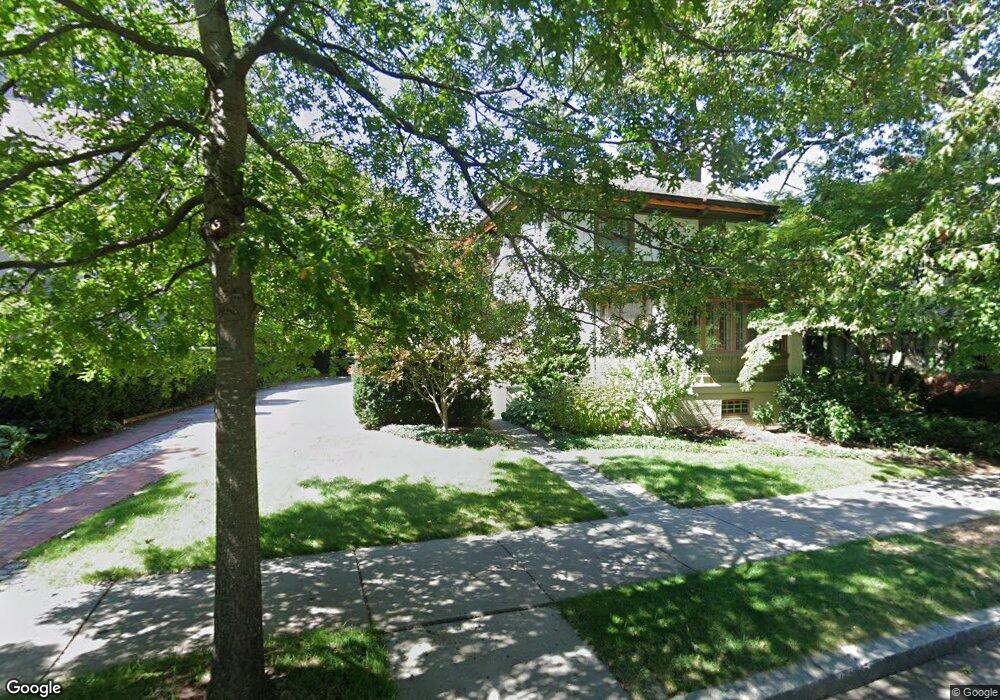
64 Amory St Brookline, MA 02446
Coolidge Corner NeighborhoodEstimated Value: $3,610,739 - $5,002,000
6
Beds
6
Baths
4,720
Sq Ft
$922/Sq Ft
Est. Value
About This Home
This home is located at 64 Amory St, Brookline, MA 02446 and is currently estimated at $4,349,685, approximately $921 per square foot. 64 Amory St is a home located in Norfolk County with nearby schools including Amos A. Lawrence School, Brookline High School, and Match Charter Public School.
Ownership History
Date
Name
Owned For
Owner Type
Purchase Details
Closed on
Dec 14, 2012
Sold by
Krauss Richard and Krauss Martha W
Bought by
Bergin Richard and Ingraham Katherine A
Current Estimated Value
Home Financials for this Owner
Home Financials are based on the most recent Mortgage that was taken out on this home.
Original Mortgage
$1,668,750
Outstanding Balance
$355,752
Interest Rate
3.44%
Mortgage Type
Purchase Money Mortgage
Estimated Equity
$3,993,933
Purchase Details
Closed on
Mar 25, 2009
Sold by
Krauss Richard
Bought by
Krauss Richard and Krauss Martha W
Create a Home Valuation Report for This Property
The Home Valuation Report is an in-depth analysis detailing your home's value as well as a comparison with similar homes in the area
Home Values in the Area
Average Home Value in this Area
Purchase History
| Date | Buyer | Sale Price | Title Company |
|---|---|---|---|
| Bergin Richard | $2,350,000 | -- | |
| Krauss Richard | -- | -- |
Source: Public Records
Mortgage History
| Date | Status | Borrower | Loan Amount |
|---|---|---|---|
| Open | Bergin Richard | $1,668,750 |
Source: Public Records
Tax History
| Year | Tax Paid | Tax Assessment Tax Assessment Total Assessment is a certain percentage of the fair market value that is determined by local assessors to be the total taxable value of land and additions on the property. | Land | Improvement |
|---|---|---|---|---|
| 2025 | $36,895 | $3,738,100 | $1,409,900 | $2,328,200 |
| 2024 | $35,232 | $3,606,100 | $1,355,600 | $2,250,500 |
| 2023 | $34,020 | $3,412,200 | $1,252,600 | $2,159,600 |
| 2022 | $33,114 | $3,249,700 | $1,192,900 | $2,056,800 |
| 2021 | $30,622 | $3,124,700 | $1,147,000 | $1,977,700 |
| 2020 | $28,304 | $2,995,100 | $1,042,800 | $1,952,300 |
| 2019 | $26,727 | $2,852,400 | $993,100 | $1,859,300 |
| 2018 | $24,881 | $2,630,100 | $827,700 | $1,802,400 |
| 2017 | $24,513 | $2,481,100 | $780,700 | $1,700,400 |
| 2016 | $24,162 | $2,318,800 | $729,600 | $1,589,200 |
| 2015 | $23,262 | $2,178,100 | $681,900 | $1,496,200 |
| 2014 | $23,613 | $2,073,100 | $568,300 | $1,504,800 |
Source: Public Records
Map
Nearby Homes
- 7 Parkman St Unit 1
- 79 Pleasant St Unit 4
- 178 Ivy St
- 180 Ivy St
- 108 Crowninshield Rd
- 14 James St Unit 3
- 99 Crowninshield Rd Unit 99
- 39 Worthington Rd
- 100 Sewall Ave Unit 5
- 63-65 Green St Unit PH-3
- 105 Babcock St
- 50 Longwood Ave Unit 518
- 50 Longwood Ave Unit 718
- 50 Longwood Ave Unit 712
- 50 Longwood Ave Unit 611
- 55 Sewall Ave Unit 1C
- 60 Longwood Ave Unit 802
- 95 Stedman St Unit 1
- 52 Babcock St Unit 5
- 52 Babcock St Unit 1
- 60 Amory St
- 68 Amory St
- 65 Powell St
- 67 Powell St
- 67 Powell St Unit 1
- 67 Powell St Unit 2
- 74 Amory St
- 50 Amory St
- 50 Amory St Unit SF
- 63 Powell St
- 53 Powell St
- 44 Amory St
- 45 Powell St
- 45 Powell St Unit 1
- 72 Powell St
- 66 Powell St
- 115 Freeman St Unit 1
- 115 Freeman St Unit 3A
- 115 Freeman St Unit 3
- 115 Freeman St Unit 2A
Your Personal Tour Guide
Ask me questions while you tour the home.