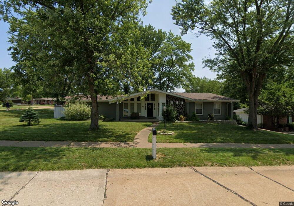
64 Burning Tree Dr Chesterfield, MO 63017
Estimated Value: $427,612 - $488,000
About This Home
This home is located at 64 Burning Tree Dr, Chesterfield, MO 63017 and is currently estimated at $448,153, approximately $242 per square foot. 64 Burning Tree Dr is a home located in St. Louis County with nearby schools including River Bend Elementary School, Parkway Central Middle School, and Parkway Central High School.
Ownership History
We collect this data history from publicly available records. To have your information removed, we recommend requesting removal directly through your county’s website.
Purchase Details
Home Financials for this Owner
Home Financials are based on the most recent Mortgage that was taken out on this home.Purchase Details
Home Values in the Area
Average Home Value in this Area
Purchase History
We collect this data history from publicly available records. To have your information removed, we recommend requesting removal directly through your county’s website.
| Date | Buyer | Sale Price | Title Company |
|---|---|---|---|
| $144,000 | Investors Title Co Clayton | ||
| -- | -- |
Mortgage History
We collect this data history from publicly available records. To have your information removed, we recommend requesting removal directly through your county’s website.
| Date | Status | Borrower | Loan Amount |
|---|---|---|---|
| Open | $141,391 |
Tax History
We collect this data history from publicly available records. To have your information removed, we recommend requesting removal directly through your county’s website.
| Year | Tax Paid | Tax Assessment Tax Assessment Total Assessment is a certain percentage of the fair market value that is determined by local assessors to be the total taxable value of land and additions on the property. | Land | Improvement |
|---|---|---|---|---|
| 2025 | $4,167 | $68,900 | $38,670 | $30,230 |
| 2024 | $4,167 | $62,910 | $25,710 | $37,200 |
| 2023 | $4,167 | $62,910 | $25,710 | $37,200 |
| 2022 | $3,549 | $50,790 | $25,710 | $25,080 |
| 2021 | $3,535 | $50,790 | $25,710 | $25,080 |
| 2020 | $3,504 | $48,360 | $22,040 | $26,320 |
| 2019 | $3,428 | $48,360 | $22,040 | $26,320 |
| 2018 | $3,672 | $48,070 | $20,200 | $27,870 |
| 2017 | $3,572 | $48,070 | $20,200 | $27,870 |
| 2016 | $3,386 | $43,280 | $16,530 | $26,750 |
| 2015 | $3,549 | $43,280 | $16,530 | $26,750 |
| 2014 | $3,288 | $42,860 | $10,030 | $32,830 |
Map
- 287 Glen Valley Dr
- 13573 Coliseum Dr
- 113 High Valley Dr
- 51 High Valley Dr
- 133 Glen Cove Dr
- 13556 Coliseum Dr
- 45 Orange Hills Dr
- 111 La Gorce Dr
- 13815 Olive Blvd
- 13451 Land O Woods Dr Unit C
- 357 N Woods Mill Rd
- 13503 Coliseum Dr
- 13484 Coliseum Dr
- 13438 Forestlac Dr
- 13485 Coliseum Dr Unit G
- 13453 Coliseum Dr Unit E
- 13419 Forestlac Dr
- 14308 Strawbridge Ct
- 13312 Wood Chapel Dr
- 13304 Streamwood Dr
- 73 Burning Tree Dr
- 72 Highland Park Dr
- 74 Burning Tree Dr
- 83 Burning Tree Dr
- 84 Burning Tree Dr
- 82 Burning Tree Dr
- 63 Highland Park Dr
- 641 Highland Park Dr
- 635 Burning Tree Dr
- 85 Burning Tree Dr
- 62 Highland Park Dr
- 61 Highland Park Dr
- 81 Burning Tree Dr
- 65 Burning Tree Dr
- 633 Broadmoor Dr
- 1 Valley Spring Tblt
- 3 Spring Valley Tbd
- 60 Highland Park Dr
- 2 Valley Spring Tblt
- 2 Spring Valley Tbd
Ask me questions while you tour the home.