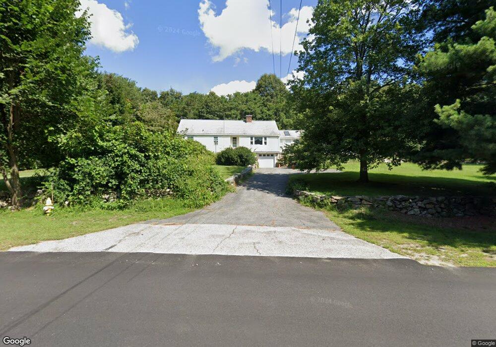
64 Flanders Rd Westborough, MA 01581
Estimated Value: $540,000 - $798,000
2
Beds
1
Bath
1,435
Sq Ft
$437/Sq Ft
Est. Value
About This Home
This home is located at 64 Flanders Rd, Westborough, MA 01581 and is currently estimated at $627,356, approximately $437 per square foot. 64 Flanders Rd is a home located in Worcester County with nearby schools including Westborough High School, Westboro Knowledge Beginnings, and Ebridge Montessori School.
Ownership History
Date
Name
Owned For
Owner Type
Purchase Details
Closed on
Jun 26, 2019
Sold by
Johnson Richard B and Johnson Raymond A
Bought by
Johnson Robert W and Johnson Constance
Current Estimated Value
Purchase Details
Closed on
Apr 1, 1988
Sold by
Vose Edithe E
Bought by
Johnson Richard B
Home Financials for this Owner
Home Financials are based on the most recent Mortgage that was taken out on this home.
Original Mortgage
$225,000
Interest Rate
9.89%
Mortgage Type
Purchase Money Mortgage
Create a Home Valuation Report for This Property
The Home Valuation Report is an in-depth analysis detailing your home's value as well as a comparison with similar homes in the area
Home Values in the Area
Average Home Value in this Area
Purchase History
| Date | Buyer | Sale Price | Title Company |
|---|---|---|---|
| Johnson Robert W | $200,000 | -- | |
| Johnson Robert W | $200,000 | -- | |
| Johnson Richard B | $300,000 | -- |
Source: Public Records
Mortgage History
| Date | Status | Borrower | Loan Amount |
|---|---|---|---|
| Previous Owner | Johnson Richard B | $225,000 |
Source: Public Records
Tax History
| Year | Tax Paid | Tax Assessment Tax Assessment Total Assessment is a certain percentage of the fair market value that is determined by local assessors to be the total taxable value of land and additions on the property. | Land | Improvement |
|---|---|---|---|---|
| 2025 | $7,987 | $490,300 | $349,700 | $140,600 |
| 2024 | $7,762 | $473,000 | $325,800 | $147,200 |
| 2023 | $7,445 | $442,100 | $309,200 | $132,900 |
| 2022 | $6,974 | $377,200 | $247,400 | $129,800 |
| 2021 | $6,508 | $351,000 | $221,200 | $129,800 |
| 2020 | $6,742 | $368,000 | $230,000 | $138,000 |
| 2019 | $6,353 | $346,600 | $230,000 | $116,600 |
| 2018 | $5,693 | $308,400 | $214,700 | $93,700 |
| 2017 | $5,490 | $308,400 | $214,700 | $93,700 |
| 2016 | $5,317 | $299,200 | $203,800 | $95,400 |
| 2015 | $5,506 | $296,200 | $203,800 | $92,400 |
Source: Public Records
Map
Nearby Homes
- 12 Butterfield Dr
- 500 Union St Unit 5404
- 18 Cedar St
- 5 Jacob Amsden Rd
- 24 Summer St
- 6 Peters Farm Way Unit 411
- 109 South St
- 4403 Peters Farm Way Unit 4403
- 2306 Talbot Way Unit 2306
- 7 Huckleberry Rd
- 20 Washington Ln
- 3 Quaker Way Unit 40
- 196 -198 Turnpike Rd
- 4204 Peters Farm Way Unit 204
- 12308 Peters Farm Way Unit 308
- 4 Peters Farm Way Unit 206
- 6312 Peters Farm Way Unit 6312
- 1207 Codman Way Unit 1207
- 11101 Peters Farm Way Unit 101
- 1109 Peters Farm Way Unit 1109
- 60 Flanders Rd
- 66 Flanders Rd
- 71 Flanders Rd
- 75 Flanders Rd
- 8 Chamberlain Ct
- 58 Flanders Rd
- 6 Chamberlain Ct
- 81 Flanders Rd
- 74 Flanders Rd
- 2 Chamberlain Ct
- 27 Butterfield Dr
- 65 Flanders Rd
- 83 Flanders Rd
- 3 Chamberlain Ct
- 29 Butterfield Dr
- 23 Butterfield Dr
- 52 Flanders Rd
- 52 Flanders Rd Unit A
- 63 Flanders Rd
- 76 Flanders Rd
Your Personal Tour Guide
Ask me questions while you tour the home.