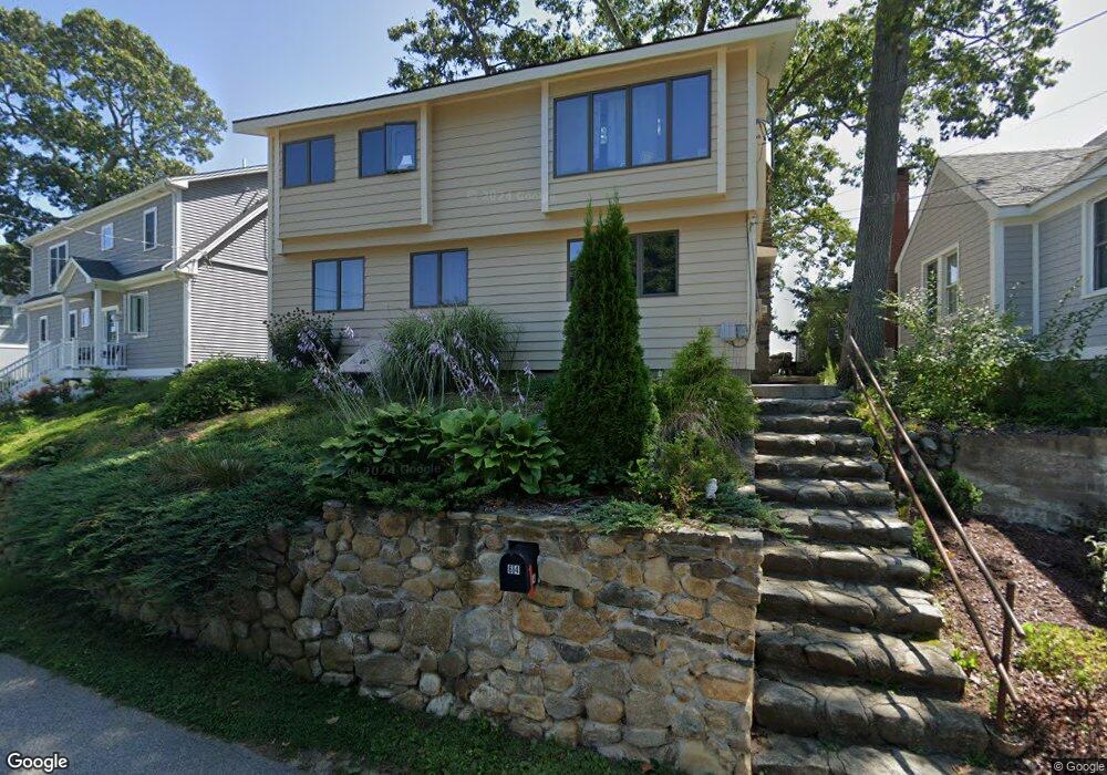
64 Indian Trail Westbrook, CT 06498
Estimated Value: $619,000 - $1,270,511
4
Beds
3
Baths
2,233
Sq Ft
$431/Sq Ft
Est. Value
About This Home
This home is located at 64 Indian Trail, Westbrook, CT 06498 and is currently estimated at $963,128, approximately $431 per square foot. 64 Indian Trail is a home located in Middlesex County with nearby schools including Daisy Ingraham School, Westbrook Middle School, and Westbrook High School.
Ownership History
Date
Name
Owned For
Owner Type
Purchase Details
Closed on
Oct 11, 2017
Sold by
Bon Mary
Bought by
Mccarthy George M
Current Estimated Value
Home Financials for this Owner
Home Financials are based on the most recent Mortgage that was taken out on this home.
Original Mortgage
$424,100
Outstanding Balance
$354,243
Interest Rate
3.82%
Mortgage Type
Purchase Money Mortgage
Estimated Equity
$608,885
Purchase Details
Closed on
Apr 24, 2017
Sold by
Marringa Menno and Bon Mary
Bought by
Bon Mary
Purchase Details
Closed on
Apr 9, 2002
Sold by
Cacase John A
Bought by
Marringo Menno and Bon Mary
Home Financials for this Owner
Home Financials are based on the most recent Mortgage that was taken out on this home.
Original Mortgage
$273,750
Interest Rate
6.85%
Mortgage Type
Purchase Money Mortgage
Create a Home Valuation Report for This Property
The Home Valuation Report is an in-depth analysis detailing your home's value as well as a comparison with similar homes in the area
Home Values in the Area
Average Home Value in this Area
Purchase History
We collect this data history from publicly available records. To have your information removed, we recommend requesting removal directly through your county’s website.
| Date | Buyer | Sale Price | Title Company |
|---|---|---|---|
| Mccarthy George M | $460,000 | -- | |
| Bon Mary | -- | -- | |
| Marringo Menno | $365,000 | -- |
Source: Public Records
Mortgage History
We collect this data history from publicly available records. To have your information removed, we recommend requesting removal directly through your county’s website.
| Date | Status | Borrower | Loan Amount |
|---|---|---|---|
| Open | Marringo Menno | $424,100 | |
| Previous Owner | Marringo Menno | $273,750 |
Source: Public Records
Tax History
| Year | Tax Paid | Tax Assessment Tax Assessment Total Assessment is a certain percentage of the fair market value that is determined by local assessors to be the total taxable value of land and additions on the property. | Land | Improvement |
|---|---|---|---|---|
| 2025 | $9,835 | $437,100 | $310,100 | $127,000 |
| 2024 | $9,485 | $437,100 | $310,100 | $127,000 |
| 2023 | $9,319 | $437,100 | $310,100 | $127,000 |
| 2022 | $9,074 | $437,100 | $310,100 | $127,000 |
| 2021 | $8,547 | $341,870 | $223,650 | $118,220 |
| 2020 | $8,547 | $341,870 | $223,650 | $118,220 |
| 2019 | $8,434 | $341,870 | $223,650 | $118,220 |
| 2018 | $8,331 | $341,870 | $223,650 | $118,220 |
| 2017 | $8,331 | $341,870 | $223,650 | $118,220 |
| 2016 | $8,247 | $356,410 | $213,710 | $142,700 |
| 2015 | $8,023 | $356,410 | $213,710 | $142,700 |
| 2014 | $7,766 | $356,390 | $213,710 | $142,680 |
Source: Public Records
Map
Nearby Homes
- 123 Old Mail Trail
- 23 Linden Ave N
- 18 Broadway N
- 68 Groveway
- 44 Linden Ave N
- 48 Linden Ave N
- 6 Leeway Dr
- 0 Boston Post Rd Unit 24080344
- 4 Robin Ln
- 449 Seaside Ave
- 520 Marina Way Landing Unit 520
- 296 E Main St
- 0 Causeway
- 176 Shore Rd
- 167 Shore Rd
- 273 Seaside Ave
- 280 E Main St Unit B5
- 280 E Main St Unit A3
- 280 E Main St Unit E2
- 448 Grove Beach Rd N
- 54 Menunketesuck Rd
- 58 Menunketesuck Rd
- 62 Menunketesuck Rd
- 50 Menunketesuck Rd
- 68 Menunketesuck Rd
- 62 Uncas Rd E
- 72 Indian Trail
- 70 Menunketesuck Rd
- 70 Mohican Rd
- 66 Mohican Rd
- 70 Indian Trail
- 58 Uncas Rd E
- 66 Mohican Rd
- 74 Menunketesuck Rd
- 62 Mohican Rd
- 54 Uncas Rd E
- 36 Menunketesuck Rd
- 58 Mohican Rd
- 78 Menunketesuck Rd
- 54 Mohican Rd
Your Personal Tour Guide
Ask me questions while you tour the home.