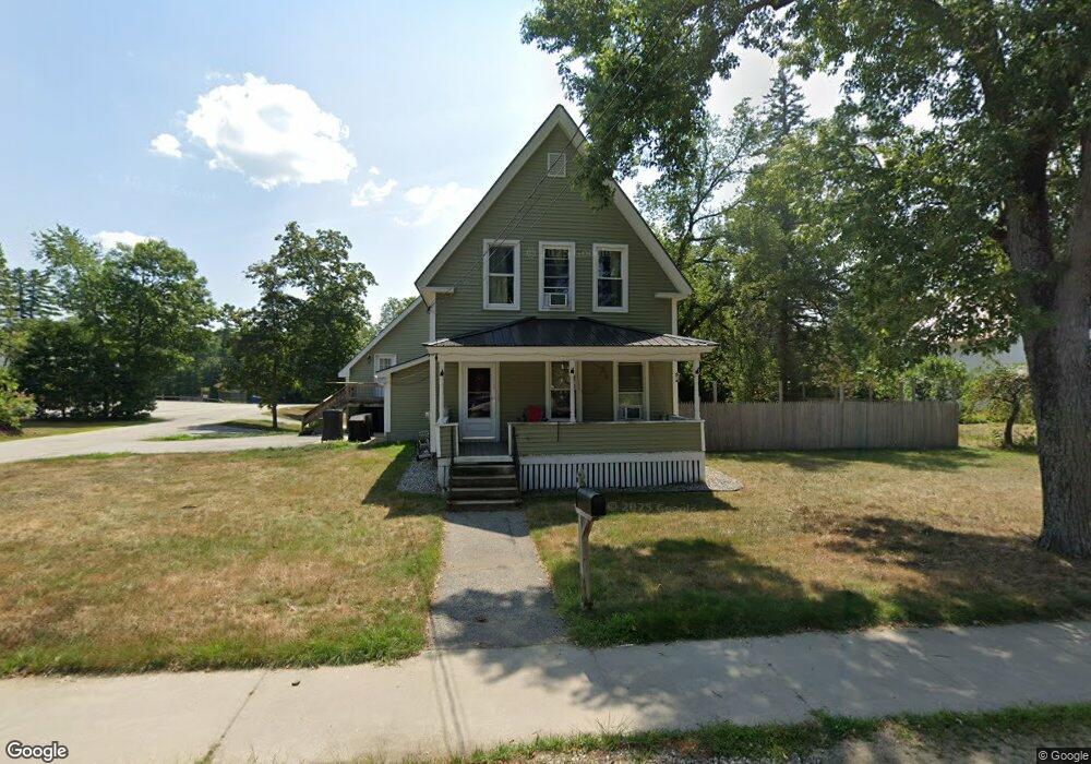
64 Main St Porter, ME 04068
Estimated Value: $266,973 - $348,000
About This Home
This home is located at 64 Main St, Porter, ME 04068 and is currently estimated at $302,993, approximately $182 per square foot. 64 Main St is a home located in Oxford County.
Ownership History
We collect this data history from publicly available records. To have your information removed, we recommend requesting removal directly through your county’s website.
Purchase Details
Home Values in the Area
Average Home Value in this Area
Purchase History
We collect this data history from publicly available records. To have your information removed, we recommend requesting removal directly through your county’s website.
| Date | Buyer | Sale Price | Title Company |
|---|---|---|---|
| $85,000 | -- |
Mortgage History
We collect this data history from publicly available records. To have your information removed, we recommend requesting removal directly through your county’s website.
| Date | Status | Borrower | Loan Amount |
|---|---|---|---|
| Closed | $40,000 |
Tax History
We collect this data history from publicly available records. To have your information removed, we recommend requesting removal directly through your county’s website.
| Year | Tax Paid | Tax Assessment Tax Assessment Total Assessment is a certain percentage of the fair market value that is determined by local assessors to be the total taxable value of land and additions on the property. | Land | Improvement |
|---|---|---|---|---|
| 2025 | $2,382 | $245,600 | $55,100 | $190,500 |
| 2024 | $2,698 | $226,739 | $41,183 | $185,556 |
| 2023 | $2,462 | $140,100 | $26,700 | $113,400 |
| 2022 | $2,326 | $140,115 | $26,739 | $113,376 |
| 2021 | $2,326 | $140,115 | $26,739 | $113,376 |
| 2020 | $2,281 | $140,115 | $26,739 | $113,376 |
| 2019 | $2,361 | $140,115 | $26,739 | $113,376 |
| 2018 | $2,361 | $140,115 | $26,739 | $113,376 |
| 2017 | $2,326 | $140,115 | $26,739 | $113,376 |
| 2016 | $2,116 | $140,115 | $26,739 | $113,376 |
| 2014 | $1,791 | $132,645 | $44,705 | $87,940 |
| 2013 | $1,791 | $132,645 | $44,705 | $87,940 |
Map
- 32 Summer St
- 66 Summer St
- 74 Summer St
- 15 Wadleigh St
- M-U5 L 1-2 Sunnydale Ln
- 84 Federal Rd
- 62 & 66 Brownfield Rd
- 66 Brownfield Rd
- 122 Ossipee Trail
- 81 Swan Point
- 31A-4 Trafton Way
- 206 Gilman Rd
- 461 Ossipee Trail
- 272 Tripptown Rd
- 583 Ossipee Trail
- 42AC Ben Gilpatrick Rd
- 00 Brownfield Rd
- 5 Moulton Ridge Rd
- 839 Brownfield Rd
- 65 Road Between the Ponds
Ask me questions while you tour the home.