H
Seller's Agent in 2024
Hannah Holmes
Cottage & Co Real Estate
(207) 450-2346
3 in this area
59 Total Sales


Estimated Value: $1,176,000 - $2,754,000
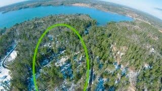
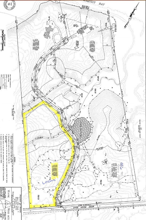
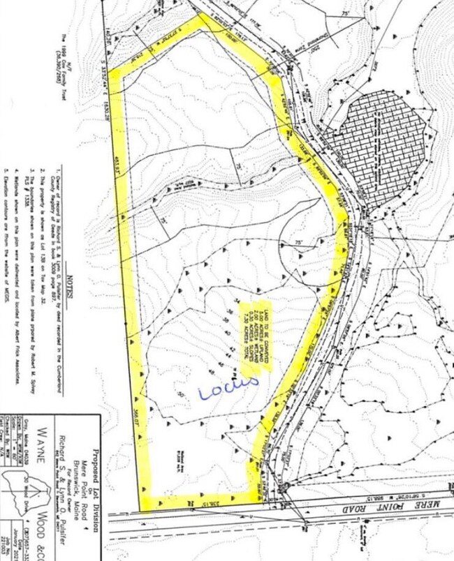
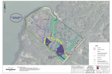
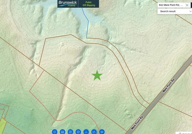
On magical Mere Point, here's a rare opportunity to build your dream home! This large, deep lot offers two different house site options, and a wealth of healthy forest and streams. Building areas have already been identified, and soil tests completed. Call your builder!
While your home is being built, clear your own trails for a walk that could even take in a peek of a Maquiot Bay estuary--a birder's bonus!
Mere Point itself is a marvel of geology, a slender peninsula stretching three miles into the Atlantic Ocean. The drive alone is a treat, with glimpses of the Maquoit Bay on one side of the road, and Middle Bay on the other. And at road's end, find a well appointed boat launch with docks, picnic tables, and a gorgeous view of the sparkling sea. At the top of the peninsula, of course, is the pretty town of Brunswick, a creative hotspot and home to Bowdoin College. Portland and the jetport are only about 30 miles down the coast.
| Date | Buyer | Sale Price | Title Company |
|---|---|---|---|
| Woodmere Llc | -- | None Available | |
| Woodmere Llc | -- | None Available | |
| Stjohn Ashley M | -- | Stewart Title | |
| Stjohn Ashley M | -- | Stewart Title |
| Date | Status | Borrower | Loan Amount |
|---|---|---|---|
| Open | Woodmere Llc | $600,000 | |
| Closed | Woodmere Llc | $600,000 | |
| Previous Owner | Stjohn Ashley M | $185,250 |
| Date | Event | Price | List to Sale | Price per Sq Ft |
|---|---|---|---|---|
| 08/16/2024 08/16/24 | Sold | $220,000 | -7.2% | -- |
| 06/07/2024 06/07/24 | Pending | -- | -- | -- |
| 02/26/2024 02/26/24 | For Sale | $237,000 | -- | -- |
| Year | Tax Paid | Tax Assessment Tax Assessment Total Assessment is a certain percentage of the fair market value that is determined by local assessors to be the total taxable value of land and additions on the property. | Land | Improvement |
|---|---|---|---|---|
| 2024 | $24,842 | $1,041,600 | $335,300 | $706,300 |
| 2023 | $24,254 | $1,041,400 | $335,300 | $706,100 |
| 2022 | $22,410 | $1,033,200 | $335,300 | $697,900 |
| 2021 | $21,553 | $1,033,200 | $335,300 | $697,900 |
| 2020 | $20,460 | $1,004,400 | $306,500 | $697,900 |
| 2019 | $19,755 | $1,001,800 | $307,000 | $694,800 |
| 2018 | $18,466 | $1,002,000 | $307,200 | $694,800 |
| 2017 | $18,401 | $1,001,700 | $306,900 | $694,800 |
| 2016 | $18,646 | $635,300 | $168,400 | $466,900 |
| 2015 | $17,980 | $634,000 | $167,100 | $466,900 |
| 2014 | $17,185 | $634,200 | $167,300 | $466,900 |
| 2013 | -- | $634,300 | $167,400 | $466,900 |
H
Seller's Agent in 2024
Hannah Holmes
Cottage & Co Real Estate
(207) 450-2346
3 in this area
59 Total Sales
L
Buyer's Agent in 2024
Lisa Holley
Shoreland Real Estate
(207) 751-0374
3 in this area
23 Total Sales
Source: Maine Listings
MLS Number: 1582934
APN: BRUN-000031-000000-000013B
Disclaimer: Certain information contained herein is derived from information provided by parties other than Homes.com. All information provided is deemed reliable, but is not guaranteed to be accurate and should be independently verified.
![]() Listing data is derived in whole or in part from Maine Real Estate Information System, Inc. (d/b/a Maine Listings) and is for consumers' personal, noncommercial use only. Dimensions are approximate and not guaranteed. All data should be independently verified.
Listing data is derived in whole or in part from Maine Real Estate Information System, Inc. (d/b/a Maine Listings) and is for consumers' personal, noncommercial use only. Dimensions are approximate and not guaranteed. All data should be independently verified.
© 2026 Maine Real Estate Information System, Inc. All Rights Reserved. Equal Housing Opportunity.
Homes.com, LLC, 17600 Laguna Canyon Rd Irvine, CA 92618 (888)-952-6393
![]()
Ask me questions while you tour the home.
