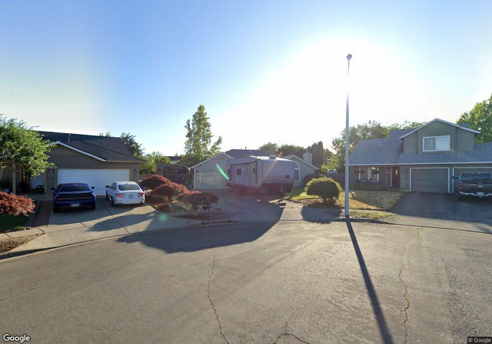
642 S Beech Cir Cornelius, OR 97113
Estimated Value: $455,000 - $470,000
3
Beds
2
Baths
1,448
Sq Ft
$318/Sq Ft
Est. Value
About This Home
This home is located at 642 S Beech Cir, Cornelius, OR 97113 and is currently estimated at $460,345, approximately $317 per square foot. 642 S Beech Cir is a home located in Washington County with nearby schools including Echo Shaw Elementary School, Neil Armstrong Middle School, and Tom McCall Upper Elementary School.
Ownership History
Date
Name
Owned For
Owner Type
Purchase Details
Closed on
Aug 30, 2012
Sold by
The Secretary Of Housing & Urban Develop
Bought by
Thomas Jordan
Current Estimated Value
Home Financials for this Owner
Home Financials are based on the most recent Mortgage that was taken out on this home.
Original Mortgage
$132,602
Outstanding Balance
$90,750
Interest Rate
3.49%
Mortgage Type
New Conventional
Estimated Equity
$369,595
Purchase Details
Closed on
Feb 2, 2012
Sold by
Jpmorgan Chase Bank National Association
Bought by
The Secretary Of Housing & Urban Develop
Purchase Details
Closed on
Oct 27, 2011
Sold by
Andrade Maria E
Bought by
Chase Home Finance Llc
Purchase Details
Closed on
Oct 26, 2005
Sold by
Andrade Nancy
Bought by
Andrade Jose and Andrade Maria E
Home Financials for this Owner
Home Financials are based on the most recent Mortgage that was taken out on this home.
Original Mortgage
$176,000
Interest Rate
8.37%
Mortgage Type
Fannie Mae Freddie Mac
Purchase Details
Closed on
Oct 25, 2005
Sold by
Andrade Jose J
Bought by
Andrade Jose and Andrade Maria E
Home Financials for this Owner
Home Financials are based on the most recent Mortgage that was taken out on this home.
Original Mortgage
$176,000
Interest Rate
8.37%
Mortgage Type
Fannie Mae Freddie Mac
Purchase Details
Closed on
Sep 26, 2000
Sold by
Stults Philip M and Stults Lorie B
Bought by
Andrade Jose and Andrade Maria E
Home Financials for this Owner
Home Financials are based on the most recent Mortgage that was taken out on this home.
Original Mortgage
$147,137
Interest Rate
7.98%
Mortgage Type
FHA
Purchase Details
Closed on
Jan 20, 1995
Sold by
Michaelis Bernice and Zinn Lorine
Bought by
Stults Philip M and Stults Lorie B
Home Financials for this Owner
Home Financials are based on the most recent Mortgage that was taken out on this home.
Original Mortgage
$115,900
Interest Rate
9.16%
Mortgage Type
Seller Take Back
Purchase Details
Closed on
Nov 4, 1994
Sold by
Stennes Howard A
Bought by
Lee & Lee Ltd
Create a Home Valuation Report for This Property
The Home Valuation Report is an in-depth analysis detailing your home's value as well as a comparison with similar homes in the area
Purchase History
We collect this data history from publicly available records. To have your information removed, we recommend requesting removal directly through your county’s website.
| Date | Buyer | Sale Price | Title Company |
|---|---|---|---|
| Thomas Jordan | $123,000 | Fidelity Natl Title Co Of Or | |
| The Secretary Of Housing & Urban Develop | $213,639 | Fatco | |
| Chase Home Finance Llc | $245,328 | Fatco | |
| Andrade Jose | -- | -- | |
| Andrade Jose | -- | -- | |
| Andrade Jose | $148,400 | Transnation Title Insurance | |
| Stults Philip M | $125,900 | Stewart Title | |
| Lee & Lee Ltd | $105,000 | Fidelity National Title Co |
Source: Public Records
Mortgage History
We collect this data history from publicly available records. To have your information removed, we recommend requesting removal directly through your county’s website.
| Date | Status | Borrower | Loan Amount |
|---|---|---|---|
| Open | Thomas Jordan | $132,602 | |
| Previous Owner | Andrade Jose | $176,000 | |
| Previous Owner | Andrade Jose | $147,137 | |
| Previous Owner | Stults Philip M | $115,900 |
Source: Public Records
Tax History
| Year | Tax Paid | Tax Assessment Tax Assessment Total Assessment is a certain percentage of the fair market value that is determined by local assessors to be the total taxable value of land and additions on the property. | Land | Improvement |
|---|---|---|---|---|
| 2026 | $4,215 | $242,600 | -- | -- |
| 2025 | $4,215 | $235,540 | -- | -- |
| 2024 | $3,849 | $228,680 | -- | -- |
| 2023 | $3,849 | $222,020 | $0 | $0 |
| 2022 | $3,410 | $222,020 | $0 | $0 |
| 2021 | $3,370 | $209,290 | $0 | $0 |
| 2020 | $3,357 | $203,200 | $0 | $0 |
| 2019 | $3,284 | $197,290 | $0 | $0 |
| 2018 | $3,183 | $191,550 | $0 | $0 |
| 2017 | $3,085 | $185,980 | $0 | $0 |
| 2016 | $2,998 | $180,570 | $0 | $0 |
| 2015 | $2,821 | $175,320 | $0 | $0 |
| 2014 | $2,724 | $170,220 | $0 | $0 |
Source: Public Records
Map
Nearby Homes
- 332 S Tarrybrook Dr
- 1232 Elder Place
- 1214 N Clark St
- 961 S 4th Ave
- 726 S Linden St
- 1509 Centennial Cir
- 570 N 10th St Unit 29
- 570 N 10th Ave Unit 43
- 570 N 10th Ave Unit 2
- 570 N 10th Ave Unit 71
- 570 N 10th Ave Unit 110
- 1701 S Alpine St
- 4403 Wagon Wheel Cir
- 302 S 19th Ave
- 1680 N Davis St
- 1301 Settlers Loop
- 3839 Pacific Ave Unit 314
- 333 N 19th Ave
- 507 N 19th Ave Unit 15
- 507 N 19th Ave Unit 99
Your Personal Tour Guide
Ask me questions while you tour the home.