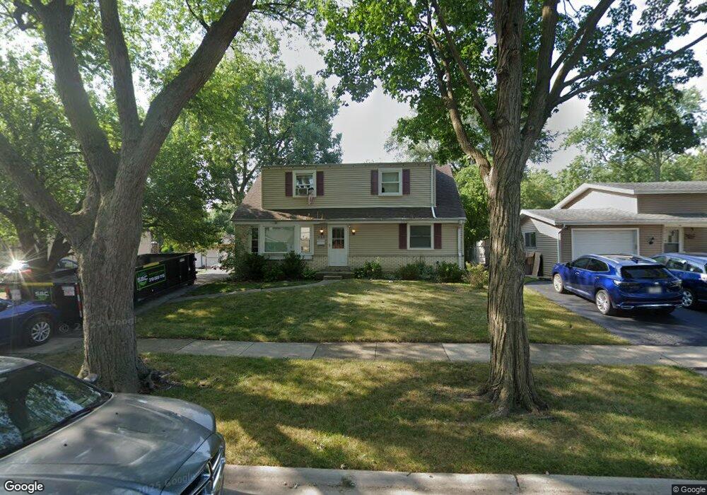
643 Maple Dr Buffalo Grove, IL 60089
South Buffalo Grove NeighborhoodEstimated Value: $360,000 - $455,000
4
Beds
2
Baths
1,770
Sq Ft
$228/Sq Ft
Est. Value
About This Home
This home is located at 643 Maple Dr, Buffalo Grove, IL 60089 and is currently estimated at $404,209, approximately $228 per square foot. 643 Maple Dr is a home located in Cook County with nearby schools including Henry W Longfellow Elementary School, Cooper Middle School, and Buffalo Grove High School.
Ownership History
Date
Name
Owned For
Owner Type
Purchase Details
Closed on
Dec 16, 2016
Sold by
Nickerson Leanne
Bought by
Nickerson Leanne and Leanne Nickerson Trust
Current Estimated Value
Purchase Details
Closed on
Sep 22, 2016
Sold by
Carmain Clyde J and Carmain Carol
Bought by
Nickerson Leanne
Home Financials for this Owner
Home Financials are based on the most recent Mortgage that was taken out on this home.
Original Mortgage
$105,000
Outstanding Balance
$83,432
Interest Rate
3.52%
Mortgage Type
New Conventional
Estimated Equity
$320,777
Purchase Details
Closed on
Jun 30, 2016
Sold by
Carmain Clyde J and Carmain Carol
Bought by
Carmain Cyde J and Carmain Carol
Purchase Details
Closed on
Sep 15, 2011
Sold by
Muryn Gregory J
Bought by
Carmain Clyde J and Carmain Carol
Home Financials for this Owner
Home Financials are based on the most recent Mortgage that was taken out on this home.
Original Mortgage
$106,750
Interest Rate
4.02%
Mortgage Type
New Conventional
Purchase Details
Closed on
Dec 8, 1997
Sold by
Lakewood Streams Ltd Partnership
Bought by
Gautam Vikas and Gautam Simmi
Home Financials for this Owner
Home Financials are based on the most recent Mortgage that was taken out on this home.
Original Mortgage
$160,200
Interest Rate
7.25%
Create a Home Valuation Report for This Property
The Home Valuation Report is an in-depth analysis detailing your home's value as well as a comparison with similar homes in the area
Home Values in the Area
Average Home Value in this Area
Purchase History
| Date | Buyer | Sale Price | Title Company |
|---|---|---|---|
| Nickerson Leanne | -- | Attorney | |
| Nickerson Leanne | -- | None Available | |
| Carmain Cyde J | -- | None Available | |
| Carmain Clyde J | $152,500 | Republic Title Co | |
| Gautam Vikas | $178,500 | -- |
Source: Public Records
Mortgage History
| Date | Status | Borrower | Loan Amount |
|---|---|---|---|
| Open | Nickerson Leanne | $105,000 | |
| Previous Owner | Carmain Clyde J | $106,750 | |
| Previous Owner | Gautam Vikas | $160,200 |
Source: Public Records
Tax History
| Year | Tax Paid | Tax Assessment Tax Assessment Total Assessment is a certain percentage of the fair market value that is determined by local assessors to be the total taxable value of land and additions on the property. | Land | Improvement |
|---|---|---|---|---|
| 2025 | $8,541 | $40,000 | $7,560 | $32,440 |
| 2024 | $8,541 | $30,000 | $6,480 | $23,520 |
| 2023 | $8,185 | $30,000 | $6,480 | $23,520 |
| 2022 | $8,185 | $30,000 | $6,480 | $23,520 |
| 2021 | $7,564 | $24,740 | $4,140 | $20,600 |
| 2020 | $7,439 | $24,740 | $4,140 | $20,600 |
| 2019 | $7,430 | $27,428 | $4,140 | $23,288 |
| 2018 | $9,709 | $31,628 | $3,600 | $28,028 |
| 2017 | $9,551 | $31,628 | $3,600 | $28,028 |
| 2016 | $9,933 | $31,628 | $3,600 | $28,028 |
| 2015 | $8,887 | $26,159 | $3,060 | $23,099 |
| 2014 | $8,740 | $26,159 | $3,060 | $23,099 |
| 2013 | $8,079 | $26,159 | $3,060 | $23,099 |
Source: Public Records
Map
Nearby Homes
- 8 Greenwood Ct N
- 393 Indian Hill Dr
- 517 Longwood Dr
- 535 Weidner Rd
- 496 Raupp Blvd
- 462 Longwood Dr
- 140 Manchester Dr Unit 408
- 808 Old Checker Rd Unit C2
- 141 Manchester Ct
- 125 N Buffalo Grove Rd Unit 407
- 611 Hapsfield Ln Unit 100
- 671 Hapsfield Ln Unit 105
- 1096 Beechwood Rd
- 621 Hapsfield Ln Unit 103
- 820 Weidner Rd Unit 409
- 631 Hapsfield Ln Unit 631106
- 760 Weidner Rd Unit 107
- 302 Chateau Dr
- 4 Burnt Ember Ct
- 219 Old Oak Ct W Unit 305
Your Personal Tour Guide
Ask me questions while you tour the home.