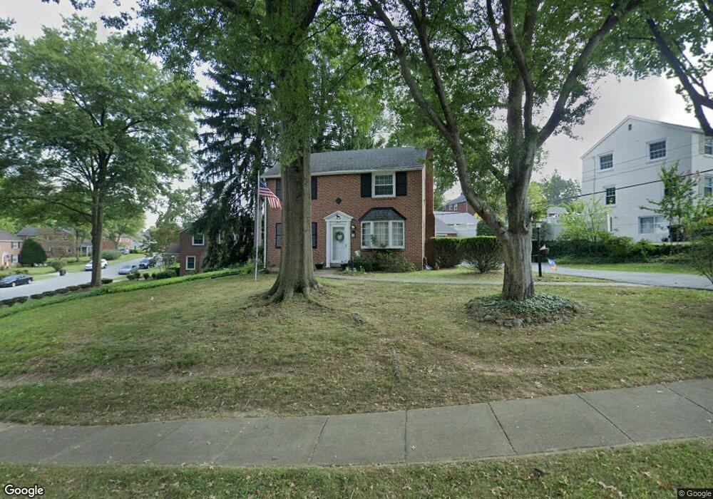
643 Newlin Rd Springfield, PA 19064
Estimated Value: $400,000 - $445,000
3
Beds
2
Baths
1,418
Sq Ft
$299/Sq Ft
Est. Value
About This Home
This home is located at 643 Newlin Rd, Springfield, PA 19064 and is currently estimated at $424,012, approximately $299 per square foot. 643 Newlin Rd is a home located in Delaware County with nearby schools including Springfield High School, St Francis Of Assisi School, and Cardinal O'Hara High School.
Ownership History
Date
Name
Owned For
Owner Type
Purchase Details
Closed on
Nov 11, 2025
Sold by
Hanlon Charles A
Bought by
Hanlon Daniel
Current Estimated Value
Home Financials for this Owner
Home Financials are based on the most recent Mortgage that was taken out on this home.
Original Mortgage
$310,000
Outstanding Balance
$309,128
Interest Rate
6.34%
Mortgage Type
New Conventional
Estimated Equity
$114,884
Purchase Details
Closed on
Jun 15, 1990
Sold by
Curley Edw E
Bought by
Hanlon Charles A and Hanlon Dorothy M
Create a Home Valuation Report for This Property
The Home Valuation Report is an in-depth analysis detailing your home's value as well as a comparison with similar homes in the area
Home Values in the Area
Average Home Value in this Area
Purchase History
| Date | Buyer | Sale Price | Title Company |
|---|---|---|---|
| Hanlon Daniel | $400,000 | Sage Premier Settlements | |
| Hanlon Charles A | $163,000 | -- |
Source: Public Records
Mortgage History
| Date | Status | Borrower | Loan Amount |
|---|---|---|---|
| Open | Hanlon Daniel | $310,000 |
Source: Public Records
Tax History
| Year | Tax Paid | Tax Assessment Tax Assessment Total Assessment is a certain percentage of the fair market value that is determined by local assessors to be the total taxable value of land and additions on the property. | Land | Improvement |
|---|---|---|---|---|
| 2025 | $7,424 | $264,140 | $96,230 | $167,910 |
| 2024 | $7,424 | $264,140 | $96,230 | $167,910 |
| 2023 | $7,149 | $264,140 | $96,230 | $167,910 |
| 2022 | $6,994 | $264,140 | $96,230 | $167,910 |
| 2021 | $10,832 | $264,140 | $96,230 | $167,910 |
| 2020 | $5,872 | $129,590 | $46,270 | $83,320 |
| 2019 | $5,734 | $129,590 | $46,270 | $83,320 |
| 2018 | $5,652 | $129,590 | $0 | $0 |
| 2017 | $5,521 | $129,590 | $0 | $0 |
| 2016 | $711 | $129,590 | $0 | $0 |
| 2015 | $726 | $129,590 | $0 | $0 |
| 2014 | $726 | $129,590 | $0 | $0 |
Source: Public Records
Map
Nearby Homes
- 71 W Sproul Rd
- 493 Wheatsheaf Rd
- 1363 Palmer Dr Unit O122
- 1291 Country Club Dr Unit Q137
- 249 Gleaves Rd
- 231 E Woodland Ave
- 364 S Rolling Rd
- 525 N Swarthmore Ave
- 519 Walnut Ln Unit 1
- 264 Pancoast Ave
- 720 Evans Rd
- 359 Spring Valley Rd
- 933 Greenbriar Ln
- 658 E Leamy Ave
- 253 Saxer Ave
- 208 Parham Rd
- 436 Kerr Ln
- 334 Parham Rd
- 114 Providence Rd
- 341 Harwicke Rd
Your Personal Tour Guide
Ask me questions while you tour the home.