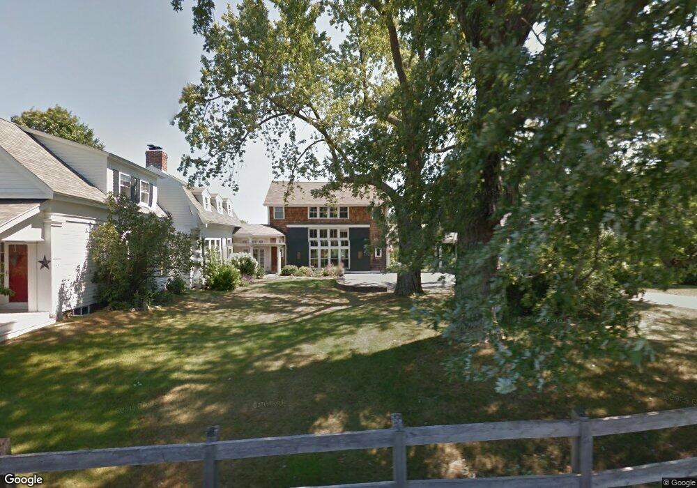
645 Main St Boxford, MA 01921
Estimated Value: $1,425,000 - $1,675,000
4
Beds
4
Baths
4,273
Sq Ft
$358/Sq Ft
Est. Value
About This Home
This home is located at 645 Main St, Boxford, MA 01921 and is currently estimated at $1,528,700, approximately $357 per square foot. 645 Main St is a home located in Essex County with nearby schools including Harry Lee Cole, Spofford Pond School, and Sacred Heart School.
Ownership History
Date
Name
Owned For
Owner Type
Purchase Details
Closed on
Jun 12, 2017
Sold by
Melson Donald B and Melson Jennifer A
Bought by
Jennifer A Melson 1993
Current Estimated Value
Purchase Details
Closed on
Dec 20, 2007
Sold by
Ricciardone-Storm A Lina and Thacher Storm G
Bought by
Menard Christopher J
Purchase Details
Closed on
Jun 10, 1996
Sold by
Newcomb Gail C and Newcomb Peter
Bought by
Storm G Thacher and Ricciardone Lina
Create a Home Valuation Report for This Property
The Home Valuation Report is an in-depth analysis detailing your home's value as well as a comparison with similar homes in the area
Home Values in the Area
Average Home Value in this Area
Purchase History
| Date | Buyer | Sale Price | Title Company |
|---|---|---|---|
| Jennifer A Melson 1993 | -- | -- | |
| Menard Christopher J | $900,000 | -- | |
| Storm G Thacher | $305,000 | -- |
Source: Public Records
Mortgage History
| Date | Status | Borrower | Loan Amount |
|---|---|---|---|
| Previous Owner | Storm G Thacher | $285,000 |
Source: Public Records
Tax History
| Year | Tax Paid | Tax Assessment Tax Assessment Total Assessment is a certain percentage of the fair market value that is determined by local assessors to be the total taxable value of land and additions on the property. | Land | Improvement |
|---|---|---|---|---|
| 2025 | $18,990 | $1,411,900 | $412,400 | $999,500 |
| 2024 | $17,923 | $1,373,400 | $412,400 | $961,000 |
| 2023 | $16,957 | $1,225,200 | $368,300 | $856,900 |
| 2022 | $16,279 | $1,069,600 | $309,100 | $760,500 |
| 2021 | $15,839 | $989,300 | $282,000 | $707,300 |
| 2020 | $15,602 | $964,900 | $282,000 | $682,900 |
| 2019 | $14,847 | $912,000 | $269,000 | $643,000 |
| 2018 | $14,797 | $913,400 | $269,000 | $644,400 |
| 2017 | $13,960 | $855,900 | $256,300 | $599,600 |
| 2016 | $14,040 | $853,000 | $256,300 | $596,700 |
| 2015 | $12,886 | $805,900 | $256,300 | $549,600 |
Source: Public Records
Map
Nearby Homes
- 1401 Great Pond Rd Unit 3
- 175 Carter Field Rd
- 108 Campion Rd
- 499 Main St
- Lot B Willow Ave
- 35 Bonny Ln
- 65 Saile Way
- 44 Pine Plain Rd
- 1785 Great Pond Rd
- 116 Towne Hill Rd
- 0 S Cross Rd
- 768 Salem St
- 427b Ipswich Rd
- 13 Towne Hill Rd
- 98 Washington St
- 15 Cedarcrest Ln
- 40 William Ave
- 414 Farrwood Dr Unit 414
- 499 Chadwick Rd
- 183 Farrwood Dr
Your Personal Tour Guide
Ask me questions while you tour the home.