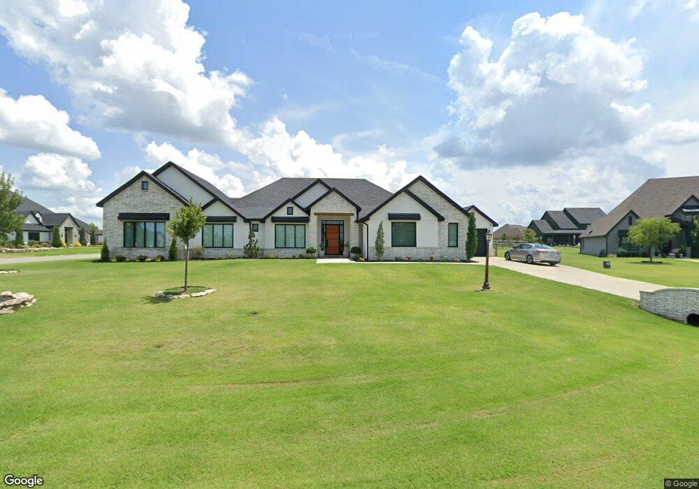
6455 N Linger Loop Owasso, OK 74055
Stone Canyon NeighborhoodEstimated Value: $630,000 - $744,000
3
Beds
4
Baths
3,453
Sq Ft
$193/Sq Ft
Est. Value
About This Home
This home is located at 6455 N Linger Loop, Owasso, OK 74055 and is currently estimated at $666,911, approximately $193 per square foot. 6455 N Linger Loop is a home with nearby schools including Stone Canyon Elementary School, Owasso 6th Grade Center, and Owasso 8th Grade Center.
Ownership History
Date
Name
Owned For
Owner Type
Purchase Details
Closed on
Jun 21, 2019
Sold by
C A B O Development Company Llc
Bought by
Szuba Gracjan K and Szuba Crystal A
Current Estimated Value
Home Financials for this Owner
Home Financials are based on the most recent Mortgage that was taken out on this home.
Original Mortgage
$67,950
Outstanding Balance
$44,112
Interest Rate
4%
Mortgage Type
Commercial
Estimated Equity
$622,799
Create a Home Valuation Report for This Property
The Home Valuation Report is an in-depth analysis detailing your home's value as well as a comparison with similar homes in the area
Home Values in the Area
Average Home Value in this Area
Purchase History
| Date | Buyer | Sale Price | Title Company |
|---|---|---|---|
| Szuba Gracjan K | $75,500 | Investors Title & Escrow Co |
Source: Public Records
Mortgage History
| Date | Status | Borrower | Loan Amount |
|---|---|---|---|
| Open | Szuba Gracjan K | $67,950 |
Source: Public Records
Tax History
| Year | Tax Paid | Tax Assessment Tax Assessment Total Assessment is a certain percentage of the fair market value that is determined by local assessors to be the total taxable value of land and additions on the property. | Land | Improvement |
|---|---|---|---|---|
| 2025 | $5,974 | $61,984 | $10,228 | $51,756 |
| 2024 | $4,985 | $52,894 | $9,626 | $43,268 |
| 2023 | $4,985 | $51,353 | $8,799 | $42,554 |
| 2022 | $4,787 | $49,857 | $8,415 | $41,442 |
| 2021 | $4,586 | $48,405 | $8,415 | $39,990 |
| 2020 | $813 | $8,415 | $8,415 | $0 |
| 2019 | $61 | $626 | $626 | $0 |
| 2018 | $58 | $626 | $626 | $0 |
| 2017 | $2,645 | $25,457 | $1,980 | $23,477 |
| 2016 | $2,572 | $24,751 | $1,980 | $22,771 |
| 2015 | $2,498 | $24,020 | $1,980 | $22,040 |
| 2014 | $2,549 | $24,508 | $1,980 | $22,528 |
Source: Public Records
Map
Nearby Homes
- 6381 N Locust Ln
- 19236 E Twin Creeks Dr
- 6110 N Creekwood Dr
- 19063 E Twin Creeks Dr
- 6502 N Oakwood Cir
- 6131 N Creekwood Dr
- 5961 N Meadows Ridge Rd
- 18533 E Crooked Oak Dr
- 19835 E Redbud Dr
- 6480 N Blue Sage Dr
- 5838 N River Birch Rd
- 6322 N Wildwood Ln
- 18203 Anthem Ridge Rd
- 6341 S Ridgeview Rd
- 20030 E Chinquapin Ln
- 18127 Anthem Ridge Rd
- 17940 E Red Hawk Rd
- 7160 Bluebird Ct
- 17822 E Patriot Dr
- 17702 E Falcon Pass
- 6435 N Linger Loop
- 18806 E Chokeberry St
- 18741 E Red Fox Trail
- 18826 E Chokeberry St
- 6415 N Linger Loop
- 18781 E Red Fox Trail
- 18721 E Red Fox Trail
- 6436 N Linger Loop
- 18846 E Chokeberry St
- 6337 N Dogwood Trail
- 18805 E Red Fox Trail
- 18688 E Red Fox Trail
- 18701 E Red Fox Trail
- 18847 E Chokeberry St
- 18685 E Persimmon Ln
- 6438 N Twin Creeks Dr
- 6446 N Twin Creeks Dr
- 18866 E Chokeberry St
- 18825 E Red Fox Trail
- 6426 N Twin Creeks Dr
Your Personal Tour Guide
Ask me questions while you tour the home.