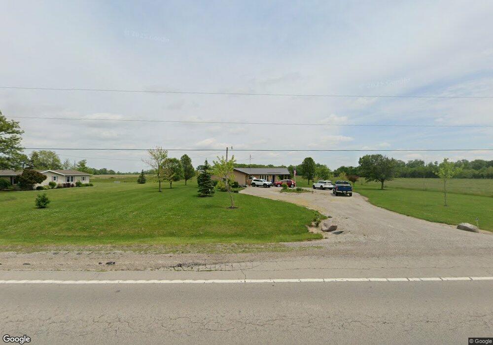
6460 Us Route 127 Paulding, OH 45879
Estimated Value: $177,275 - $185,000
2
Beds
1
Bath
1,152
Sq Ft
$157/Sq Ft
Est. Value
About This Home
This home is located at 6460 Us Route 127, Paulding, OH 45879 and is currently estimated at $181,319, approximately $157 per square foot. 6460 Us Route 127 is a home with nearby schools including Wayne Trace High School.
Ownership History
Date
Name
Owned For
Owner Type
Purchase Details
Closed on
Aug 21, 2025
Sold by
Plummer Jerry
Bought by
Aho Calvin and Aho Ronda
Current Estimated Value
Home Financials for this Owner
Home Financials are based on the most recent Mortgage that was taken out on this home.
Original Mortgage
$174,600
Outstanding Balance
$173,840
Interest Rate
6.75%
Mortgage Type
New Conventional
Estimated Equity
$7,479
Purchase Details
Closed on
May 13, 2019
Sold by
Plummer Anna Marie
Bought by
Plummer Jerry
Purchase Details
Closed on
Aug 9, 2010
Sold by
Plummer Anna Marie and Plummer Carol A
Bought by
Plummer Ann Marie
Create a Home Valuation Report for This Property
The Home Valuation Report is an in-depth analysis detailing your home's value as well as a comparison with similar homes in the area
Purchase History
| Date | Buyer | Sale Price | Title Company |
|---|---|---|---|
| Aho Calvin | -- | Baker Mcclure Law & Title | |
| Plummer Jerry | $65,000 | None Available | |
| Plummer Ann Marie | -- | None Available |
Source: Public Records
Mortgage History
| Date | Status | Borrower | Loan Amount |
|---|---|---|---|
| Open | Aho Calvin | $174,600 |
Source: Public Records
Tax History
| Year | Tax Paid | Tax Assessment Tax Assessment Total Assessment is a certain percentage of the fair market value that is determined by local assessors to be the total taxable value of land and additions on the property. | Land | Improvement |
|---|---|---|---|---|
| 2025 | $1,547 | $51,250 | $10,750 | $40,500 |
| 2024 | $1,547 | $40,040 | $8,400 | $31,640 |
| 2023 | $1,254 | $40,040 | $8,400 | $31,640 |
| 2022 | $1,291 | $40,040 | $8,400 | $31,640 |
| 2021 | $1,044 | $28,810 | $8,120 | $20,690 |
| 2020 | $1,080 | $28,810 | $8,120 | $20,690 |
| 2019 | $757 | $26,110 | $8,120 | $17,990 |
| 2018 | $588 | $26,110 | $8,120 | $17,990 |
| 2017 | $589 | $26,110 | $8,120 | $17,990 |
| 2016 | $589 | $26,110 | $8,120 | $17,990 |
| 2015 | $541 | $25,000 | $7,670 | $17,330 |
| 2014 | $548 | $25,000 | $7,670 | $17,330 |
| 2013 | $608 | $25,000 | $7,670 | $17,330 |
Source: Public Records
Map
Nearby Homes
- 0 Road 72
- 742 E Perry St
- 200 German St
- 701 E Wayne St
- 111 W Wayne St
- 520 W Wayne St
- 714 W Wayne St
- 717 W Harrison St
- 780 W Jackson St
- 301 N Main St
- 215 N Dewitt St
- 516 N Williams St
- 713 N Walnut St
- 741 Tom Tim Dr
- 11051 Road 93
- 1067 College Ave
- 830 N Walnut St
- 12744 Blaine St
- 434 Haven St
- 13795 Nancy St
- 6474 Us Route 127
- 6540 Us Route 127
- 6521 Us Route 127
- 6540 Us
- 6601 Us Route 127
- 6112 Us Route 127
- 6054 Us Route 127
- 6087 Us Route 127
- 6894 Us Route 127
- 12938 Road 72
- 13321 Road 72
- 12689 Road 72
- 12724 Road 72
- 12664 Road 72
- 13368 Road 82
- 5785 Us Highway 127
- 13501 Road 72
- 5785 Us Route 127
- 5785 State Route 127
Your Personal Tour Guide
Ask me questions while you tour the home.