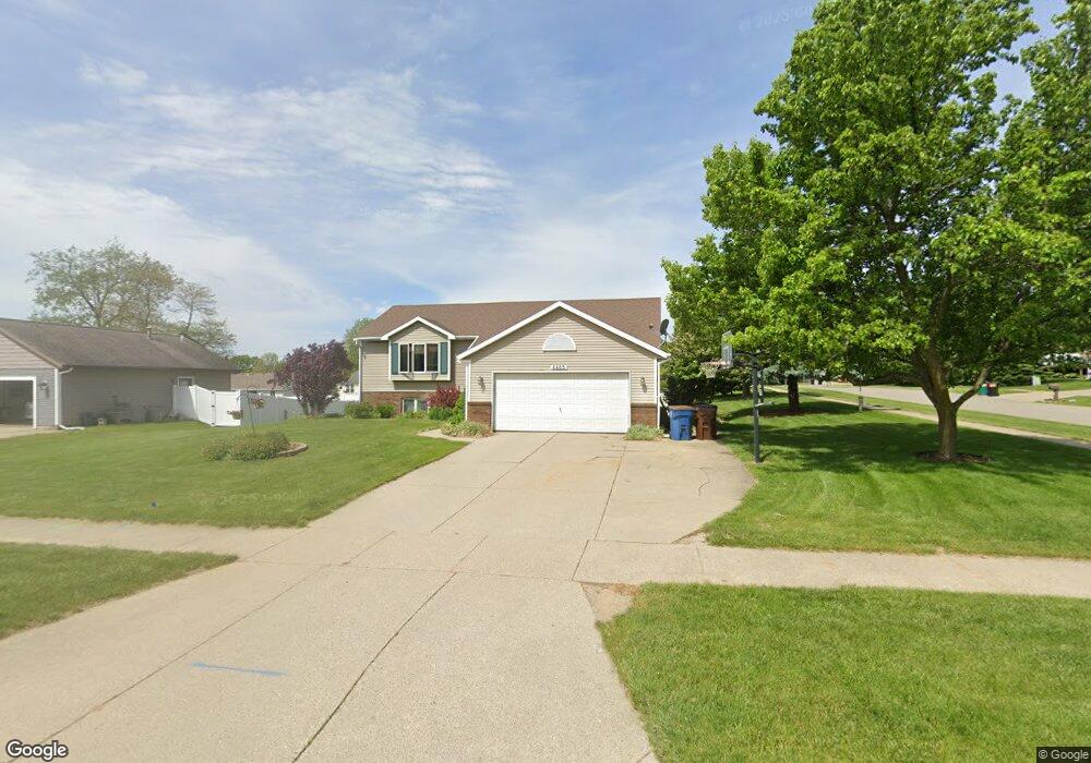
6465 Kingtree Dr SW Byron Center, MI 49315
Estimated Value: $397,000 - $424,000
3
Beds
2
Baths
2,400
Sq Ft
$169/Sq Ft
Est. Value
About This Home
This home is located at 6465 Kingtree Dr SW, Byron Center, MI 49315 and is currently estimated at $405,073, approximately $168 per square foot. 6465 Kingtree Dr SW is a home located in Kent County with nearby schools including Marshall Elementary School, Robert L. Nickels Intermediate School, and Byron Center West Middle School.
Ownership History
Date
Name
Owned For
Owner Type
Purchase Details
Closed on
Aug 17, 2005
Sold by
Lenig Charles E and Lenig Ginger
Bought by
May Brian and May Jillyn
Current Estimated Value
Home Financials for this Owner
Home Financials are based on the most recent Mortgage that was taken out on this home.
Original Mortgage
$140,000
Outstanding Balance
$76,868
Interest Rate
6.37%
Mortgage Type
Fannie Mae Freddie Mac
Estimated Equity
$328,205
Create a Home Valuation Report for This Property
The Home Valuation Report is an in-depth analysis detailing your home's value as well as a comparison with similar homes in the area
Home Values in the Area
Average Home Value in this Area
Purchase History
| Date | Buyer | Sale Price | Title Company |
|---|---|---|---|
| May Brian | $175,000 | Metropolitan Title Company |
Source: Public Records
Mortgage History
| Date | Status | Borrower | Loan Amount |
|---|---|---|---|
| Open | May Brian | $140,000 |
Source: Public Records
Tax History
| Year | Tax Paid | Tax Assessment Tax Assessment Total Assessment is a certain percentage of the fair market value that is determined by local assessors to be the total taxable value of land and additions on the property. | Land | Improvement |
|---|---|---|---|---|
| 2025 | $1,962 | $174,200 | $0 | $0 |
| 2024 | $20 | $157,600 | $0 | $0 |
| 2023 | $1,877 | $140,000 | $0 | $0 |
| 2022 | $2,616 | $123,200 | $0 | $0 |
| 2021 | $2,546 | $113,500 | $0 | $0 |
| 2020 | $1,727 | $103,000 | $0 | $0 |
| 2019 | $2,484 | $99,400 | $0 | $0 |
| 2018 | $2,433 | $95,800 | $18,800 | $77,000 |
| 2017 | $2,367 | $86,200 | $0 | $0 |
| 2016 | $2,283 | $81,800 | $0 | $0 |
| 2015 | $2,244 | $81,800 | $0 | $0 |
| 2013 | -- | $72,900 | $0 | $0 |
Source: Public Records
Map
Nearby Homes
- 6593 Crownpointe Dr SW
- 873 Northpointe Dr SW
- 1171 Runway Place SW
- 6458 Estate Dr SW
- 6450 Estate Dr SW
- 944 Harper Woods Dr SW
- 981 Amber View Dr SW
- 694 68th St SW
- 1005 Amber Ridge Dr SW
- 1120 Amber Ridge Dr SW
- 854 Amberwood West Dr SW Unit 3
- 1075 Amberwood West Dr SW
- 328 N Hardwick Dr SW
- 369 N Harewood Dr SW
- 357 N Harewood Dr SW
- 328 N Edingberg Dr S W Unit 201
- 6989 Festival Dr SW Unit 91
- 6380 Southtown Ln
- 6374 Southtown Ln
- 6223 Skipton Dr SW
- 6473 Kingtree Dr SW
- 1022 Northpointe Dr SW
- 1141 Woodspointe Dr SW
- 1007 Northpointe Dr SW
- 6487 Kingtree Dr SW
- 1007 Northpointe Dr SW
- 980 Northpointe Dr SW
- 993 Northpointe Dr SW
- 1193 Woodspointe Dr SW
- 1133 Woodspointe Dr SW
- 6476 Kingtree Dr SW
- 975 Northpointe Dr SW
- 6499 Kingtree Dr SW
- 6490 Kingtree Dr SW
- 968 Northpointe Dr SW
- 0 Northpointe Dr SW
- Lot A Northpointe Dr SW
- 1125 Woodspointe Dr SW
- 1162 Woodspointe Dr SW
- 1174 Woodspointe Dr SW
Your Personal Tour Guide
Ask me questions while you tour the home.