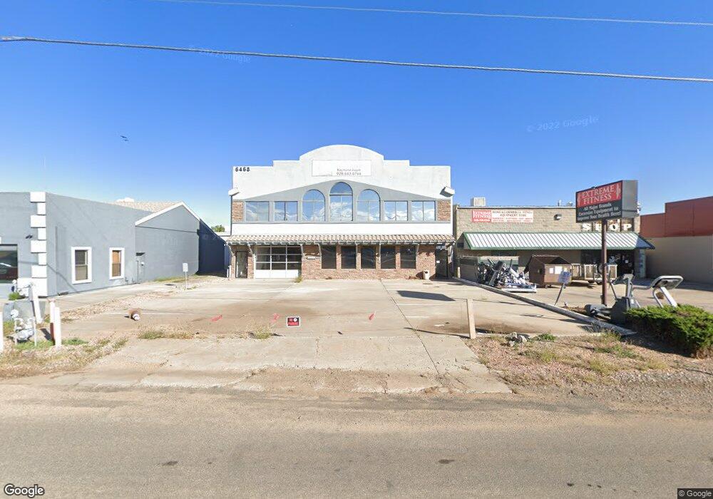
6468 E State Route 69 Prescott Valley, AZ 86314
Prescott East NeighborhoodEstimated Value: $859,143
Studio
--
Bath
6,710
Sq Ft
$128/Sq Ft
Est. Value
About This Home
This home is located at 6468 E State Route 69, Prescott Valley, AZ 86314 and is currently estimated at $859,143, approximately $128 per square foot. 6468 E State Route 69 is a home located in Yavapai County with nearby schools including Lake Valley Elementary School, Bradshaw Mountain Middle School, and Bradshaw Mountain High School.
Ownership History
Date
Name
Owned For
Owner Type
Purchase Details
Closed on
Mar 25, 2024
Sold by
Homer Ray J and Homer Julie
Bought by
Homer Family Trust and Homer
Current Estimated Value
Purchase Details
Closed on
Oct 18, 2022
Sold by
Highway 69 Property Llc
Bought by
Homer Ray J and Homer Julie
Purchase Details
Closed on
Aug 23, 2010
Sold by
Fetters Gary E and Fetters Theresa C
Bought by
Highway 69 Property Llc
Purchase Details
Closed on
May 19, 1998
Sold by
Koelle Howard L and Koelle Sandra A
Bought by
Fetters Gary E and Fetters Theresa C
Home Financials for this Owner
Home Financials are based on the most recent Mortgage that was taken out on this home.
Original Mortgage
$195,000
Interest Rate
7.03%
Mortgage Type
Seller Take Back
Purchase Details
Closed on
Nov 29, 1993
Sold by
Mastrangelo John L
Bought by
Koelle Howard L and Koelle Sandra A
Create a Home Valuation Report for This Property
The Home Valuation Report is an in-depth analysis detailing your home's value as well as a comparison with similar homes in the area
Home Values in the Area
Average Home Value in this Area
Purchase History
| Date | Buyer | Sale Price | Title Company |
|---|---|---|---|
| Homer Family Trust | -- | None Listed On Document | |
| Homer Ray J | $835,000 | First Equity Title | |
| Highway 69 Property Llc | -- | None Available | |
| Fetters Gary E | $200,000 | First American Title | |
| Koelle Howard L | $43,500 | Transamerica Title Ins Co |
Source: Public Records
Mortgage History
| Date | Status | Borrower | Loan Amount |
|---|---|---|---|
| Previous Owner | Fetters Gary E | $195,000 |
Source: Public Records
Tax History
| Year | Tax Paid | Tax Assessment Tax Assessment Total Assessment is a certain percentage of the fair market value that is determined by local assessors to be the total taxable value of land and additions on the property. | Land | Improvement |
|---|---|---|---|---|
| 2026 | $6,613 | -- | -- | -- |
| 2024 | $6,318 | -- | -- | -- |
| 2023 | $6,318 | $76,982 | $11,430 | $65,552 |
| 2022 | $6,400 | $64,684 | $11,058 | $53,626 |
| 2021 | $6,758 | $67,999 | $13,010 | $54,989 |
| 2020 | $6,522 | $0 | $0 | $0 |
| 2019 | $6,436 | $0 | $0 | $0 |
| 2018 | $6,154 | $0 | $0 | $0 |
| 2017 | $6,034 | $0 | $0 | $0 |
| 2016 | $5,840 | $0 | $0 | $0 |
| 2015 | -- | $0 | $0 | $0 |
| 2014 | -- | $0 | $0 | $0 |
Source: Public Records
Map
Nearby Homes
- 2800 N Starlight Dr
- 2923 N Kings Hwy E
- 3161 N Valley View Dr
- 6321 E Sunset Ln
- 3133 N Queen St
- 6151 E Sunset Ln
- 2651 N 3rd St
- 3499 N Tower Rd
- 3455 N Castle Dr
- 3601 N Valley View Dr
- 3600 N Mountain View Dr
- 3550 N Pleasant View Dr
- 6352 E Slow Cattle Dr
- 7022 E Lynx Wagon Rd Unit 1
- 7161 E Slow Draw Dr
- 6877 E Lynx Wagon Rd
- 1829 N Fence Line Dr
- 1829 N Fence Line Dr Unit 1
- 1972 E Regent
- 6318 E Boothwyn St
- 6444 E State Route 69
- 6467 E Copper Hill Dr
- 6443 E Copper Hill Dr
- 6496 E State Route 69
- 6426 E State Route 69
- 6490 E Copper Hill Dr Unit B
- 6490 E Copper Hill Dr
- 6490 E Copper Hill Dr
- 6490 E Copper Hill Dr Unit C
- 6490 E Copper Hill Dr Unit E
- 6400 E Copper Hill Dr
- 6400 E Copper Hill Dr Unit B
- 6400 E Copper Hill Dr Unit D
- 6400 E Copper Hill Dr Unit A
- 6400 E Copper Hill Dr Unit C
- 6400 E State Route 69
- 2743 N Superstition Ln
- 2743 N Superstition Ln Unit 1
- 6380 Arizona 69
- 6392 E Copper Hill Dr
Your Personal Tour Guide
Ask me questions while you tour the home.