Estimated Value: $611,000 - $726,000
About This Home
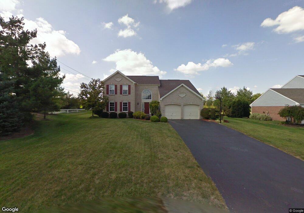
This home is located at 6475 Fieldstone Dr, Mason, OH 45040 and is currently estimated at $653,497, approximately $246 per square foot. 6475 Fieldstone Dr is a home located in Warren County with nearby schools including Mason Intermediate Elementary School, Mason Middle School, and William Mason High School.
Ownership History
We collect this data history from publicly available records. To have your information removed, we recommend requesting removal directly through your county’s website.
Purchase Details
Home Financials for this Owner
Home Financials are based on the most recent Mortgage that was taken out on this home.Purchase Details
Home Financials for this Owner
Home Financials are based on the most recent Mortgage that was taken out on this home.Purchase Details
Purchase Details
Home Values in the Area
Average Home Value in this Area
Purchase History
We collect this data history from publicly available records. To have your information removed, we recommend requesting removal directly through your county’s website.
| Date | Buyer | Sale Price | Title Company |
|---|---|---|---|
| $271,000 | Stewart Advanced Land Title | ||
| $218,100 | -- | ||
| $66,000 | -- | ||
| -- | -- |
Mortgage History
We collect this data history from publicly available records. To have your information removed, we recommend requesting removal directly through your county’s website.
| Date | Status | Borrower | Loan Amount |
|---|---|---|---|
| Open | $216,800 | ||
| Previous Owner | $174,000 |
Tax History
We collect this data history from publicly available records. To have your information removed, we recommend requesting removal directly through your county’s website.
| Year | Tax Paid | Tax Assessment Tax Assessment Total Assessment is a certain percentage of the fair market value that is determined by local assessors to be the total taxable value of land and additions on the property. | Land | Improvement |
|---|---|---|---|---|
| 2025 | $7,194 | $177,270 | $38,500 | $138,770 |
| 2024 | $7,194 | $177,270 | $38,500 | $138,770 |
| 2023 | $6,195 | $128,950 | $19,250 | $109,700 |
| 2022 | $6,115 | $128,951 | $19,250 | $109,701 |
| 2021 | $5,793 | $128,951 | $19,250 | $109,701 |
| 2020 | $6,142 | $117,229 | $17,500 | $99,729 |
| 2019 | $5,646 | $117,229 | $17,500 | $99,729 |
| 2018 | $5,665 | $117,229 | $17,500 | $99,729 |
| 2017 | $5,695 | $110,012 | $17,504 | $92,509 |
| 2016 | $5,866 | $110,012 | $17,504 | $92,509 |
| 2015 | $5,878 | $110,012 | $17,504 | $92,509 |
| 2014 | $5,629 | $98,220 | $15,630 | $82,600 |
| 2013 | $5,641 | $109,990 | $17,500 | $92,490 |
Map
- 4762 Flagstone Dr
- 4556 Creekrun Dr
- 4625 Creekrun Dr
- 6565 Covefield Ct
- 4355 Towneside Ct
- 4335 Towneside Ct Unit 56E
- 4321 Towneside Ct
- 4119 Old Manchester Ct
- 4172 E Village Dr
- 4109 Old Manchester Ct
- 6674 Villager Place Unit 153D
- 6682 Villager Place Unit 153B
- 6355 Blackheath Cir
- 4120 E Village Dr
- 4156 Lakeknoll Dr
- 7033 Johns Course
- 7044 Johns Course
- 7034 Johns Course
- 7036 Scarlet Oak Ct
- 4741 Tribute Ln
- 6457 Fieldstone Dr
- 4781 Flagstone Dr
- 6437 Fieldstone Dr
- 6620 Parklake Dr
- 6624 Parklake Dr
- 4778 Flagstone Dr
- 4767 Flagstone Dr
- 6419 Fieldstone Dr
- 6638 Parklake Dr
- 6617 Parklake Dr
- 6646 Parklake Dr
- 6420 Fieldstone Dr
- 4755 Flagstone Dr
- 6654 Parklake Dr
- 6631 Parklake Dr
- 6399 Fieldstone Dr
- 6633 Parklake Dr
- 4800 Tylersville Rd
- 6637 Parklake Dr
- 6656 Parklake Dr
Ask me questions while you tour the home.