Estimated Value: $162,388 - $205,000
3
Beds
1
Bath
1,020
Sq Ft
$179/Sq Ft
Est. Value
About This Home
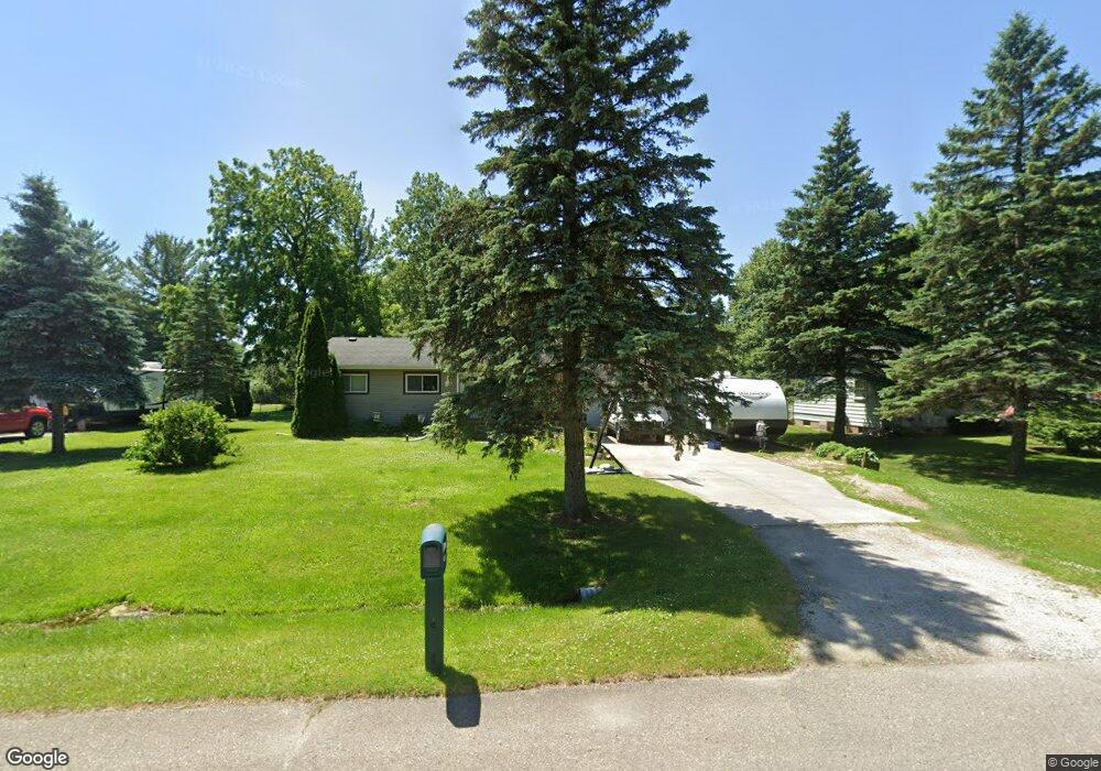
This home is located at 6484 Nightingale Dr, Flint, MI 48506 and is currently estimated at $182,847, approximately $179 per square foot. 6484 Nightingale Dr is a home located in Genesee County with nearby schools including Weston Elementary School, Leota Fiedler Elementary School, and Kate Dowdall Elementary School.
Ownership History
Date
Name
Owned For
Owner Type
Purchase Details
Closed on
Jul 30, 2009
Sold by
Okoniewski Danny and Okoniewski Ann
Bought by
Shaker Rachel
Current Estimated Value
Home Financials for this Owner
Home Financials are based on the most recent Mortgage that was taken out on this home.
Original Mortgage
$88,271
Outstanding Balance
$57,758
Interest Rate
5.36%
Mortgage Type
FHA
Estimated Equity
$125,089
Purchase Details
Closed on
Feb 9, 2005
Sold by
Reiman Pearl and Reiman Ronnie Lee
Bought by
Okoniewski Danny
Purchase Details
Closed on
Oct 15, 2004
Sold by
Granquist Leslie D and Granquist Edna Mae
Bought by
Rieman Pearl
Create a Home Valuation Report for This Property
The Home Valuation Report is an in-depth analysis detailing your home's value as well as a comparison with similar homes in the area
Home Values in the Area
Average Home Value in this Area
Purchase History
| Date | Buyer | Sale Price | Title Company |
|---|---|---|---|
| Shaker Rachel | $89,900 | Guaranty Title Company | |
| Okoniewski Danny | $109,250 | Sargents Title Company | |
| Rieman Pearl | $15,000 | Sargents Title Company |
Source: Public Records
Mortgage History
| Date | Status | Borrower | Loan Amount |
|---|---|---|---|
| Open | Shaker Rachel | $88,271 |
Source: Public Records
Tax History
| Year | Tax Paid | Tax Assessment Tax Assessment Total Assessment is a certain percentage of the fair market value that is determined by local assessors to be the total taxable value of land and additions on the property. | Land | Improvement |
|---|---|---|---|---|
| 2025 | $2,114 | $71,300 | $0 | $0 |
| 2024 | $406 | $65,600 | $0 | $0 |
| 2023 | $387 | $58,600 | $0 | $0 |
| 2022 | $1,525 | $55,100 | $0 | $0 |
| 2021 | $1,515 | $49,900 | $0 | $0 |
| 2020 | $354 | $45,900 | $0 | $0 |
| 2019 | $349 | $40,700 | $0 | $0 |
| 2018 | $1,689 | $37,600 | $0 | $0 |
| 2017 | $1,425 | $36,300 | $0 | $0 |
| 2016 | $1,281 | $34,900 | $0 | $0 |
| 2015 | $963 | $31,600 | $0 | $0 |
| 2014 | $322 | $29,200 | $0 | $0 |
| 2012 | -- | $27,100 | $27,100 | $0 |
Source: Public Records
Map
Nearby Homes
- 7045 Normandy Ct
- 6443 Richfield Rd
- 4126 N Belsay Rd
- 5165 N Irish Rd
- 5177 N Irish Rd
- 5411 Squire Ln
- 1240 N Irish Rd
- 6076 E Carpenter Rd
- 3424 N Irish Rd
- 6490 E Coldwater Rd
- 0 Whisper Ridge Ct
- 7200 E Potter Rd
- 2401 Mcclellan Blvd
- 4044 N Genesee Rd
- 6099 Brookwood Dr
- 5131 E Carpenter Rd
- 5113 Richfield Rd
- 4489 Home Town Dr Unit 32
- 4465 Market Place
- 0 Belsay Unit 20261021515
- 6474 Nightingale Dr
- 6492 Nightingale Dr
- 6504 Nightingale Dr Unit Bldg-Unit
- 6504 Nightingale Dr
- 6464 Nightingale Dr
- 4187 Red Bird Ln
- 4191 Red Bird Ln
- 6479 Nightingale Dr
- 6456 Nightingale Dr
- 4238 Pheasant Dr
- 6501 Nightingale Dr Unit Bldg-Unit
- 6501 Nightingale Dr
- 4266 Pheasant Dr
- 4231 N Vassar Rd
- 4226 Pheasant Dr
- 0 Pheasant Dr
- 4255 N Vassar Rd
- 4215 N Vassar Rd
- 4286 Pheasant Dr
- 4185 Red Bird Ln
Your Personal Tour Guide
Ask me questions while you tour the home.