Estimated Value: $270,000 - $292,000
3
Beds
2
Baths
1,144
Sq Ft
$243/Sq Ft
Est. Value
About This Home
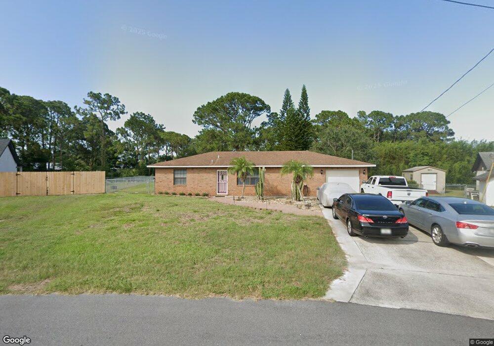
This home is located at 6499 Hudson Rd, Cocoa, FL 32927 and is currently estimated at $278,132, approximately $243 per square foot. 6499 Hudson Rd is a home located in Brevard County with nearby schools including Enterprise Elementary School, Space Coast Junior/Senior High School, and East Atlantic Prep of Brevard County.
Ownership History
Date
Name
Owned For
Owner Type
Purchase Details
Closed on
Dec 28, 2012
Sold by
Petersen Gary R
Bought by
Petersen Gary R and Petersen Pamela J
Current Estimated Value
Purchase Details
Closed on
Jan 15, 1998
Sold by
Vesch Eric W and Vesch Sherri L
Bought by
Peterson Gary R
Home Financials for this Owner
Home Financials are based on the most recent Mortgage that was taken out on this home.
Original Mortgage
$82,924
Interest Rate
7.16%
Purchase Details
Closed on
Nov 29, 1993
Sold by
Pelt Stephen G and Pelt Beverly J
Bought by
Vesch Eric W
Home Financials for this Owner
Home Financials are based on the most recent Mortgage that was taken out on this home.
Original Mortgage
$61,750
Interest Rate
6.81%
Create a Home Valuation Report for This Property
The Home Valuation Report is an in-depth analysis detailing your home's value as well as a comparison with similar homes in the area
Home Values in the Area
Average Home Value in this Area
Purchase History
We collect this data history from publicly available records. To have your information removed, we recommend requesting removal directly through your county’s website.
| Date | Buyer | Sale Price | Title Company |
|---|---|---|---|
| Petersen Gary R | -- | None Available | |
| Peterson Gary R | $83,000 | -- | |
| Vesch Eric W | $65,000 | -- |
Source: Public Records
Mortgage History
We collect this data history from publicly available records. To have your information removed, we recommend requesting removal directly through your county’s website.
| Date | Status | Borrower | Loan Amount |
|---|---|---|---|
| Previous Owner | Peterson Gary R | $82,924 | |
| Previous Owner | Vesch Eric W | $61,750 |
Source: Public Records
Tax History
| Year | Tax Paid | Tax Assessment Tax Assessment Total Assessment is a certain percentage of the fair market value that is determined by local assessors to be the total taxable value of land and additions on the property. | Land | Improvement |
|---|---|---|---|---|
| 2025 | $1,139 | $85,360 | -- | -- |
| 2024 | $1,105 | $82,960 | -- | -- |
| 2023 | $1,105 | $80,550 | $0 | $0 |
| 2022 | $1,025 | $78,210 | $0 | $0 |
| 2021 | $1,013 | $75,940 | $0 | $0 |
| 2020 | $961 | $74,900 | $0 | $0 |
| 2019 | $908 | $73,220 | $0 | $0 |
| 2018 | $910 | $71,860 | $0 | $0 |
| 2017 | $912 | $70,390 | $0 | $0 |
| 2016 | $921 | $68,950 | $18,000 | $50,950 |
| 2015 | $930 | $68,480 | $15,000 | $53,480 |
| 2014 | $935 | $67,940 | $11,000 | $56,940 |
Source: Public Records
Map
Nearby Homes
- 5424 Flint Rd
- 5525 Fairbridge St
- 6460 Irving Rd
- 6438 Hudson Rd
- 6450 Ember Ave
- 6601 Cedar Ave
- 6615 Dock Ave
- 6581 Bancroft Ave
- 6570 Bancroft Ave
- No Access W
- 00 Unknown
- 6643 Emil Ave
- 5220 Holden Rd
- 5770 Fairbridge St
- 5209 Holden Rd
- 6815 Bryant Rd
- 6965 Hundred Acre Dr
- 6813 Cecil Rd
- 5221 Carrick Rd
- 6375 Cable Ave
- 6450 Gillette Ave
- 6460 Gillette Ave
- 6430 Gillette Ave
- 6481 Hudson Rd
- 6455 Gillette Ave
- 6487 Hudson Rd
- 6435 Gillette Ave
- 5385 Fruitport St
- 6493 Hudson Rd
- 6469 Hudson Rd
- 6420 Gillette Ave
- 6425 Gillette Ave
- 5408 Flint Rd
- 6463 Hudson Rd
- 5416 Flint Rd
- 5400 Flint Rd
- 5400 Fruitport St
- 6410 Gillette Ave
- 5380 Fruitport St
- 6486 Hudson Rd
Your Personal Tour Guide
Ask me questions while you tour the home.