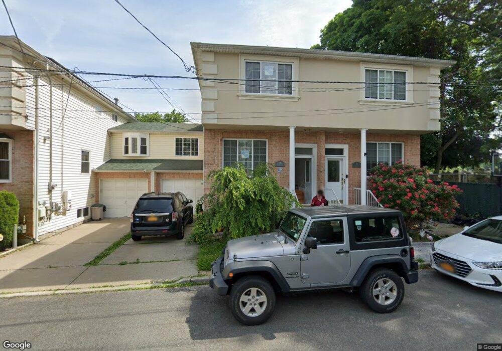
65 Chess Loop Staten Island, NY 10306
Great Kills NeighborhoodEstimated Value: $650,621 - $732,000
Studio
4
Baths
1,400
Sq Ft
$497/Sq Ft
Est. Value
About This Home
This home is located at 65 Chess Loop, Staten Island, NY 10306 and is currently estimated at $695,655, approximately $496 per square foot. 65 Chess Loop is a home located in Richmond County with nearby schools including P.S. 23 Richmondtown, Myra S. Barnes Intermediate School 24, and Susan E Wagner High School.
Ownership History
Date
Name
Owned For
Owner Type
Purchase Details
Closed on
Jun 14, 2004
Sold by
Hills Of Heartland Llc
Bought by
Massanova Daniel A and Massanova Irena
Current Estimated Value
Home Financials for this Owner
Home Financials are based on the most recent Mortgage that was taken out on this home.
Original Mortgage
$263,000
Interest Rate
5.84%
Mortgage Type
Purchase Money Mortgage
Create a Home Valuation Report for This Property
The Home Valuation Report is an in-depth analysis detailing your home's value as well as a comparison with similar homes in the area
Home Values in the Area
Average Home Value in this Area
Purchase History
| Date | Buyer | Sale Price | Title Company |
|---|---|---|---|
| Massanova Daniel A | $410,670 | Fidelity National Title Insu |
Source: Public Records
Mortgage History
| Date | Status | Borrower | Loan Amount |
|---|---|---|---|
| Previous Owner | Massanova Daniel A | $263,000 | |
| Closed | Massanova Daniel A | $25,000 |
Source: Public Records
Tax History
| Year | Tax Paid | Tax Assessment Tax Assessment Total Assessment is a certain percentage of the fair market value that is determined by local assessors to be the total taxable value of land and additions on the property. | Land | Improvement |
|---|---|---|---|---|
| 2025 | $6,313 | $42,240 | $5,876 | $36,364 |
| 2024 | $6,325 | $36,540 | $6,793 | $29,747 |
| 2023 | $6,334 | $32,586 | $6,183 | $26,403 |
| 2022 | $5,850 | $39,300 | $7,560 | $31,740 |
| 2021 | $5,800 | $36,120 | $7,560 | $28,560 |
| 2020 | $5,495 | $31,320 | $7,560 | $23,760 |
| 2019 | $5,431 | $33,960 | $7,560 | $26,400 |
| 2018 | $5,238 | $27,155 | $6,898 | $20,257 |
| 2017 | $4,923 | $25,618 | $7,472 | $18,146 |
| 2016 | $4,522 | $24,168 | $7,148 | $17,020 |
| 2015 | $4,071 | $22,800 | $6,300 | $16,500 |
| 2014 | $4,071 | $22,800 | $6,300 | $16,500 |
Source: Public Records
Map
Nearby Homes
- 22 Tanglewood Dr
- 394 Clarke Ave
- 25 Elkhart St
- 62 Daleham St
- 43 Country Woods Ln
- 71 Luke Ct
- 74 Elkhart St
- 203 Center St
- 52 Sandalwood Dr
- 439 Saint Andrews Rd
- 11 Ironwood St
- 437 Lighthouse Ave
- 274 Barbara St
- 281 Thomas St
- 87 Pemberton Ave
- 265 Barbara St Unit 275
- 25 Fuller Ct Unit A
- 393 Saint Andrews Rd
- 219 Ardsley St
- 24 Eric Ln
Your Personal Tour Guide
Ask me questions while you tour the home.