Estimated Value: $970,000 - $1,284,361
2
Beds
1
Bath
685
Sq Ft
$1,553/Sq Ft
Est. Value
About This Home
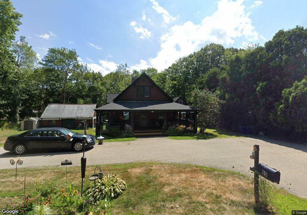
This home is located at 65 Main St Unit 2, York, ME 03909 and is currently estimated at $1,064,090, approximately $1,553 per square foot. 65 Main St Unit 2 is a home located in York County with nearby schools including Coastal Ridge Elementary School, Village Elementary School, and York Middle School.
Create a Home Valuation Report for This Property
The Home Valuation Report is an in-depth analysis detailing your home's value as well as a comparison with similar homes in the area
Home Values in the Area
Average Home Value in this Area
Tax History
| Year | Tax Paid | Tax Assessment Tax Assessment Total Assessment is a certain percentage of the fair market value that is determined by local assessors to be the total taxable value of land and additions on the property. | Land | Improvement |
|---|---|---|---|---|
| 2025 | $8,927 | $1,082,000 | $426,100 | $655,900 |
| 2024 | $8,089 | $963,000 | $378,800 | $584,200 |
| 2023 | $7,937 | $939,300 | $355,100 | $584,200 |
| 2022 | $7,371 | $862,100 | $330,100 | $532,000 |
| 2021 | $7,359 | $764,600 | $303,000 | $461,600 |
| 2020 | $6,273 | $590,100 | $213,100 | $377,000 |
| 2019 | $6,315 | $566,400 | $189,400 | $377,000 |
| 2018 | $3,075 | $566,400 | $189,400 | $377,000 |
| 2017 | $5,920 | $540,600 | $189,400 | $351,200 |
| 2016 | $6,072 | $544,600 | $161,000 | $383,600 |
| 2015 | $5,982 | $543,800 | $161,000 | $382,800 |
| 2014 | $5,819 | $543,800 | $161,000 | $382,800 |
| 2013 | $5,672 | $543,800 | $161,000 | $382,800 |
Source: Public Records
Map
Nearby Homes
- 2 Rosewood Ln
- 99 Freeman St
- 4 Hamlin Place
- 1 Ocean Ave Unit 211/213 Fraction 1
- 1 Ocean Ave Unit 414 Fraction 6
- 1 Ocean Ave Unit 210/212 Fraction 3
- 1 Ocean Ave Unit 205
- 1 Ocean Ave Unit 306/308 Fraction 4
- 22,23,24 Wanaque Rd
- 147 River Rd
- 11 Driftwood Ln
- 68 Airport Dr
- 28 Prospect Ave
- 7 Nubble Point
- 115 Long Beach Ave Unit 3
- 35 Gunnison Rd
- 1 Cassidy Way
- 1327 U S 1
- 5 Mckenna Ln
- 8 Oceanside Ave Unit 2
- 65 Main St Unit 1
- 63 Main St
- 67 Main St
- 1 Cappy's Ln
- 3 Cappy's Ln
- 62 Main St
- 69 Main St
- 112 Main St
- 68 Main St
- 4 Collinsport Way Unit 2
- 4 Collinsport Way Unit 1
- 4 Collinsport Way Unit 4
- 4 Collinsport Way
- 59 Main St
- 70 Main St
- 71 Main St
- 3 Collinsport Way Unit 2
- 3 Collinsport Way Unit 1
- 3 Collinsport Way
- 60 Main St
Your Personal Tour Guide
Ask me questions while you tour the home.