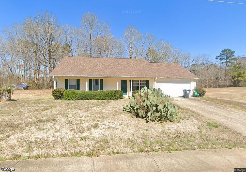
65 Thrasher Rd Unit 1 Covington, GA 30016
Covington AreaEstimated Value: $241,146 - $265,000
About This Home
This home is located at 65 Thrasher Rd Unit 1, Covington, GA 30016 and is currently estimated at $255,787, approximately $211 per square foot. 65 Thrasher Rd Unit 1 is a home located in Newton County with nearby schools including Oak Hill Elementary School, Veterans Memorial Middle School, and Alcovy High School.
Ownership History
We collect this data history from publicly available records. To have your information removed, we recommend requesting removal directly through your county’s website.
Purchase Details
Purchase Details
Home Values in the Area
Average Home Value in this Area
Purchase History
We collect this data history from publicly available records. To have your information removed, we recommend requesting removal directly through your county’s website.
| Date | Buyer | Sale Price | Title Company |
|---|---|---|---|
| $171,600 | -- | ||
| $106,600 | -- |
Mortgage History
We collect this data history from publicly available records. To have your information removed, we recommend requesting removal directly through your county’s website.
| Date | Status | Borrower | Loan Amount |
|---|---|---|---|
| Open | $5,231 | ||
| Previous Owner | $107,710 |
Tax History
We collect this data history from publicly available records. To have your information removed, we recommend requesting removal directly through your county’s website.
| Year | Tax Paid | Tax Assessment Tax Assessment Total Assessment is a certain percentage of the fair market value that is determined by local assessors to be the total taxable value of land and additions on the property. | Land | Improvement |
|---|---|---|---|---|
| 2025 | $1,368 | $96,360 | $16,400 | $79,960 |
| 2024 | $1,278 | $89,680 | $16,400 | $73,280 |
| 2023 | $1,639 | $87,200 | $12,000 | $75,200 |
| 2022 | $1,828 | $69,040 | $9,600 | $59,440 |
| 2021 | $1,623 | $55,440 | $9,600 | $45,840 |
| 2020 | $1,578 | $49,120 | $8,400 | $40,720 |
| 2019 | $1,526 | $46,920 | $8,400 | $38,520 |
| 2018 | $1,410 | $43,280 | $6,800 | $36,480 |
| 2017 | $1,173 | $36,360 | $6,800 | $29,560 |
| 2016 | $1,044 | $32,600 | $6,200 | $26,400 |
| 2015 | $956 | $30,480 | $3,800 | $26,680 |
| 2014 | $756 | $24,680 | $0 | $0 |
Map
- 145 Arthurs Ln
- 10 Wilbur Way
- 345 Arthurs Ln
- 127 Covered Bridge Rd
- 119 Covered Bridge Rd
- 45 Wilbur Way
- 150 Willow Shoals Dr
- 0 Wehunt Unit 7807689
- 0 Wehunt Unit 10808994
- 100 Willow Shoals Dr
- 931 Bethany Rd
- 624 Bethany Rd
- 2103 Breamore Dr
- 2111 Breamore Dr
- 2089 Breamore Dr
- 444 Covered Bridge Rd
- 406 Covered Bridge Rd
- 5618 Highway 212
- 15 Barcelona Dr
- 40 Granville Ln
- 55 Thrasher Rd
- 45 Thrasher Rd
- 40 Thrasher Rd
- 50 Thrasher Rd
- 20 Salali Ct Unit 10
- 20 Salali Ct Unit 20
- 20 Salali Ct
- 80 Patterson Way
- 30 Thrasher Rd
- 20 Salali Ct
- 75 Thrasher Rd
- 35 Thrasher Rd
- 90 Patterson Way
- 70 Patterson Way
- 30 Salali Ct
- 20 Thrasher Rd
- 60 Patterson Way
- 25 Thrasher Rd
- 85 Thrasher Rd
- 10 Thrasher Rd
Ask me questions while you tour the home.