Estimated Value: $245,947 - $332,000
Studio
--
Bath
1,220
Sq Ft
$244/Sq Ft
Est. Value
About This Home
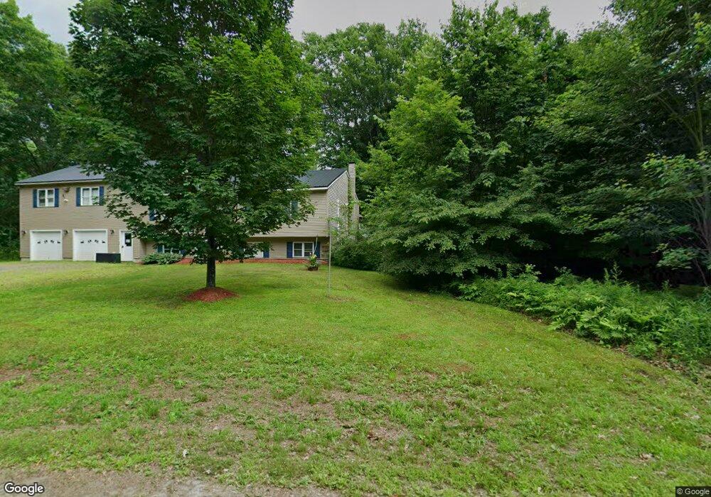
This home is located at 65 Wesley Rd, Unity, ME 04988 and is currently estimated at $297,487, approximately $243 per square foot. 65 Wesley Rd is a home with nearby schools including Mt. View Middle School, Mt. View High School, and Ecology Learning Center.
Ownership History
Date
Name
Owned For
Owner Type
Purchase Details
Closed on
Dec 12, 2023
Sold by
Hubbard Daniel M
Bought by
Caron James B and Levesque Crystal D
Current Estimated Value
Purchase Details
Closed on
Mar 2, 2018
Sold by
Hubbard Daniel and Hubbard Constance L
Bought by
Hubbard Constance L and Hubbard Daniel M
Home Financials for this Owner
Home Financials are based on the most recent Mortgage that was taken out on this home.
Original Mortgage
$120,000
Interest Rate
4.04%
Mortgage Type
Unknown
Create a Home Valuation Report for This Property
The Home Valuation Report is an in-depth analysis detailing your home's value as well as a comparison with similar homes in the area
Purchase History
| Date | Buyer | Sale Price | Title Company |
|---|---|---|---|
| Caron James B | -- | None Available | |
| Caron James B | -- | None Available | |
| Hubbard Constance L | -- | -- | |
| Hubbard Constance L | -- | -- |
Source: Public Records
Mortgage History
| Date | Status | Borrower | Loan Amount |
|---|---|---|---|
| Previous Owner | Hubbard Constance L | $120,000 |
Source: Public Records
Tax History
| Year | Tax Paid | Tax Assessment Tax Assessment Total Assessment is a certain percentage of the fair market value that is determined by local assessors to be the total taxable value of land and additions on the property. | Land | Improvement |
|---|---|---|---|---|
| 2025 | $2,665 | $245,800 | $35,400 | $210,400 |
| 2024 | $2,665 | $175,900 | $26,200 | $149,700 |
| 2022 | $2,236 | $140,600 | $20,900 | $119,700 |
| 2021 | $2,271 | $140,600 | $20,900 | $119,700 |
| 2020 | $2,453 | $140,600 | $20,900 | $119,700 |
| 2019 | $1,886 | $108,100 | $20,900 | $87,200 |
| 2018 | $1,811 | $108,100 | $20,900 | $87,200 |
| 2017 | $1,800 | $108,100 | $20,900 | $87,200 |
| 2016 | $1,821 | $108,100 | $20,900 | $87,200 |
| 2014 | $1,600 | $108,100 | $20,900 | $87,200 |
| 2013 | $1,449 | $108,100 | $20,900 | $87,200 |
Source: Public Records
Map
Nearby Homes
- 391 School St
- 13 Chestnut St
- 126 Newell Ct
- 173 Main St
- Pond View Subdivision Us-202
- 156 Depot St
- 23 Bangor Rd
- M12 L31-3 Stage Coach Rd
- Lot 45-1 Maine 220
- 44 Charles Taylor Ln
- Lot # 5 Locust Ln
- 126 Rancourt Ln
- 87 Pond Rd
- M 5 Lot 41 Morgan Rd
- M 5 Lot 40 Morgan Rd
- M5 Lot 43 Morgan Rd
- M11L10 Gordon Hill Rd
- 309 Pond Rd
- Lot 3-1 Bryant Rd
- Lot 12 Moulton Hill Ln
Your Personal Tour Guide
Ask me questions while you tour the home.