Estimated Value: $131,000 - $222,317
Studio
2
Baths
1,194
Sq Ft
$148/Sq Ft
Est. Value
About This Home
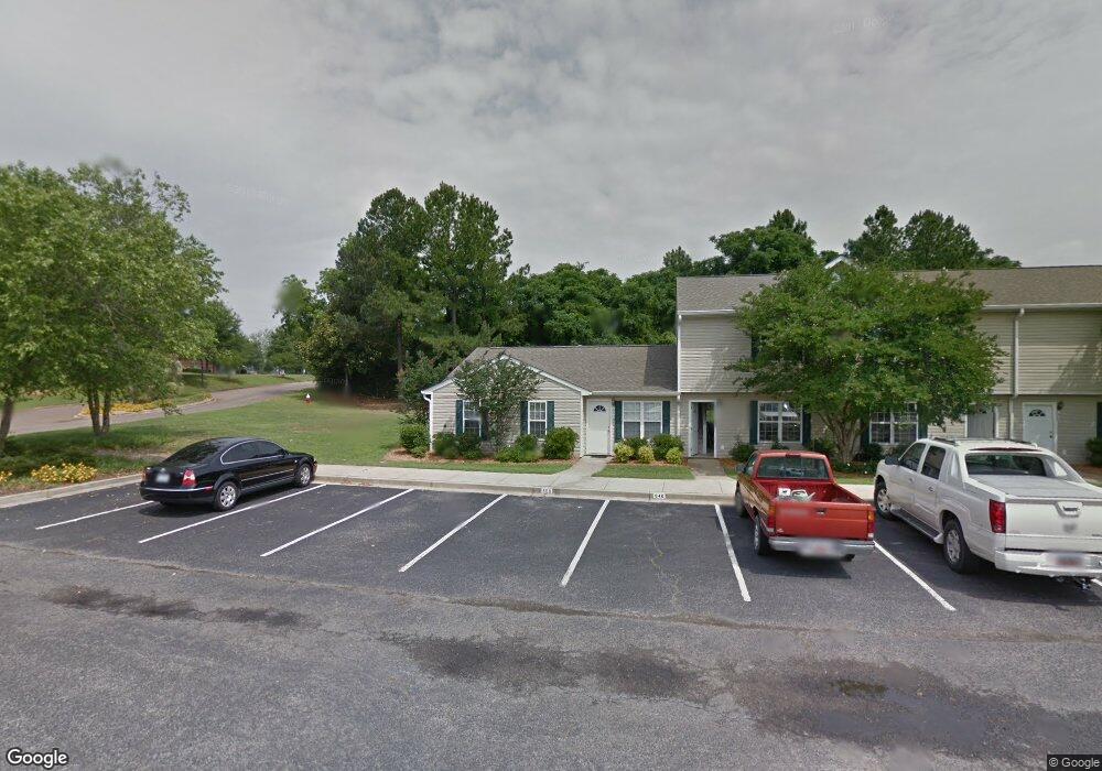
This home is located at 650 Date Palm Cir, Aiken, SC 29803 and is currently estimated at $176,329, approximately $147 per square foot. 650 Date Palm Cir is a home located in Aiken County with nearby schools including East Aiken School of the Arts, M.B. Kennedy Middle School, and South Aiken High School.
Ownership History
Date
Name
Owned For
Owner Type
Purchase Details
Closed on
Apr 13, 2021
Sold by
Nunn Jerry Dean and Nunn Brenda B
Bought by
Ceja Eduardo Talavera and Osorio Alma Briseida
Current Estimated Value
Home Financials for this Owner
Home Financials are based on the most recent Mortgage that was taken out on this home.
Original Mortgage
$103,790
Outstanding Balance
$93,303
Interest Rate
3%
Mortgage Type
New Conventional
Estimated Equity
$83,026
Purchase Details
Closed on
May 7, 2019
Sold by
Nunn Jerry Dean and Nunn Brenda B
Bought by
Nunn Jerry Dean and Nunn Brenda B
Create a Home Valuation Report for This Property
The Home Valuation Report is an in-depth analysis detailing your home's value as well as a comparison with similar homes in the area
Home Values in the Area
Average Home Value in this Area
Purchase History
| Date | Buyer | Sale Price | Title Company |
|---|---|---|---|
| Ceja Eduardo Talavera | $107,000 | None Available | |
| Nunn Jerry Dean | -- | None Available |
Source: Public Records
Mortgage History
| Date | Status | Borrower | Loan Amount |
|---|---|---|---|
| Open | Ceja Eduardo Talavera | $103,790 |
Source: Public Records
Tax History
| Year | Tax Paid | Tax Assessment Tax Assessment Total Assessment is a certain percentage of the fair market value that is determined by local assessors to be the total taxable value of land and additions on the property. | Land | Improvement |
|---|---|---|---|---|
| 2025 | $426 | $4,250 | -- | -- |
| 2023 | $426 | $4,250 | $720 | $88,280 |
| 2022 | $415 | $4,250 | $0 | $0 |
| 2021 | $357 | $3,650 | $0 | $0 |
| 2020 | $1,147 | $4,850 | $0 | $0 |
| 2019 | $1,147 | $4,850 | $0 | $0 |
| 2018 | $301 | $4,850 | $1,080 | $3,770 |
| 2017 | $1,124 | $0 | $0 | $0 |
| 2016 | $1,124 | $0 | $0 | $0 |
| 2015 | $1,084 | $0 | $0 | $0 |
| 2014 | $1,085 | $0 | $0 | $0 |
| 2013 | -- | $0 | $0 | $0 |
Source: Public Records
Map
Nearby Homes
- 630 Date Palm Cir
- 770 E Pine Log Rd
- Lot 8 Bolton Ct
- Lot 9 Bolton Ct
- 250 Tahoe Dr
- 319 Tahoe Dr
- 4174 Sorensten Dr
- 4087 Sorensten Dr
- 222 Gatewood Dr
- 117 Ashwood Dr
- 107 Robinwood Dr
- 503 E Pine Log Rd
- 302 Marstrand Cir
- 749 Banks Mill Rd SE
- 000 Banks Mill Rd SE
- 558 Palm Dr S
- 1005 Old Ellis Square
- 515 Henry St
- 201 Dunbarton Cir SE
- 221 Surrey Cir
- 640 Date Palm Cir
- 620 Date Palm Cir
- 600 Date Palm Cir
- 550 Date Palm Cir
- 540 Date Palm Cir
- 530 Date Palm Cir
- 510 Date Palm Cir
- 520 Date Palm Cir
- 500 Date Palm Cir
- 440 Date Palm Cir
- 430 Date Palm Cir
- 420 Date Palm Cir
- 450 Date Palm Cir Unit 450
- 410 Date Palm Cir
- 400 Date Palm Cir Unit 400
- 210 Date Palm Cir
- 220 Date Palm Cir
- 350 Date Palm Cir Unit 350
- 340 Date Palm Cir
- 230 Date Palm Cir
Your Personal Tour Guide
Ask me questions while you tour the home.