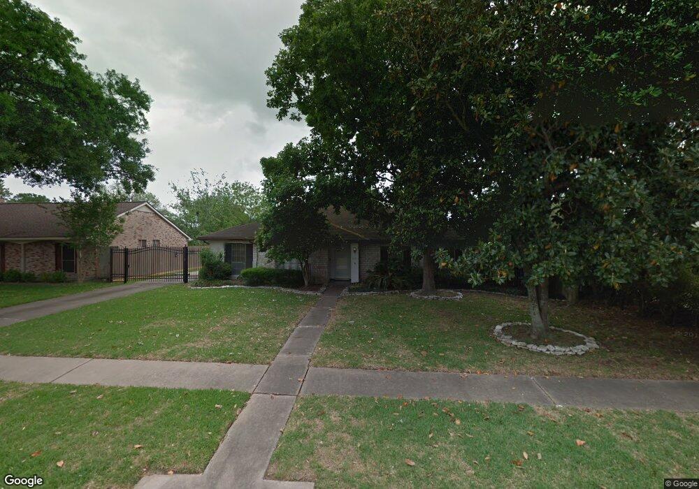
6511 Redding Rd Houston, TX 77036
Sharpstown NeighborhoodEstimated Value: $284,000 - $303,000
About This Home
This home is located at 6511 Redding Rd, Houston, TX 77036 and is currently estimated at $296,698, approximately $144 per square foot. 6511 Redding Rd is a home located in Harris County with nearby schools including Neff Elementary School, Sugar Grove Academy, and Sharpstown High School.
Ownership History
We collect this data history from publicly available records. To have your information removed, we recommend requesting removal directly through your county’s website.
Purchase Details
Home Values in the Area
Average Home Value in this Area
Purchase History
We collect this data history from publicly available records. To have your information removed, we recommend requesting removal directly through your county’s website.
| Date | Buyer | Sale Price | Title Company |
|---|---|---|---|
| -- | Capital Title |
Tax History
We collect this data history from publicly available records. To have your information removed, we recommend requesting removal directly through your county’s website.
| Year | Tax Paid | Tax Assessment Tax Assessment Total Assessment is a certain percentage of the fair market value that is determined by local assessors to be the total taxable value of land and additions on the property. | Land | Improvement |
|---|---|---|---|---|
| 2025 | $6,305 | $296,658 | $71,959 | $224,699 |
| 2024 | $575 | $267,342 | $71,959 | $195,383 |
| 2023 | $575 | $295,583 | $71,959 | $223,624 |
| 2022 | $5,668 | $280,100 | $71,959 | $208,141 |
| 2021 | $5,262 | $225,791 | $64,249 | $161,542 |
| 2020 | $5,511 | $220,300 | $53,969 | $166,331 |
| 2019 | $5,760 | $220,651 | $53,969 | $166,682 |
| 2018 | $5,992 | $229,894 | $53,969 | $175,925 |
| 2017 | $5,624 | $219,962 | $53,969 | $165,993 |
| 2016 | $5,113 | $196,000 | $53,969 | $142,031 |
| 2015 | $3,184 | $196,000 | $53,969 | $142,031 |
| 2014 | $3,184 | $173,400 | $53,969 | $119,431 |
Map
- 6407 Burning Tree Dr
- 8531 Hiawatha Dr
- 8499 Sands Point Dr
- 8435 Sands Point Dr
- 6602 Harbor Town Dr Unit 506
- 6602 Harbor Town Dr Unit 308
- 8389 Sands Point Dr
- 8365 Sands Point Dr Unit 221
- 8811 Leader St
- 8222 Leader St
- 8359 Sands Point Dr Unit 218
- 8314 Edgemoor Dr
- 8275 Sands Point Dr Unit 176
- 6500 Harbor Town Dr Unit 2808
- 8226 Gold Tee Dr
- 6201 Ranchester Dr Unit 4
- 6201 Ranchester Dr Unit 29
- 8253 Sands Point Dr Unit 165
- 8052 Golf Green Cir
- 8910 Neff St
- 8515 Hornwood Dr
- 8519 Hornwood Dr
- 8518 Clarewood Dr
- 8514 Clarewood Dr
- 8522 Clarewood Dr
- 8507 Hornwood Dr
- 8514 Hornwood Dr
- 8510 Hornwood Dr
- 8510 Clarewood Dr
- 8518 Hornwood Dr
- 8506 Hornwood Dr
- 8506 Clarewood Dr
- 8503 Hornwood Dr
- 6522 Redding Rd
- 6526 Redding Rd
- 8502 Hornwood Dr
- 6518 Redding Rd
- 8519 Clarewood Dr
- 6530 Redding Rd
- 6510 Burning Tree Dr
Ask me questions while you tour the home.