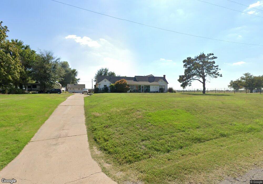
6512 Foreman Rd E El Reno, OK 73036
Estimated Value: $241,000 - $251,000
Studio
--
Bath
2,128
Sq Ft
$116/Sq Ft
Est. Value
About This Home
This home is located at 6512 Foreman Rd E, El Reno, OK 73036 and is currently estimated at $246,000, approximately $115 per square foot. 6512 Foreman Rd E is a home.
Ownership History
Date
Name
Owned For
Owner Type
Purchase Details
Closed on
Mar 15, 2023
Sold by
Lancaster Karri
Bought by
Heinrich Roy Henry and Heinrich Angela K
Current Estimated Value
Purchase Details
Closed on
Oct 22, 2021
Sold by
Lancaster and Karri
Bought by
Lancaster Darrell and Lancaster Karri
Purchase Details
Closed on
Feb 24, 2017
Sold by
Heinrich Roy Henry and Heinrich Angela K
Bought by
Lancaster Darrell and Lancaster Karri
Home Financials for this Owner
Home Financials are based on the most recent Mortgage that was taken out on this home.
Original Mortgage
$134,518
Interest Rate
4.4%
Mortgage Type
FHA
Create a Home Valuation Report for This Property
The Home Valuation Report is an in-depth analysis detailing your home's value as well as a comparison with similar homes in the area
Home Values in the Area
Average Home Value in this Area
Purchase History
| Date | Buyer | Sale Price | Title Company |
|---|---|---|---|
| Heinrich Roy Henry | $144,500 | Old Republic Title | |
| Heinrich Roy Henry | -- | Old Republic Title | |
| Lancaster Darrell | -- | Old Republic Title | |
| Lancaster Darrell | -- | Old Republic Title | |
| Lancaster Darrell | $137,000 | Old Republic Title |
Source: Public Records
Mortgage History
| Date | Status | Borrower | Loan Amount |
|---|---|---|---|
| Previous Owner | Lancaster Darrell | $134,518 |
Source: Public Records
Tax History
| Year | Tax Paid | Tax Assessment Tax Assessment Total Assessment is a certain percentage of the fair market value that is determined by local assessors to be the total taxable value of land and additions on the property. | Land | Improvement |
|---|---|---|---|---|
| 2025 | $1,585 | $20,692 | $978 | $19,714 |
| 2024 | $947 | $21,750 | $978 | $20,772 |
| 2023 | $947 | $14,741 | $978 | $13,763 |
| 2022 | $976 | $14,312 | $978 | $13,334 |
| 2021 | $947 | $13,895 | $978 | $12,917 |
| 2020 | $945 | $13,865 | $978 | $12,887 |
| 2019 | $915 | $13,461 | $978 | $12,483 |
| 2018 | $961 | $13,069 | $978 | $12,091 |
| 2017 | $934 | $12,684 | $593 | $12,091 |
Source: Public Records
Map
Nearby Homes
- 0 S Radio Rd Unit 781180
- 1223 Land Run Way
- 16751 W Wilshire Blvd
- 3390 Manning Farms Blvd
- 6104 Hummingbird Cir
- 3530 Manning Farms Blvd
- 3490 Manning Rd
- 3440 Manning Rd
- 16925 W Wilshire Blvd
- 8832 US Highway 66 E
- 0 090149004 Unit 1147019
- 8701 Rebekah Rd
- 408 Vista Dr
- 401 Nest Dr
- 0 N Hope Ln Unit 1186936
- 0 Ew Highway 66 Hwy
- 11020 N Banner Rd
- 8911 N Hope Ln
- 3808 S Manning Rd
- 6745 N Gregory Rd
- 6507 Foreman Rd E
- 503 S Evans Rd
- 6503 Foreman Rd E
- 6211 Foreman Rd E
- 6211 Foreman Rd E
- 6211 Foreman Rd E
- 6511 Foreman Rd E
- 7500 Foreman Rd E
- 80 80 Acres Foreman Rd
- 0 80 Acres Foreman Rd
- 5632 Foreman Rd E
- 0 SW 15th & Manning Rd Rd Unit 1068182
- 223 N Manning Rd
- 0 Manning Rd 1 19 Acres
- 5108 Foreman Rd E
Your Personal Tour Guide
Ask me questions while you tour the home.