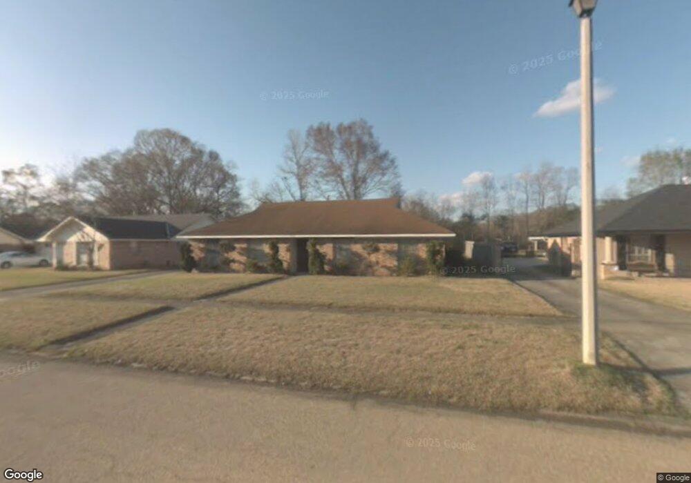
6513 Lebrent Ave Baker, LA 70714
Brownfields NeighborhoodEstimated Value: $158,618 - $215,000
Studio
--
Bath
1,582
Sq Ft
$111/Sq Ft
Est. Value
About This Home
This home is located at 6513 Lebrent Ave, Baker, LA 70714 and is currently estimated at $174,905, approximately $110 per square foot. 6513 Lebrent Ave is a home located in East Baton Rouge Parish with nearby schools including White Hills Elementary School, Northeast High School, and Impact Charter School.
Ownership History
Date
Name
Owned For
Owner Type
Purchase Details
Closed on
Jun 18, 2021
Sold by
Womack Victor
Bought by
J & J Property Holdings Llc
Current Estimated Value
Home Financials for this Owner
Home Financials are based on the most recent Mortgage that was taken out on this home.
Original Mortgage
$120,000
Outstanding Balance
$107,215
Interest Rate
2.9%
Mortgage Type
Future Advance Clause Open End Mortgage
Estimated Equity
$67,690
Create a Home Valuation Report for This Property
The Home Valuation Report is an in-depth analysis detailing your home's value as well as a comparison with similar homes in the area
Home Values in the Area
Average Home Value in this Area
Purchase History
| Date | Buyer | Sale Price | Title Company |
|---|---|---|---|
| J & J Property Holdings Llc | $118,000 | Cypress Title Llc |
Source: Public Records
Mortgage History
| Date | Status | Borrower | Loan Amount |
|---|---|---|---|
| Open | J & J Property Holdings Llc | $120,000 |
Source: Public Records
Tax History
| Year | Tax Paid | Tax Assessment Tax Assessment Total Assessment is a certain percentage of the fair market value that is determined by local assessors to be the total taxable value of land and additions on the property. | Land | Improvement |
|---|---|---|---|---|
| 2024 | $1,950 | $15,210 | $1,200 | $14,010 |
| 2023 | $1,958 | $11,210 | $1,200 | $10,010 |
| 2022 | $1,503 | $11,210 | $1,200 | $10,010 |
| 2021 | $922 | $6,900 | $1,100 | $5,800 |
| 2020 | $932 | $6,900 | $1,100 | $5,800 |
| 2019 | $964 | $6,900 | $1,100 | $5,800 |
| 2018 | $953 | $6,900 | $1,100 | $5,800 |
| 2017 | $953 | $6,900 | $1,100 | $5,800 |
| 2016 | $32 | $4,870 | $1,100 | $3,770 |
| 2015 | $32 | $6,900 | $1,100 | $5,800 |
| 2014 | $32 | $6,900 | $1,100 | $5,800 |
| 2013 | -- | $6,900 | $1,100 | $5,800 |
Source: Public Records
Map
Nearby Homes
- 13261 Plank Rd
- 13311 Plank Rd
- 13443 Plank Rd
- 16920 Plank Rd
- 13841 Blairstown Dr
- 7425 Comite Dr
- 12105 Foster Rd
- 6525 Brownfields Dr
- 6878 Yorkdale Ave
- 12265 Plank Rd
- 11940 Newsom Dr
- 13326 Lillywood Ct
- 13315 Lillywood Ct
- 7743 Misty Oaks Ave
- 5885 Lavey Ln Unit 128
- 5885 Lavey Ln Unit 125
- 5885 Lavey Ln Unit 131
- 5885 Lavey Ln Unit 123
- 5885 Lavey Ln Unit 26
- 13314 Lilywood Ct
- 6523 Lebrent Ave
- 6431 Lebrent Ave
- 6421 Lebrent Ave
- 6533 Lebrent Ave
- 6514 Lebrent Ave
- 6524 Lebrent Ave
- 6432 Lebrent Ave
- 6411 Lebrent Ave
- 6543 Lebrent Ave
- 6534 Lebrent Ave
- 6422 Lebrent Ave
- 6544 Lebrent Ave
- 6553 Lebrent Ave
- 6412 Lebrent Ave
- 6513 Garland Ave
- 6523 Garland Ave
- 6431 Garland Ave
- 6554 Lebrent Ave
- 6533 Garland Ave
- 6421 Garland Ave
Your Personal Tour Guide
Ask me questions while you tour the home.