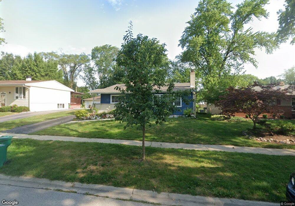
652 Maple Dr Buffalo Grove, IL 60089
South Buffalo Grove NeighborhoodEstimated Value: $345,000 - $407,000
3
Beds
2
Baths
1,024
Sq Ft
$363/Sq Ft
Est. Value
About This Home
This home is located at 652 Maple Dr, Buffalo Grove, IL 60089 and is currently estimated at $372,033, approximately $363 per square foot. 652 Maple Dr is a home located in Cook County with nearby schools including Henry W Longfellow Elementary School, Cooper Middle School, and Buffalo Grove High School.
Ownership History
Date
Name
Owned For
Owner Type
Purchase Details
Closed on
Jun 6, 2003
Sold by
Evans Jordan and Evans Stephanie
Bought by
Evans Stephanie A
Current Estimated Value
Home Financials for this Owner
Home Financials are based on the most recent Mortgage that was taken out on this home.
Original Mortgage
$190,000
Interest Rate
5.3%
Mortgage Type
Unknown
Create a Home Valuation Report for This Property
The Home Valuation Report is an in-depth analysis detailing your home's value as well as a comparison with similar homes in the area
Home Values in the Area
Average Home Value in this Area
Purchase History
| Date | Buyer | Sale Price | Title Company |
|---|---|---|---|
| Evans Stephanie A | -- | Ticor Title Insurance Compan |
Source: Public Records
Mortgage History
| Date | Status | Borrower | Loan Amount |
|---|---|---|---|
| Closed | Evans Stephanie A | $190,000 |
Source: Public Records
Tax History
| Year | Tax Paid | Tax Assessment Tax Assessment Total Assessment is a certain percentage of the fair market value that is determined by local assessors to be the total taxable value of land and additions on the property. | Land | Improvement |
|---|---|---|---|---|
| 2025 | $7,581 | $32,000 | $7,560 | $24,440 |
| 2024 | $7,581 | $27,000 | $6,480 | $20,520 |
| 2023 | $7,261 | $27,000 | $6,480 | $20,520 |
| 2022 | $7,261 | $27,000 | $6,480 | $20,520 |
| 2021 | $7,442 | $24,395 | $4,140 | $20,255 |
| 2020 | $7,321 | $24,395 | $4,140 | $20,255 |
| 2019 | $7,312 | $27,046 | $4,140 | $22,906 |
| 2018 | $7,008 | $23,783 | $3,600 | $20,183 |
| 2017 | $6,899 | $23,783 | $3,600 | $20,183 |
| 2016 | $6,685 | $23,783 | $3,600 | $20,183 |
| 2015 | $6,219 | $20,928 | $3,060 | $17,868 |
| 2014 | $6,134 | $20,928 | $3,060 | $17,868 |
| 2013 | $5,652 | $20,928 | $3,060 | $17,868 |
Source: Public Records
Map
Nearby Homes
- 267 Timber Hill Rd
- 393 Indian Hill Dr
- 334 Stillwell Dr
- 517 Longwood Dr
- 222 Saint Marys Pkwy
- 140 Manchester Dr Unit 408
- 535 Weidner Rd
- 808 Old Checker Rd Unit C2
- 170 Manchester Dr Unit 306
- 462 Longwood Dr
- 496 Raupp Blvd
- 141 Manchester Ct
- 125 N Buffalo Grove Rd Unit 407
- 800 Weidner Rd Unit 208
- 671 Hapsfield Ln Unit 105
- 1096 Beechwood Rd
- 621 Hapsfield Ln Unit 103
- 820 Weidner Rd Unit 4013
- 820 Weidner Rd Unit 409
- 302 Chateau Dr
- 644 Maple Dr
- 662 Maple Dr
- 636 Maple Dr
- 674 Maple Dr
- 653 Saint Marys Pkwy
- 643 Saint Marys Pkwy
- 663 Saint Marys Pkwy
- 635 Saint Marys Pkwy
- 673 Saint Marys Pkwy Unit 6
- 653 Maple Dr Unit 6
- 684 Maple Dr
- 626 Maple Dr
- 661 Maple Dr
- 643 Maple Dr
- 673 Maple Dr
- 625 Saint Marys Pkwy
- 683 Saint Marys Pkwy
- 637 Maple Dr
- 692 Maple Dr
- 620 Maple Dr
Your Personal Tour Guide
Ask me questions while you tour the home.