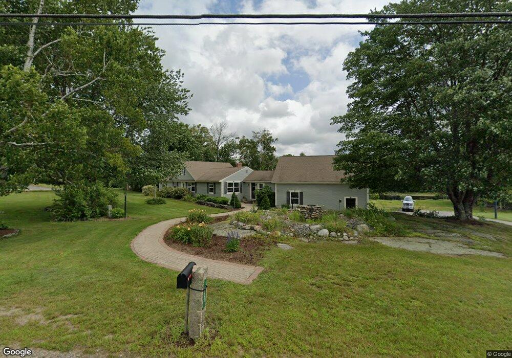
655 Hanson Ridge Rd Springvale, ME 04083
Estimated Value: $446,026 - $521,000
About This Home
This home is located at 655 Hanson Ridge Rd, Springvale, ME 04083 and is currently estimated at $483,009, approximately $216 per square foot. 655 Hanson Ridge Rd is a home located in York County.
Ownership History
We collect this data history from publicly available records. To have your information removed, we recommend requesting removal directly through your county’s website.
Purchase Details
Home Financials for this Owner
Home Financials are based on the most recent Mortgage that was taken out on this home.Home Values in the Area
Average Home Value in this Area
Purchase History
We collect this data history from publicly available records. To have your information removed, we recommend requesting removal directly through your county’s website.
| Date | Buyer | Sale Price | Title Company |
|---|---|---|---|
| -- | -- |
Mortgage History
We collect this data history from publicly available records. To have your information removed, we recommend requesting removal directly through your county’s website.
| Date | Status | Borrower | Loan Amount |
|---|---|---|---|
| Open | $140,000 |
Tax History
We collect this data history from publicly available records. To have your information removed, we recommend requesting removal directly through your county’s website.
| Year | Tax Paid | Tax Assessment Tax Assessment Total Assessment is a certain percentage of the fair market value that is determined by local assessors to be the total taxable value of land and additions on the property. | Land | Improvement |
|---|---|---|---|---|
| 2025 | $6,378 | $373,000 | $51,300 | $321,700 |
| 2024 | $6,020 | $373,000 | $51,300 | $321,700 |
| 2023 | $5,599 | $369,800 | $51,300 | $318,500 |
| 2022 | $5,473 | $369,800 | $51,300 | $318,500 |
| 2021 | $5,316 | $292,400 | $51,300 | $241,100 |
| 2020 | $4,637 | $255,000 | $51,300 | $203,700 |
| 2019 | $4,912 | $237,300 | $51,300 | $186,000 |
| 2018 | $4,377 | $226,300 | $46,600 | $179,700 |
| 2017 | $4,447 | $214,400 | $46,600 | $167,800 |
| 2016 | $4,446 | $195,500 | $46,700 | $148,800 |
| 2015 | $4,377 | $198,600 | $51,100 | $147,500 |
| 2014 | $4,490 | $200,300 | $52,800 | $147,500 |
| 2013 | -- | $207,700 | $58,900 | $148,800 |
Map
- 273 Deering Neighborhood Rd
- Lot 27-1 Blanchard Rd
- 271 Deering Neighborhood Rd
- 252 Deering Neighborhood Rd
- 631 Hanson Ridge Rd
- 0 Blanchard Rd
- 630 Hanson Ridge Rd
- 13 Blanchard Rd
- 680 Hanson Ridge Rd
- 619 Hanson Ridge Rd
- 245 Deering Neighborhood Rd
- 21 Blanchard Rd
- 687 Hanson Ridge Rd
- 593 Hanson's Ridge Rd
- 701 Hanson Ridge Rd
- 37 Blanchard Rd
- 593 Hanson Ridge Rd
- 222 Deering Neighborhood Rd
- 222 Deering Neighborhood Rd
- 219 Deering Neighborhood Rd
Ask me questions while you tour the home.