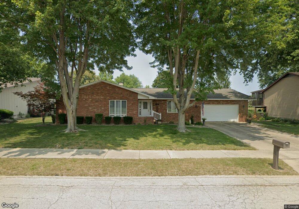
656 W Wolf Rd Decatur, IL 62526
Cresthaven NeighborhoodEstimated Value: $197,000 - $230,000
3
Beds
2
Baths
1,908
Sq Ft
$111/Sq Ft
Est. Value
About This Home
This home is located at 656 W Wolf Rd, Decatur, IL 62526 and is currently estimated at $212,502, approximately $111 per square foot. 656 W Wolf Rd is a home located in Macon County with nearby schools including Parsons Elementary School, Stephen Decatur Middle School, and Our Lady of Lourdes School.
Ownership History
Date
Name
Owned For
Owner Type
Purchase Details
Closed on
Oct 7, 2005
Sold by
Lutes Edward L and Lutesa Mary Ann
Bought by
Vasquez Richard and Vasquez Susan
Current Estimated Value
Home Financials for this Owner
Home Financials are based on the most recent Mortgage that was taken out on this home.
Original Mortgage
$50,000
Interest Rate
5.48%
Mortgage Type
New Conventional
Purchase Details
Closed on
Oct 1, 1998
Create a Home Valuation Report for This Property
The Home Valuation Report is an in-depth analysis detailing your home's value as well as a comparison with similar homes in the area
Home Values in the Area
Average Home Value in this Area
Purchase History
| Date | Buyer | Sale Price | Title Company |
|---|---|---|---|
| Vasquez Richard | $143,000 | None Available | |
| -- | $110,000 | -- |
Source: Public Records
Mortgage History
| Date | Status | Borrower | Loan Amount |
|---|---|---|---|
| Closed | Vasquez Richard | $50,000 |
Source: Public Records
Tax History
| Year | Tax Paid | Tax Assessment Tax Assessment Total Assessment is a certain percentage of the fair market value that is determined by local assessors to be the total taxable value of land and additions on the property. | Land | Improvement |
|---|---|---|---|---|
| 2024 | $4,655 | $58,144 | $10,683 | $47,461 |
| 2023 | $4,276 | $53,451 | $9,821 | $43,630 |
| 2022 | $3,985 | $49,574 | $9,109 | $40,465 |
| 2021 | $3,707 | $46,736 | $8,517 | $38,219 |
| 2020 | $3,709 | $45,770 | $8,341 | $37,429 |
| 2019 | $3,709 | $45,770 | $8,341 | $37,429 |
| 2018 | $3,697 | $46,098 | $8,401 | $37,697 |
| 2017 | $3,716 | $46,354 | $8,447 | $37,907 |
| 2016 | $3,755 | $46,465 | $8,467 | $37,998 |
| 2015 | $3,571 | $45,914 | $8,367 | $37,547 |
| 2014 | $3,346 | $45,914 | $8,367 | $37,547 |
| 2013 | $3,334 | $45,914 | $8,367 | $37,547 |
Source: Public Records
Map
Nearby Homes
- 4487 Hale Dr
- 4454 Lawson Dr
- 4616 Lawson Dr
- 4150 N Sunderland Dr
- 4086 Arthur Ct
- 288 W Brown Ave
- 4051 Sheffield Dr
- 4394 Huston Hills Rd
- 630 Montgomery Ln
- 3994 N Northbrook Dr
- 13 Lantern Ln
- 223 Crescent Dr
- 3902 Greenridge Dr
- 3931 N Newcastle Dr
- 5244 Yavapai Dr
- 665 Crestline Dr
- 312 W Hickory Point Rd
- 5322 Navajo Dr
- 681 W Karen Ct
- 1225 W Pineview Ct
- 656 Wolf Rd
- 4402 N Waterford Ct
- 4402 Waterford Ct
- 636 Wolf Rd
- 696 Wolf Rd
- 641 Wolf Rd
- 661 W Wolf Rd
- 4403 N Waterford Ct
- 696 W Wolf Rd
- 4404 Waterford Ct
- 4404 N Waterford Ct
- 4401 Waterford Ct
- 4401 N Waterford Ct
- 702 Wolf Rd
- 4403 Waterford Ct
- 626 Wolf Rd
- 4366 N Leonore Dr
- 4353 Sheila Ct
- 702 W Wolf Rd
- 4422 Waterford Ct
Your Personal Tour Guide
Ask me questions while you tour the home.