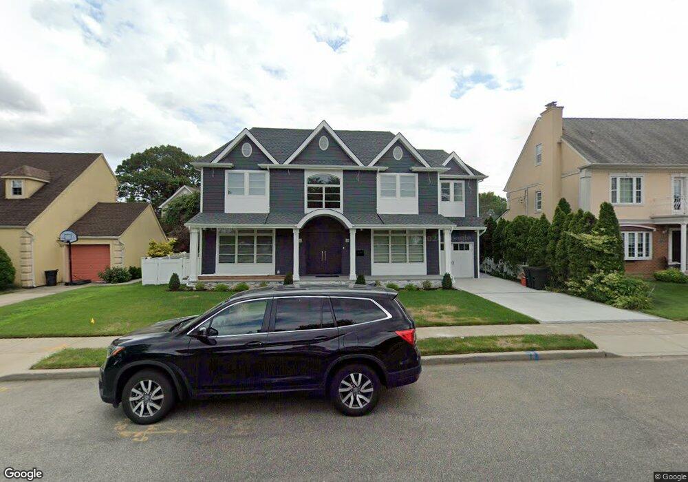
657 Colonade Rd West Hempstead, NY 11552
Estimated Value: $1,715,037 - $1,893,000
4
Beds
2
Baths
2,050
Sq Ft
$880/Sq Ft
Est. Value
About This Home
This home is located at 657 Colonade Rd, West Hempstead, NY 11552 and is currently estimated at $1,804,019, approximately $880 per square foot. 657 Colonade Rd is a home located in Nassau County with nearby schools including Chestnut Street School, West Hempstead Middle School, and West Hempstead Secondary School.
Ownership History
Date
Name
Owned For
Owner Type
Purchase Details
Closed on
Nov 1, 2019
Sold by
Meir Abraham
Bought by
Kaufman Andrew and Schwalf Leah
Current Estimated Value
Home Financials for this Owner
Home Financials are based on the most recent Mortgage that was taken out on this home.
Original Mortgage
$476,800
Outstanding Balance
$419,878
Interest Rate
3.65%
Mortgage Type
New Conventional
Estimated Equity
$1,384,141
Purchase Details
Closed on
Jun 27, 2018
Sold by
Rand Haim and Rand Malka
Bought by
Abraham Meir
Create a Home Valuation Report for This Property
The Home Valuation Report is an in-depth analysis detailing your home's value as well as a comparison with similar homes in the area
Home Values in the Area
Average Home Value in this Area
Purchase History
| Date | Buyer | Sale Price | Title Company |
|---|---|---|---|
| Kaufman Andrew | $596,000 | Fidelity National Title | |
| Abraham Meir | $307,000 | First American Title |
Source: Public Records
Mortgage History
| Date | Status | Borrower | Loan Amount |
|---|---|---|---|
| Open | Kaufman Andrew | $476,800 |
Source: Public Records
Tax History
| Year | Tax Paid | Tax Assessment Tax Assessment Total Assessment is a certain percentage of the fair market value that is determined by local assessors to be the total taxable value of land and additions on the property. | Land | Improvement |
|---|---|---|---|---|
| 2025 | $12,157 | $923 | $233 | $690 |
| 2024 | $3,162 | $920 | $232 | $688 |
| 2023 | $16,003 | $567 | $272 | $295 |
| 2022 | $16,003 | $623 | $302 | $321 |
| 2021 | $24,637 | $588 | $282 | $306 |
| 2020 | $18,816 | $1,083 | $657 | $426 |
| 2019 | $6,224 | $1,083 | $657 | $426 |
| 2018 | $12,631 | $1,083 | $0 | $0 |
| 2017 | $11,407 | $1,083 | $657 | $426 |
| 2016 | $17,028 | $1,083 | $657 | $426 |
| 2015 | $5,232 | $1,083 | $657 | $426 |
| 2014 | $5,232 | $1,083 | $657 | $426 |
| 2013 | $4,887 | $1,083 | $657 | $426 |
Source: Public Records
Map
Nearby Homes
- 575 Hawthorne St
- 550 Nassau Blvd
- 739 Dogwood Ave
- 708 Anderson Ave
- 738 Sprague Ave
- 734 Berry Ct
- 635 Hempstead Ave
- 824 Lawrence Ct
- 771 Maple Place
- 837 Cleveland St
- 350 Paul Place
- 899 Cleveland St
- 1010 Hempstead Ave
- 27 Richard St
- 567 Langley Ave
- 846 Harrison St
- 851 Hemlock St
- 303 Nassau Blvd
- 321 Oakford St
- 660 Hewlett St
- 647 Colonade Rd
- 669 Colonade Rd
- 658 Hawthorne St
- 662 Hawthorne St
- 641 Colonade Rd
- 650 Hawthorne St
- 670 Colonade Rd
- 672 Hawthorne St
- 561 Lindner Place
- 633 Colonade Rd
- 552 Lindner Place
- 683 Colonade Rd
- 680 Colonade Rd
- 680 Hawthorne St
- 547 Lindner Place
- 627 Colonade Rd
- 655 Hawthorne St
- 546 Lindner Place
Your Personal Tour Guide
Ask me questions while you tour the home.