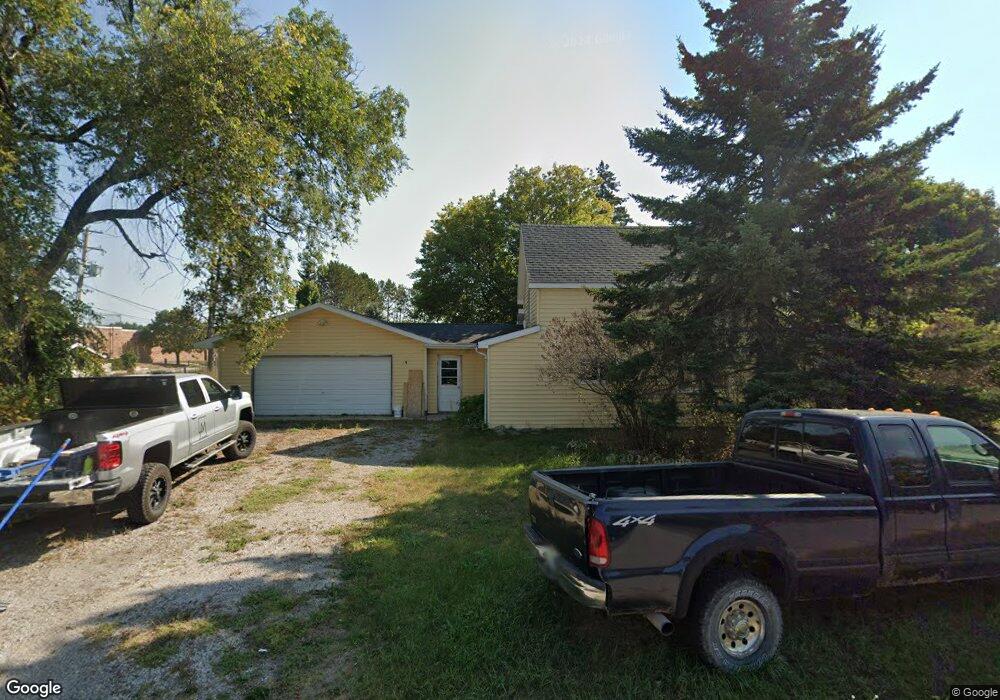
6571 E Main St Pellston, MI 49769
Estimated Value: $116,000 - $232,000
Studio
--
Bath
--
Sq Ft
15,769
Sq Ft Lot
About This Home
This home is located at 6571 E Main St, Pellston, MI 49769 and is currently estimated at $164,663. 6571 E Main St is a home located in Emmet County with nearby schools including Pellston Elementary School and Pellston Middle/High School.
Ownership History
Date
Name
Owned For
Owner Type
Purchase Details
Closed on
Oct 23, 2025
Sold by
Freeman Tyler T
Bought by
Aquila Troy Dean and Aquila Margaret Janette
Current Estimated Value
Purchase Details
Closed on
Jun 19, 2024
Sold by
Emmet County Treasurer
Bought by
Freeman Tyler T
Purchase Details
Closed on
Mar 1, 2024
Sold by
Freeman Tyler T
Bought by
Emmet County Treasurer
Purchase Details
Closed on
Jul 30, 2010
Sold by
Pierce Marshall A and Pierce Jacqueline M
Bought by
Shrader Christian E
Purchase Details
Closed on
Mar 17, 2006
Bought by
Pierce Marshall A and Pierce Jacqueline M
Purchase Details
Closed on
May 1, 1993
Bought by
Pierce
Create a Home Valuation Report for This Property
The Home Valuation Report is an in-depth analysis detailing your home's value as well as a comparison with similar homes in the area
Purchase History
| Date | Buyer | Sale Price | Title Company |
|---|---|---|---|
| Aquila Troy Dean | $100,000 | -- | |
| Freeman Tyler T | $1,348 | -- | |
| Emmet County Treasurer | $1,311 | -- | |
| Shrader Christian E | $4,000 | -- | |
| Pierce Marshall A | -- | -- | |
| Pierce | $4,000 | -- |
Source: Public Records
Mortgage History
| Date | Status | Borrower | Loan Amount |
|---|---|---|---|
| Closed | Aquila Troy Dean | -- |
Source: Public Records
Tax History
| Year | Tax Paid | Tax Assessment Tax Assessment Total Assessment is a certain percentage of the fair market value that is determined by local assessors to be the total taxable value of land and additions on the property. | Land | Improvement |
|---|---|---|---|---|
| 2025 | $2,497 | $53,500 | $53,500 | $0 |
| 2024 | $12 | $50,500 | $50,500 | $0 |
| 2023 | $791 | $46,600 | $46,600 | $0 |
| 2022 | $791 | $42,300 | $42,300 | $0 |
| 2021 | $801 | $39,100 | $39,100 | $0 |
| 2020 | $804 | $37,600 | $37,600 | $0 |
| 2019 | -- | $30,600 | $30,600 | $0 |
| 2018 | -- | $28,900 | $28,900 | $0 |
| 2017 | -- | $28,100 | $28,100 | $0 |
| 2016 | -- | $26,600 | $26,600 | $0 |
| 2015 | -- | $24,600 | $0 | $0 |
| 2014 | -- | $22,600 | $0 | $0 |
Source: Public Records
Map
Nearby Homes
- 6421 Airport Crossing Rd Unit 1
- 8959 Robinson Rd
- TBD Teal Rd
- 4333 U S 31
- 3954 Valley Rd
- 10826 Chickagami Trail
- 10999 Koepke Rd
- 6105 U S 31
- 10222 W Munro Lake Dr
- 1830 Indian Point Rd
- 6167 Lambert Dr
- 6737 Honeysette Rd
- 1442 Indian Point Rd
- 5441 Valley Rd
- 7181 Maple St
- 393 Beaux Rivages Dr
- 7325 Keystone Park Dr Unit 18
- 319 Beaux Rivages Dr
- 7028 Barney Rd
- 1253 Walkabout Ln
Your Personal Tour Guide
Ask me questions while you tour the home.