Estimated Value: $700,405 - $747,000
About This Home
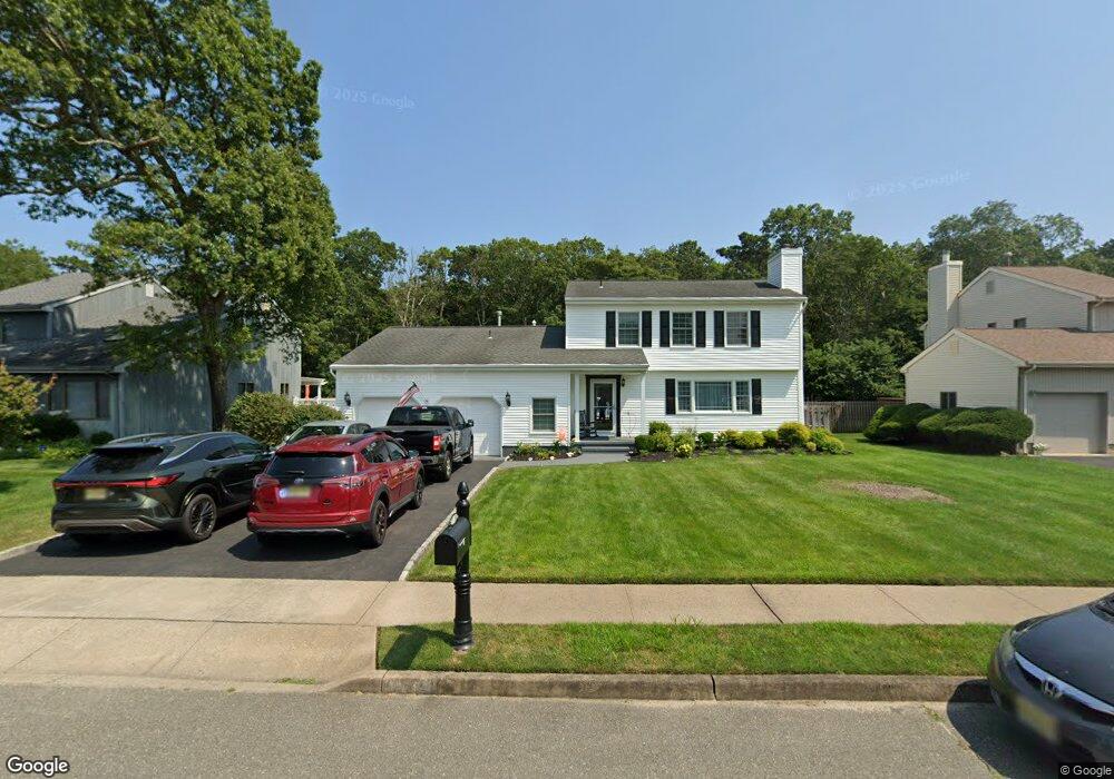
This home is located at 659 Preston St, Brick, NJ 08723 and is currently estimated at $721,351, approximately $319 per square foot. 659 Preston St is a home located in Ocean County with nearby schools including Osbornville Elementary School, Lake Riviera Middle School, and Brick Township High School.
Ownership History
We collect this data history from publicly available records. To have your information removed, we recommend requesting removal directly through your county’s website.
Purchase Details
Purchase Details
Home Financials for this Owner
Home Financials are based on the most recent Mortgage that was taken out on this home.Home Values in the Area
Average Home Value in this Area
Purchase History
We collect this data history from publicly available records. To have your information removed, we recommend requesting removal directly through your county’s website.
| Date | Buyer | Sale Price | Title Company |
|---|---|---|---|
| $100 | -- | ||
| $185,000 | -- |
Mortgage History
We collect this data history from publicly available records. To have your information removed, we recommend requesting removal directly through your county’s website.
| Date | Status | Borrower | Loan Amount |
|---|---|---|---|
| Previous Owner | $148,000 |
Tax History
We collect this data history from publicly available records. To have your information removed, we recommend requesting removal directly through your county’s website.
| Year | Tax Paid | Tax Assessment Tax Assessment Total Assessment is a certain percentage of the fair market value that is determined by local assessors to be the total taxable value of land and additions on the property. | Land | Improvement |
|---|---|---|---|---|
| 2025 | $9,179 | $338,200 | $132,600 | $205,600 |
| 2024 | $8,303 | $338,200 | $132,600 | $205,600 |
| 2023 | $8,195 | $338,200 | $132,600 | $205,600 |
| 2022 | $8,195 | $338,200 | $132,600 | $205,600 |
| 2021 | $7,730 | $338,200 | $132,600 | $205,600 |
| 2020 | $7,921 | $338,200 | $132,600 | $205,600 |
| 2019 | $7,789 | $338,200 | $132,600 | $205,600 |
| 2018 | $7,610 | $338,200 | $132,600 | $205,600 |
| 2017 | $7,403 | $338,200 | $132,600 | $205,600 |
| 2016 | $7,366 | $338,200 | $132,600 | $205,600 |
| 2015 | $7,173 | $338,200 | $132,600 | $205,600 |
| 2014 | $7,116 | $338,200 | $132,600 | $205,600 |
Map
- 418 Mamie Ct
- 471 Drum Point Rd
- 558 Mark Dr
- 521 Dorothy Place
- 609 Adamston Rd
- 439 Adamston Rd
- 0 Mantoloking Rd Unit East of 113 crosses
- 477 Mantoloking Rd
- 437 Adamston Rd
- 471 Woodpark Dr
- 511 Pinecroft Dr
- 497 Pinecroft Dr
- 331 Alden St
- 442 Mohawk Dr
- 353 Church Rd
- 299 Huppert Dr
- 36 Bay Laurel Dr
- 474 Burnt Bark Rd
- 366 Church Rd
- 421 Malibu Way
Ask me questions while you tour the home.