Estimated Value: $417,000 - $514,000
4
Beds
3
Baths
2,882
Sq Ft
$165/Sq Ft
Est. Value
About This Home
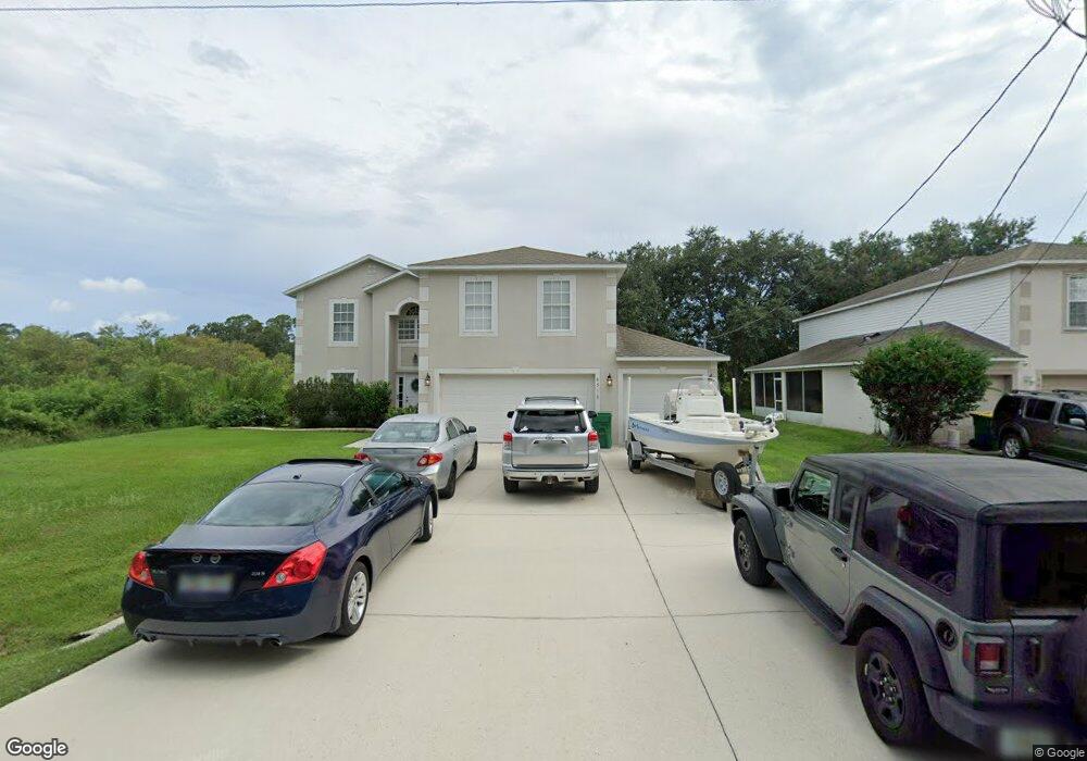
This home is located at 6595 Banyan St, Cocoa, FL 32927 and is currently estimated at $476,731, approximately $165 per square foot. 6595 Banyan St is a home located in Brevard County with nearby schools including Enterprise Elementary School, Space Coast Junior/Senior High School, and East Atlantic Prep of Brevard County.
Ownership History
Date
Name
Owned For
Owner Type
Purchase Details
Closed on
Apr 15, 2025
Sold by
Dewitt Scott A and Dewitt Karen A
Bought by
Dewitt Scott A and Dewitt Karen A
Current Estimated Value
Purchase Details
Closed on
Nov 29, 2006
Sold by
Maronda Homes Inc Of Florida
Bought by
Dewitt Scott A and Dewitt Karen A
Home Financials for this Owner
Home Financials are based on the most recent Mortgage that was taken out on this home.
Original Mortgage
$206,332
Interest Rate
6.36%
Create a Home Valuation Report for This Property
The Home Valuation Report is an in-depth analysis detailing your home's value as well as a comparison with similar homes in the area
Home Values in the Area
Average Home Value in this Area
Purchase History
We collect this data history from publicly available records. To have your information removed, we recommend requesting removal directly through your county’s website.
| Date | Buyer | Sale Price | Title Company |
|---|---|---|---|
| Dewitt Scott A | $100 | None Listed On Document | |
| Dewitt Scott A | $100 | None Listed On Document | |
| Dewitt Scott A | $258,000 | Adams Title Inc |
Source: Public Records
Mortgage History
We collect this data history from publicly available records. To have your information removed, we recommend requesting removal directly through your county’s website.
| Date | Status | Borrower | Loan Amount |
|---|---|---|---|
| Previous Owner | Dewitt Scott A | $206,332 |
Source: Public Records
Tax History
| Year | Tax Paid | Tax Assessment Tax Assessment Total Assessment is a certain percentage of the fair market value that is determined by local assessors to be the total taxable value of land and additions on the property. | Land | Improvement |
|---|---|---|---|---|
| 2025 | $2,284 | $236,100 | -- | -- |
| 2024 | $2,284 | $152,920 | -- | -- |
| 2023 | $2,238 | $148,470 | -- | -- |
| 2022 | $2,100 | $144,150 | $0 | $0 |
| 2021 | $2,118 | $139,960 | $0 | $0 |
| 2020 | $2,020 | $138,030 | $0 | $0 |
| 2019 | $1,959 | $134,930 | $0 | $0 |
| 2018 | $1,956 | $132,420 | $0 | $0 |
| 2017 | $1,956 | $129,700 | $0 | $0 |
| 2016 | $1,972 | $127,040 | $18,000 | $109,040 |
| 2015 | $2,009 | $126,160 | $15,000 | $111,160 |
| 2014 | $2,016 | $125,160 | $11,000 | $114,160 |
Source: Public Records
Map
Nearby Homes
- 6480 Golfview Ave
- 6510 Aspen Ln
- 6115 Allmont St
- 6289 Leonard Ave
- 6265 Betty Ave
- 10 Golfview Ave
- 00000 Golfview Ave
- 11 Golfview Ave
- 6505 Homestead Ave
- 5975 Aruin St
- 23-35-21-JX-B-2 Aruin St
- 6460 Ainsworth Rd
- 0 Aruin St Unit 1222557
- 6250 Ainsworth Rd
- 5770 Fairbridge St
- 6230 Balsam St
- 6990 Marvin Ave
- 6643 Emil Ave
- 5940 Fisherman Ln
- 6570 Bancroft Ave
- 6607 Banyan St
- 6619 N Banyan
- 6619 Banyan St
- 6571 Banyan St
- 1 Adrian
- 3 Adrian
- 2 Adrian
- 0000 No Address Assigned
- 6559 Banyan St
- 6547 Banyan St
- 6670 Aberdeen Ave
- 6655 Aberdeen Ave
- 6660 Aberdeen Ave
- 6535 Banyan St
- 6550 Adrian St
- 6600 Bethel St
- 6590 Bethel St
- 6610 Bethel St
- 6565 Adrian St
- 6650 Aberdeen Ave
Your Personal Tour Guide
Ask me questions while you tour the home.