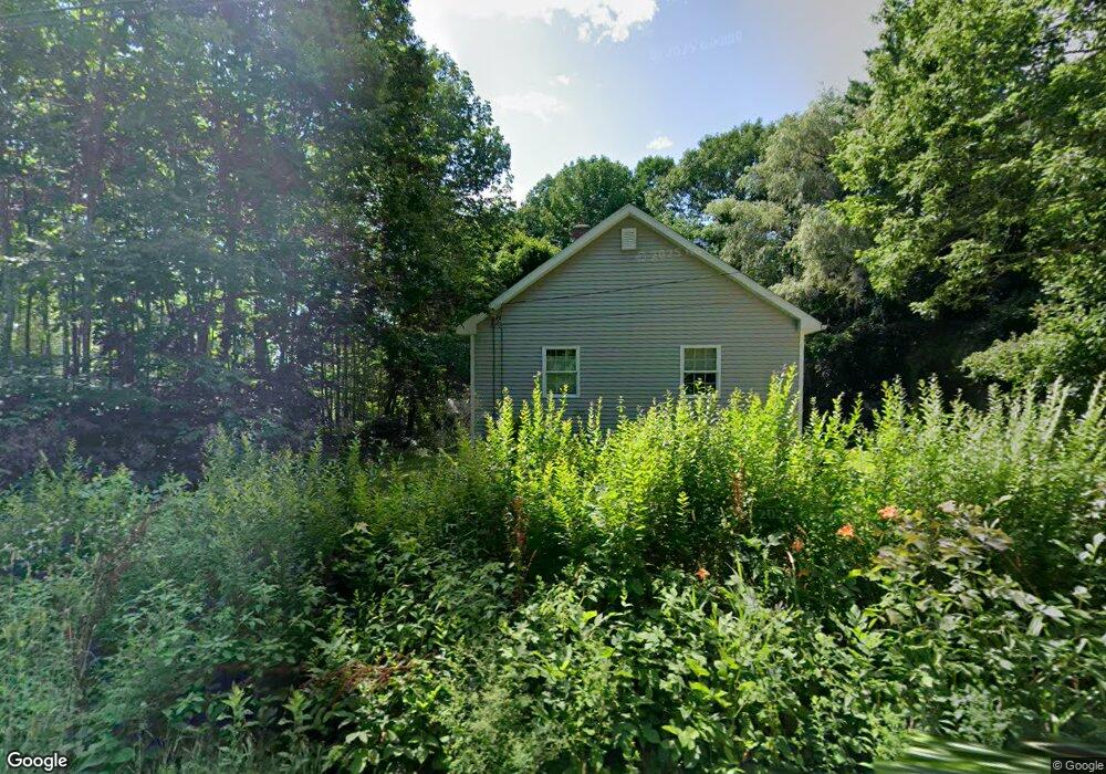
66 Lancaster Rd Pittston, ME 04345
Estimated Value: $195,331 - $278,000
1
Bed
1
Bath
816
Sq Ft
$283/Sq Ft
Est. Value
About This Home
This home is located at 66 Lancaster Rd, Pittston, ME 04345 and is currently estimated at $231,333, approximately $283 per square foot. 66 Lancaster Rd is a home located in Kennebec County with nearby schools including Gardiner Area High School.
Ownership History
Date
Name
Owned For
Owner Type
Purchase Details
Closed on
Oct 21, 2019
Sold by
Symes David and Symes Rebecca
Bought by
Wight Jennifer L
Current Estimated Value
Home Financials for this Owner
Home Financials are based on the most recent Mortgage that was taken out on this home.
Original Mortgage
$146,363
Outstanding Balance
$127,384
Interest Rate
3.4%
Mortgage Type
New Conventional
Estimated Equity
$103,949
Purchase Details
Closed on
Sep 30, 2011
Sold by
Rogers Gerald and Deutsche Bk Natl T Co Tr
Bought by
Deutsche Bk Natl T Co Tr
Create a Home Valuation Report for This Property
The Home Valuation Report is an in-depth analysis detailing your home's value as well as a comparison with similar homes in the area
Home Values in the Area
Average Home Value in this Area
Purchase History
| Date | Buyer | Sale Price | Title Company |
|---|---|---|---|
| Wight Jennifer L | -- | -- | |
| Wight Jennifer L | -- | -- | |
| Wight Jennifer L | -- | -- | |
| Deutsche Bk Natl T Co Tr | -- | -- | |
| Deutsche Bk Natl T Co Tr | -- | -- |
Source: Public Records
Mortgage History
| Date | Status | Borrower | Loan Amount |
|---|---|---|---|
| Open | Wight Jennifer L | $146,363 | |
| Closed | Wight Jennifer L | $146,363 |
Source: Public Records
Tax History
| Year | Tax Paid | Tax Assessment Tax Assessment Total Assessment is a certain percentage of the fair market value that is determined by local assessors to be the total taxable value of land and additions on the property. | Land | Improvement |
|---|---|---|---|---|
| 2024 | $1,894 | $178,700 | $26,800 | $151,900 |
| 2023 | $1,653 | $178,700 | $26,800 | $151,900 |
| 2021 | $1,224 | $86,800 | $24,200 | $62,600 |
| 2020 | $1,215 | $86,800 | $24,200 | $62,600 |
| 2019 | $1,161 | $79,000 | $22,000 | $57,000 |
| 2018 | $1,153 | $79,000 | $22,000 | $57,000 |
| 2017 | $1,112 | $77,200 | $22,100 | $55,100 |
| 2016 | $1,013 | $74,500 | $22,100 | $52,400 |
| 2014 | $561 | $42,800 | $22,100 | $20,700 |
Source: Public Records
Map
Nearby Homes
- 79 Lancaster Rd
- 0 E Pittston Rd Unit 1632032
- 227 Warren Rd
- 42 Stoney Acres Rd
- 544 Whitefield Rd
- TBD Hemlock Estates
- 20 Alexander Dr
- 0 Rt 194
- 1090 Pittston School St
- 9-2a S Tyler Rd
- 23 Warren Ave
- 1135 E Pittston Rd
- 673 River Ave
- 30 Hunts Meadow Rd
- 140 Togus Rd
- 23 Skyline Ct
- 73 Kinderhook St
- 328 Water St
- 165 Togus Rd
- 35 Moosehead Ln
- 90 Lancaster Rd
- 92 Lancaster Rd
- 76 Lancaster Rd
- 52 Lancaster Rd
- 55 Lancaster Rd
- 33 Lancaster Rd
- 32 Lancaster Rd
- Lot3-4 Lancaster Rd
- 13 Lancaster Rd
- 86 Lancaster Rd
- Lot 3-4 Lancaster Rd
- 40 Lancaster Rd
- 12 Lancaster Rd
- 21 Atherholt Ln
- 98 Lancaster Rd
- 97 Lancaster Rd
- 542 E Pittston Rd
- 520 Rt 194
- 0 Lancaster Unit 730538
- 0 Lancaster Unit 722176
Your Personal Tour Guide
Ask me questions while you tour the home.