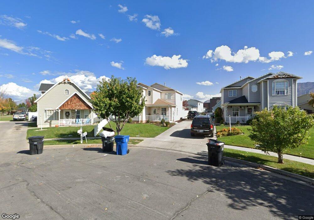
66 N 710 W Spanish Fork, UT 84660
Estimated Value: $432,000 - $466,000
4
Beds
3
Baths
1,749
Sq Ft
$255/Sq Ft
Est. Value
About This Home
This home is located at 66 N 710 W, Spanish Fork, UT 84660 and is currently estimated at $446,286, approximately $255 per square foot. 66 N 710 W is a home located in Utah County with nearby schools including Brockbank Elementary School, Spanish Fork Jr High School, and Spanish Fork High School.
Ownership History
Date
Name
Owned For
Owner Type
Purchase Details
Closed on
Aug 9, 2019
Sold by
Wise Steven Ray
Bought by
Wise Steven Ray and Wise Karlie
Current Estimated Value
Home Financials for this Owner
Home Financials are based on the most recent Mortgage that was taken out on this home.
Original Mortgage
$282,003
Outstanding Balance
$246,983
Interest Rate
3.7%
Estimated Equity
$199,303
Purchase Details
Closed on
Oct 9, 2018
Sold by
Wise Steven Ray
Bought by
Wise Steven Ray and Wise Karlie
Home Financials for this Owner
Home Financials are based on the most recent Mortgage that was taken out on this home.
Original Mortgage
$275,865
Interest Rate
4.5%
Mortgage Type
VA
Purchase Details
Closed on
Oct 5, 2018
Sold by
Brown Ellen and Brown Lincoln
Bought by
Wise Steven Ray
Home Financials for this Owner
Home Financials are based on the most recent Mortgage that was taken out on this home.
Original Mortgage
$275,865
Interest Rate
4.5%
Mortgage Type
VA
Purchase Details
Closed on
Apr 24, 2017
Sold by
Stotts Grant Perry and Stotts Rachel Nicole
Bought by
Brown Ellen and Brown Lincoln
Home Financials for this Owner
Home Financials are based on the most recent Mortgage that was taken out on this home.
Original Mortgage
$234,671
Interest Rate
3.75%
Mortgage Type
FHA
Purchase Details
Closed on
Feb 20, 2015
Sold by
Stotts Grant Perry
Bought by
Stotts Grant Perry and Stotts Rachel Nicole
Home Financials for this Owner
Home Financials are based on the most recent Mortgage that was taken out on this home.
Original Mortgage
$161,500
Interest Rate
3.57%
Mortgage Type
New Conventional
Purchase Details
Closed on
Jun 10, 2011
Sold by
Mmd Investment Corp
Bought by
Hutchings Tyler and Hutchings Tasia
Home Financials for this Owner
Home Financials are based on the most recent Mortgage that was taken out on this home.
Original Mortgage
$136,881
Interest Rate
4.55%
Mortgage Type
VA
Purchase Details
Closed on
Jan 19, 2011
Sold by
Mueller William H and Mueller Jennifer L
Bought by
Mmd Investment Corp
Purchase Details
Closed on
May 10, 2010
Sold by
Mueller Jennifer L
Bought by
Mueller William H
Purchase Details
Closed on
Mar 23, 2007
Sold by
Mueller Lindsay J
Bought by
Mueller William H
Purchase Details
Closed on
Feb 6, 2006
Sold by
Mueller William H
Bought by
Mueller William H and Mueller Lindsay J
Home Financials for this Owner
Home Financials are based on the most recent Mortgage that was taken out on this home.
Original Mortgage
$45,000
Interest Rate
6.35%
Mortgage Type
Credit Line Revolving
Purchase Details
Closed on
Jun 29, 2005
Sold by
Johnson David L
Bought by
Mueller William H
Purchase Details
Closed on
May 25, 2000
Sold by
Simpson Kevinl and Simpson Lyndi O
Bought by
Johnson David L
Home Financials for this Owner
Home Financials are based on the most recent Mortgage that was taken out on this home.
Original Mortgage
$128,838
Interest Rate
8.08%
Purchase Details
Closed on
Jan 18, 2000
Sold by
Johnson David L and Johnson Andrea L
Bought by
Johnson David L
Home Financials for this Owner
Home Financials are based on the most recent Mortgage that was taken out on this home.
Original Mortgage
$126,000
Interest Rate
7.41%
Purchase Details
Closed on
Sep 30, 1996
Sold by
Salisbury Development L C
Bought by
Simpson Kevin L and Simpson Lyndi O
Home Financials for this Owner
Home Financials are based on the most recent Mortgage that was taken out on this home.
Original Mortgage
$104,260
Interest Rate
7.95%
Mortgage Type
FHA
Create a Home Valuation Report for This Property
The Home Valuation Report is an in-depth analysis detailing your home's value as well as a comparison with similar homes in the area
Home Values in the Area
Average Home Value in this Area
Purchase History
| Date | Buyer | Sale Price | Title Company |
|---|---|---|---|
| Wise Steven Ray | -- | Accommodation | |
| Wise Steven Ray | -- | Meridian Title Company | |
| Wise Steven Ray | -- | Us Title Insurance Agency | |
| Wise Steven Ray | -- | Highland Title | |
| Brown Ellen | -- | Inwest Title | |
| Stotts Grant Perry | -- | Accommodation | |
| Stotts Grant Perry | -- | Inwest Title | |
| Hutchings Tyler | -- | Us Title Insurance Agency | |
| Mmd Investment Corp | -- | Accommodation | |
| Mueller William H | -- | None Available | |
| Mueller William H | -- | Executive Title | |
| Mueller William H | -- | None Available | |
| Mueller William H | -- | Horizon Title Insurance | |
| Johnson David L | -- | Titlewriters Inc | |
| Johnson David L | -- | Crown Title | |
| Simpson Kevin L | -- | Provo Land Title |
Source: Public Records
Mortgage History
| Date | Status | Borrower | Loan Amount |
|---|---|---|---|
| Open | Wise Steven Ray | $282,003 | |
| Previous Owner | Wise Steven Ray | $275,865 | |
| Previous Owner | Brown Ellen | $234,671 | |
| Previous Owner | Stotts Grant Perry | $161,500 | |
| Previous Owner | Hutchings Tyler | $136,881 | |
| Previous Owner | Mueller William H | $45,000 | |
| Previous Owner | Johnson David L | $128,838 | |
| Previous Owner | Johnson David L | $126,000 | |
| Previous Owner | Simpson Kevin L | $104,260 |
Source: Public Records
Tax History
| Year | Tax Paid | Tax Assessment Tax Assessment Total Assessment is a certain percentage of the fair market value that is determined by local assessors to be the total taxable value of land and additions on the property. | Land | Improvement |
|---|---|---|---|---|
| 2025 | $2,049 | $222,750 | -- | -- |
| 2024 | $2,049 | $211,200 | $0 | $0 |
| 2023 | $2,112 | $217,965 | $0 | $0 |
| 2022 | $2,128 | $215,380 | $0 | $0 |
| 2021 | $1,832 | $296,600 | $95,800 | $200,800 |
| 2020 | $1,734 | $273,000 | $87,100 | $185,900 |
| 2019 | $1,465 | $242,600 | $80,200 | $162,400 |
| 2018 | $1,332 | $213,200 | $72,000 | $141,200 |
| 2017 | $1,216 | $104,610 | $0 | $0 |
| 2016 | $1,073 | $91,135 | $0 | $0 |
| 2015 | $969 | $81,290 | $0 | $0 |
| 2014 | $934 | $78,650 | $0 | $0 |
Source: Public Records
Map
Nearby Homes
Your Personal Tour Guide
Ask me questions while you tour the home.