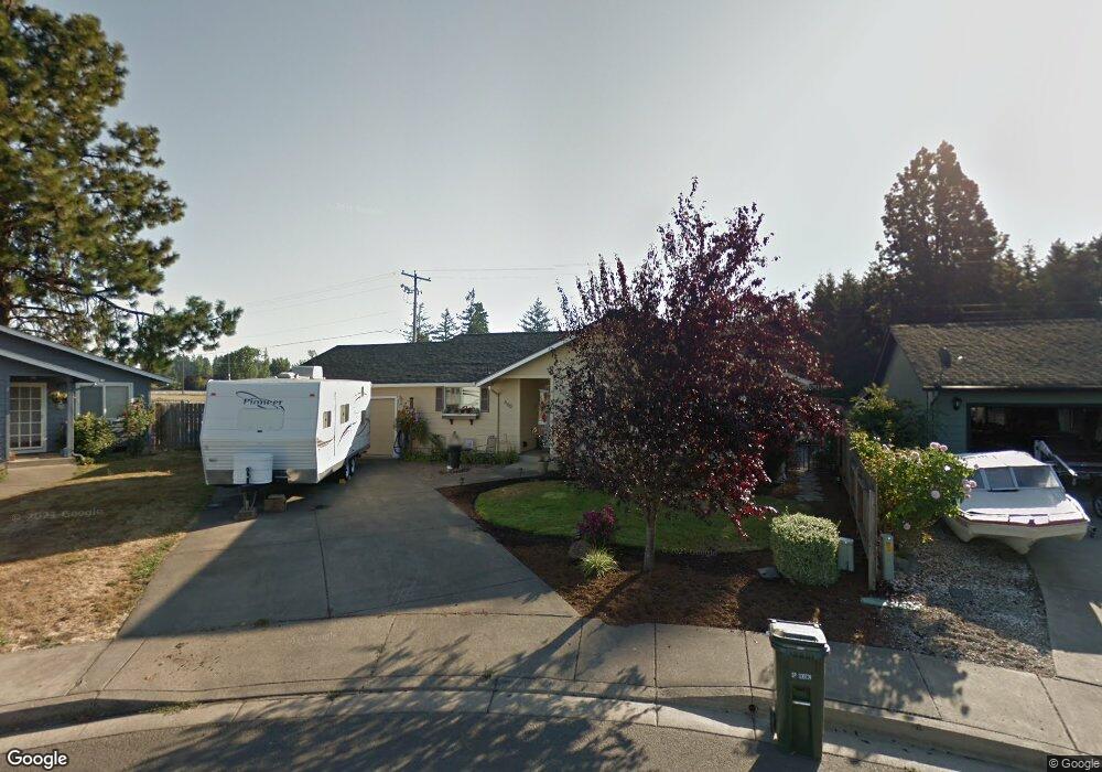
660 Pine Ct Creswell, OR 97426
Estimated Value: $396,048 - $414,000
3
Beds
2
Baths
1,258
Sq Ft
$324/Sq Ft
Est. Value
About This Home
This home is located at 660 Pine Ct, Creswell, OR 97426 and is currently estimated at $407,012, approximately $323 per square foot. 660 Pine Ct is a home located in Lane County with nearby schools including Creslane Elementary School, Creswell Middle School, and Creswell High School.
Ownership History
Date
Name
Owned For
Owner Type
Purchase Details
Closed on
Dec 29, 2014
Sold by
Thompson Glenn A and Thompson Kathy A
Bought by
Hahn Cody Ryuan and Hahn Kailie C
Current Estimated Value
Home Financials for this Owner
Home Financials are based on the most recent Mortgage that was taken out on this home.
Original Mortgage
$188,775
Outstanding Balance
$144,394
Interest Rate
3.96%
Mortgage Type
New Conventional
Estimated Equity
$262,618
Create a Home Valuation Report for This Property
The Home Valuation Report is an in-depth analysis detailing your home's value as well as a comparison with similar homes in the area
Home Values in the Area
Average Home Value in this Area
Purchase History
| Date | Buyer | Sale Price | Title Company |
|---|---|---|---|
| Hahn Cody Ryuan | $185,000 | Western Title & Escrow Co |
Source: Public Records
Mortgage History
| Date | Status | Borrower | Loan Amount |
|---|---|---|---|
| Open | Hahn Cody Ryuan | $188,775 |
Source: Public Records
Tax History
| Year | Tax Paid | Tax Assessment Tax Assessment Total Assessment is a certain percentage of the fair market value that is determined by local assessors to be the total taxable value of land and additions on the property. | Land | Improvement |
|---|---|---|---|---|
| 2025 | $3,229 | $196,765 | -- | -- |
| 2024 | $2,416 | $191,034 | -- | -- |
| 2023 | $2,416 | $185,470 | $0 | $0 |
| 2022 | $2,602 | $180,068 | $0 | $0 |
| 2021 | $2,513 | $174,824 | $0 | $0 |
| 2020 | $2,478 | $169,733 | $0 | $0 |
| 2019 | $2,424 | $164,790 | $0 | $0 |
| 2018 | $2,390 | $155,331 | $0 | $0 |
| 2017 | $2,318 | $155,331 | $0 | $0 |
| 2016 | $2,374 | $150,807 | $0 | $0 |
| 2015 | $2,288 | $146,415 | $0 | $0 |
| 2014 | $2,269 | $142,150 | $0 | $0 |
Source: Public Records
Map
Nearby Homes
- 460 Meadow Ln
- 632 N 5th St
- 524 N 5th St
- 549 Gilfry Ave
- 573 Creswood Dr
- 33465 Irish Ln
- 326 Auburn Ln
- 689 Blue Jay Loop
- 961 Bush Ln
- 41 Sandalwood Loop
- 272 S 7th St
- 83354 N Pacific Hwy
- 400 N Mill St Unit 48
- 700 N Mill St Unit 1
- 700 N Mill St Unit 21
- 700 N Mill St Unit 107
- 630 S 10th St
- 1 Queens Ave
- 805 Queens Ave
- 755 Holbrook Ln
- 670 Pine Ct
- 670 Pine Ct
- 650 Pine Ct
- 680 Pine Ct
- 1061 Swale Ridge Loop
- 640 Meadow Ln
- 1053 Swale Ridge Loop
- 595 Pine Ct
- 1069 Swale Ridge Loop
- 645 Meadow Ln
- 630 Meadow Ln
- 585 Pine Ct
- 1045 Swale Ridge Loop
- 1077 Swale Ridge Loop
- 582 Pine Ct
- 620 Meadow Ln
- 635 Meadow Ln
- 1066 Swale Ridge Loop
- 1085 Swale Ridge Loop
- 581 Pine Ct
Your Personal Tour Guide
Ask me questions while you tour the home.