Estimated Value: $637,924 - $665,000
About This Home
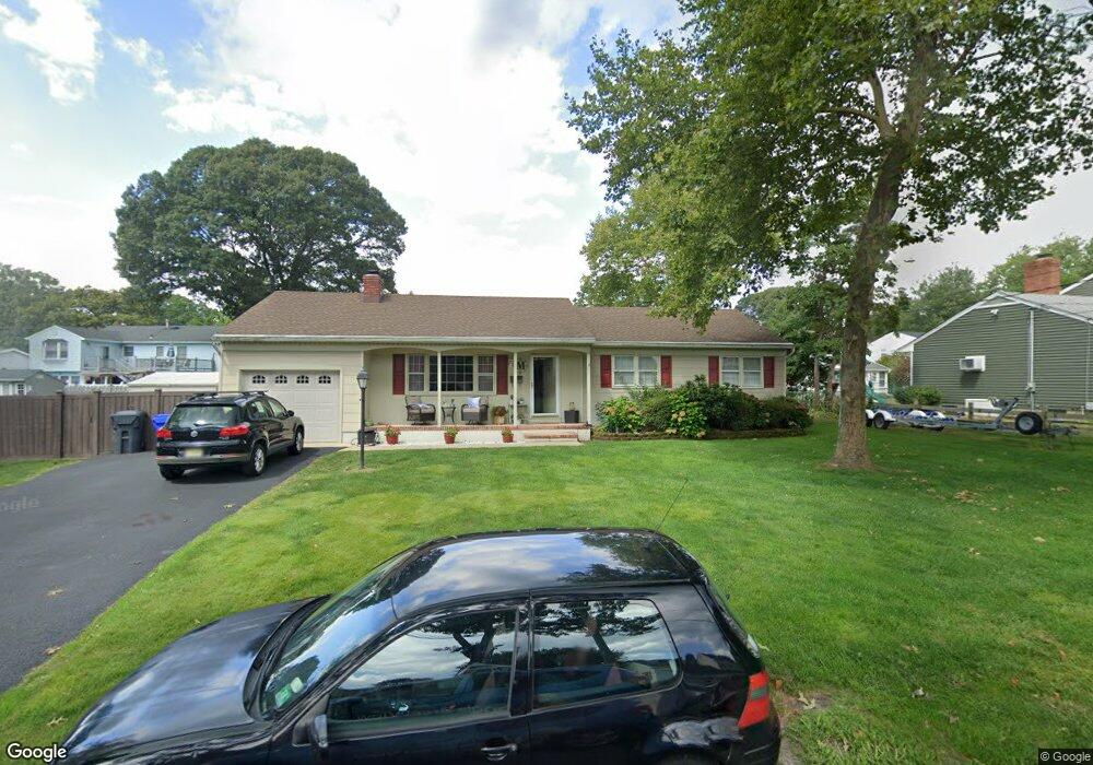
This home is located at 660 Thoroughfare Rd, Brick, NJ 08724 and is currently estimated at $651,731, approximately $392 per square foot. 660 Thoroughfare Rd is a home located in Ocean County with nearby schools including Midstreams Elementary School, Veterans Memorial Middle School, and Brick Township Memorial High School.
Ownership History
We collect this data history from publicly available records. To have your information removed, we recommend requesting removal directly through your county’s website.
Purchase Details
Home Financials for this Owner
Home Financials are based on the most recent Mortgage that was taken out on this home.Home Values in the Area
Average Home Value in this Area
Purchase History
We collect this data history from publicly available records. To have your information removed, we recommend requesting removal directly through your county’s website.
| Date | Buyer | Sale Price | Title Company |
|---|---|---|---|
| -- | Chicago Title |
Mortgage History
We collect this data history from publicly available records. To have your information removed, we recommend requesting removal directly through your county’s website.
| Date | Status | Borrower | Loan Amount |
|---|---|---|---|
| Closed | $251,500 |
Tax History
We collect this data history from publicly available records. To have your information removed, we recommend requesting removal directly through your county’s website.
| Year | Tax Paid | Tax Assessment Tax Assessment Total Assessment is a certain percentage of the fair market value that is determined by local assessors to be the total taxable value of land and additions on the property. | Land | Improvement |
|---|---|---|---|---|
| 2025 | $9,087 | $331,400 | $169,300 | $162,100 |
| 2024 | $8,209 | $331,400 | $169,300 | $162,100 |
| 2023 | $8,024 | $331,400 | $169,300 | $162,100 |
| 2022 | $8,024 | $328,700 | $169,300 | $159,400 |
| 2021 | $7,856 | $328,700 | $169,300 | $159,400 |
| 2020 | $7,754 | $328,700 | $169,300 | $159,400 |
| 2019 | $7,616 | $328,700 | $169,300 | $159,400 |
| 2018 | $7,442 | $328,700 | $169,300 | $159,400 |
| 2017 | $7,241 | $328,700 | $169,300 | $159,400 |
| 2016 | $7,202 | $328,700 | $169,300 | $159,400 |
| 2015 | $7,014 | $328,700 | $169,300 | $159,400 |
| 2014 | $6,955 | $328,700 | $169,300 | $159,400 |
Map
- 675 Thoroughfare Rd
- 546 Nicholas Rd
- 611 Fisherman Place
- 594 Princeton Ave
- 2410 Sylvan Dr Unit 2
- 1618 Calamus Place
- 10 Sea Point Dr
- 535 Carroll Fox Rd
- 1615 Calamus Place
- 603 Point Ave
- 536 Princeton Ave
- 599 Point Ave
- 510 Ernestine Place
- 41 Hidden Harbor Dr
- 502 Princeton Ave
- 1519 River Ave
- 478 Princeton Ave
- 2401 Mallow St
- 1553 Littlehill Rd
- 15 Hidden Harbor Dr
- 653 Thoroughfare Rd
- 650 Hawks Nest Rd
- 657 Thoroughfare Rd
- 649 Thoroughfare Rd
- 656 Hawks Nest Rd
- 654 Thoroughfare Rd
- 648 Carroll Fox Rd
- 650 Thoroughfare Rd
- 663 Thoroughfare Rd
- 660 Hawks Nest Rd
- 648 Thoroughfare Rd
- 583 Robinhood Rd
- 579 Robinhood Rd
- 654 Carroll Fox Rd
- 577 Robinhood Rd
- 644 Carroll Fox Rd
- 656 Carroll Fox Rd
- 585 Robinhood Rd
- 664 Thoroughfare Rd
- 667 Thoroughfare Rd
Ask me questions while you tour the home.