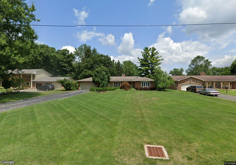
6612 Davis Rd Hilliard, OH 43026
Brown NeighborhoodEstimated Value: $433,879 - $516,000
4
Beds
3
Baths
2,036
Sq Ft
$235/Sq Ft
Est. Value
About This Home
This home is located at 6612 Davis Rd, Hilliard, OH 43026 and is currently estimated at $479,470, approximately $235 per square foot. 6612 Davis Rd is a home located in Franklin County with nearby schools including Hilliard Station Sixth Grade Elementary School, Brown Elementary School, and Hilliard Memorial Middle School.
Ownership History
Date
Name
Owned For
Owner Type
Purchase Details
Closed on
Apr 8, 2022
Sold by
Douglas Knaup J and Douglas Robin L
Bought by
Knaup Family Trust
Current Estimated Value
Purchase Details
Closed on
Aug 15, 2001
Sold by
Orth Tracey E
Bought by
Knaup J Douglas and Knaup Robin L
Home Financials for this Owner
Home Financials are based on the most recent Mortgage that was taken out on this home.
Original Mortgage
$135,000
Interest Rate
7.11%
Mortgage Type
Purchase Money Mortgage
Purchase Details
Closed on
Jul 11, 1990
Purchase Details
Closed on
Aug 1, 1986
Create a Home Valuation Report for This Property
The Home Valuation Report is an in-depth analysis detailing your home's value as well as a comparison with similar homes in the area
Home Values in the Area
Average Home Value in this Area
Purchase History
| Date | Buyer | Sale Price | Title Company |
|---|---|---|---|
| Knaup Family Trust | -- | Carlile Patchen & Murphy Llp | |
| Knaup J Douglas | $215,000 | Chicago Title | |
| -- | $135,000 | -- | |
| -- | $108,000 | -- |
Source: Public Records
Mortgage History
| Date | Status | Borrower | Loan Amount |
|---|---|---|---|
| Previous Owner | Knaup J Douglas | $135,000 |
Source: Public Records
Tax History
| Year | Tax Paid | Tax Assessment Tax Assessment Total Assessment is a certain percentage of the fair market value that is determined by local assessors to be the total taxable value of land and additions on the property. | Land | Improvement |
|---|---|---|---|---|
| 2025 | $10,199 | $116,520 | $27,160 | $89,360 |
| 2024 | $10,199 | $116,520 | $27,160 | $89,360 |
| 2023 | $6,224 | $116,520 | $27,160 | $89,360 |
| 2022 | $6,981 | $103,850 | $27,340 | $76,510 |
| 2021 | $6,984 | $103,850 | $27,340 | $76,510 |
| 2020 | $6,989 | $103,850 | $27,340 | $76,510 |
| 2019 | $7,136 | $90,690 | $23,770 | $66,920 |
| 2018 | $6,637 | $90,690 | $23,770 | $66,920 |
| 2017 | $6,811 | $90,690 | $23,770 | $66,920 |
| 2016 | $6,506 | $76,620 | $21,390 | $55,230 |
| 2015 | $6,156 | $76,620 | $21,390 | $55,230 |
| 2014 | $6,174 | $76,620 | $21,390 | $55,230 |
| 2013 | $2,831 | $72,975 | $20,370 | $52,605 |
Source: Public Records
Map
Nearby Homes
- 6572 Union Day Rd
- 6541 Marshview Dr
- 6580 Union Day Rd
- 6540 Union Day Rd
- 6067 Coventry Meadow Ln Unit 6067
- 6531 Union Day Rd
- 6500 Union Day Rd
- 6499 Union Day Rd
- 6491 Union Day Rd
- 5985 Coventry Cross Ln Unit 5985
- 6181 Heritage Point Ct
- 3984 Hill Park Rd Unit 11
- 6571 Union Day Rd
- 6587 Union Day Rd
- 6595 Union Day Rd
- 6201 Lampton Pond Dr
- 4319 Ahwick Green
- 6886 Gelderland Dr
- 4332 Ahwick Green Unit 42
- 5962 Heritage Lakes Dr
- 6600 Davis Rd
- 6624 Davis Rd
- 6590 Davis Rd
- 6636 Davis Rd
- 6633 Davis Rd
- 6637 Davis Rd
- 6568 Davis Rd
- 6643 Davis Rd
- 6648 Davis Rd
- 3983 Alton Darby Creek Rd
- 3995 Alton Darby Creek Rd
- 6556 Davis Rd
- 3955 Alton Darby Creek Rd
- 4003 Alton Darby Creek Rd
- 6649 Davis Rd
- 3875 Alton Darby Creek Rd
- 4011 Alton Darby Creek Rd
- 6656 Davis Rd
- 6484 Heritage Blvd
- 4027 Alton Darby Creek Rd
Your Personal Tour Guide
Ask me questions while you tour the home.